A digital elevation model of the Blatten glacier collapse was derived from rapid mapping imagery, allowing 3D visualization of the event and estimation of volume changes.
From Himalayas to Alps: Analyzing Patterns in Kedarnath, Chamoli, Dharali, and Blatten Disasters
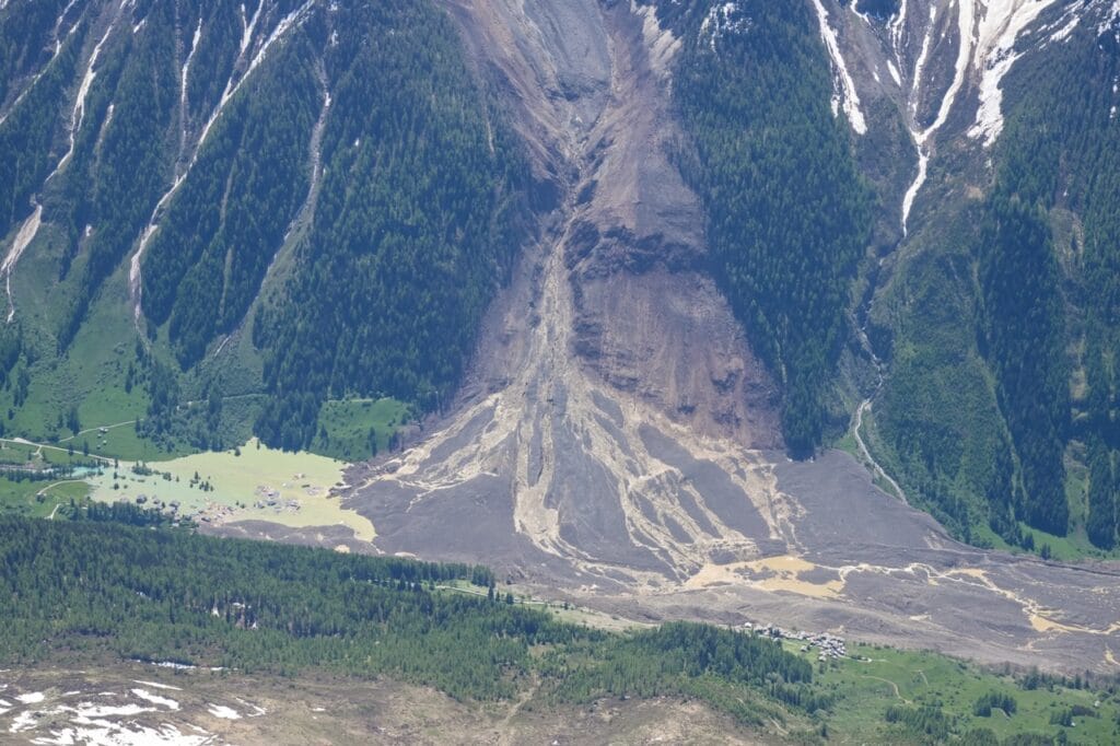
Climate warming increases mountain hazards. Unstable slopes, heavy rain, and risky development fuel disasters. Monitoring, zoning, and early warnings can reduce losses and protect communities.
Mountain disasters and local population: a dual monitoring approach.
Mountain disasters will become increasingly frequent. To assure the safety of the local population, a dual approach should be adopted: monitoring of the phenomena and the socio-economic fragilities.
Geospatial Solutions for Landslide Risk Assessment and Mitigation Strategy
This research uses GIS, RS, and multi-scale modeling for landslide risk assessment and promotes rainwater harvesting as a mitigation strategy to enhance slope stability and disaster resilience.
Snow-driven microclimate variability and climate change impacts in alpine and polar regions
Snow significantly influences microclimates in alpine and polar regions, affecting local rates of climate warming and introducing uncertainty in future biodiversity and productivity predictions.
Advancing water security in Andean Glacier-Fed Basins through an upward interdisciplinary approach from communities, monitoring and modeling implementation to local informed decisions
This study examines water security in the Peruvian Andes, focusing on hydrological monitoring in Qasqara and Yuracmayo. It highlights the impact of climate change, glacier retreat, and wetland loss on
Spatial and Temporal variability of Extreme Precipitation Events (EPEs) and their future projection over the Himalayan Ganga Basin (HGB)
Intensifying extreme precipitation events in the Himalayas, driven by climate change, project more frequent extreme 1day and 5day rainfall. These trends highlight the urgent need for climate-resilient
“Forest Fire Risk and Rural Out-Migration: A Case Study of the Himalayan Ganga Basin (HGB), Central Himalaya”
This study examines spatiotemporal forest fire trends, risk zones and identifies rural out-migration as a key driver of forest fire in the Himalayan Ganga Basin.