Private

FS 3.134

Remote sensing to capture the dynamics of mountain cryosphere

Details

  • Full Title

    FS 3.134: Remote sensing to capture the dynamics of mountain cryosphere
  • Scheduled

    Talks - Part I:
    2025-09-17, 13:30 - 15:00 (LT), SOWI – HS 2
    Talks - Part II:
    2025-09-17, 16:00 - 17:30 (LT), SOWI – HS 2
    Posters:
    2025-09-17, 17:30 - 18:30 (LT), SOWI – Garden
  • Convener

    Davide Fugazza
  • Assigned to Synthesis Workshop

    ---
  • Thematic Focus

    Cryo- & Hydrosphere, Hazards, Low-to-no-snow, Remote Sensing
  • Keywords

    remote sensing, thermal, cryosphere, multi-spectral

Description

The state of mountain glaciers, rock glaciers, permafrost and snow cover is a crucial indicator of climate change, yet the remoteness of mountain regions often makes direct observations challenging. This session aims to explore the latest advancements in remote sensing technologies and their applications in monitoring mountain cryosphere. We invite submissions that explore the use of satellite imagery, aerial and drone surveys, also in combination with ground-based techniques to monitor the cryosphere, including: – Glaciers, their characteristics and dynamics, mass balance, and the impacts of climate change. – Advancements in our understanding of rock glacier dynamics and their contribution to the hydrological budget of mountain regions. – The impacts of climate change on mountain permafrost and related natural hazards – Mapping of snow cover and the physical properties of the snowpack We are looking for case studies from diverse mountain regions across the globe that showcase how remote sensing is being used to track glacier changes, predict future trends, and inform climate mitigation strategies, also discussing present challenges and future improvements. Contributions highlighting advancements in multi-spectral and thermal imagery, and the integration of multiple platforms/sensors are particularly welcome. We look forward to your submissions and the dynamic discussions they will inspire, pushing the boundaries of cryospheric research.

Registered Abstracts

ID: 3.7833

Analysis of Snow Cover Changes Using MODIS Snow Products and Meteorological Data in the Hunza Region, Karakoram, Pakistan
Muqeet Ahmad
Karim, Parisa
Abstract/Description

The Upper Indus Basin (UIB) is characterized by contrasting meteorological behaviors; therefore, it has become pertinent to understand the meteorological trends at the sub-basin level. Many studies have investigated the snow-covered area along with meteorological trends at the basin level. Still, none have reported the spatial variability of trends and their magnitude at a sub-basin level. This study is conducted to monitor the seasonal trends in the snow-covered area and climatic factors (temperature and precipitation) in the Hunza region of the Upper Indus Basin (UIB). Summer and winter seasons were selected because temperature and precipitation during these two seasons are the key factors for snow cover variation in the region. Mann-Kendall and Spearman methods were used to study the seasonal trends and their magnitude using MODIS snow cover information (2000–2020) and meteorological data. The results showed that during the summer season, SCA and precipitation showed a non-significant (p=0.05) decreasing trend with a value of -0.0095 km²/month and -0.191 mm/month, respectively, while the temperature showed a non-significant increasing trend with a value of 0.315°C/month. While, during the winter seasons, SCA and temperature showed a non-significant increasing trend with a value of 0.114 km²/month and 0.117°C/month, respectively, and precipitation showed a significant increasing trend with a value of 0.436 mm/month. In general, the snow-covered areas of the Hunza region have an increasing trend during the winter season, while the summer season has a decreasing trend of snow-covered areas. Based on the results of this study it can be concluded that since the Hunza sub-basin of the UIB is influenced by a different climatological system (westerly system) as compared to other sub-basins of the UIB (monsoon systems), the results of those studies that treat the UIB as one unit in meteorological modeling should be used with caution. Furthermore, it is suggested that similar studies at the sub-basin level of the UIB will help in a better understanding of the Karakoram anomaly.

ID: 3.8015

Mapping Erosion and Deposition Patterns by Dirty Snow Avalanches Using Structure-from-Motion Photogrammetry
Magdalena Koschmieder
Temme, Arnaud
Abstract/Description

Gravitational mass movements and hydrological processes erode material on hillslopes and transport it to areas of deposition. By doing so, they contribute to soil formation and shape landscapes on different time scales depending on their magnitude and frequency. Among these processes are debris flows and rainfall runoff, but also full-depth avalanches. In this case, not the material itself is moving, but the snow cover, that glides over the ground and can take up sediment. In the process, glide avalanches become so-called “dirty snow avalanches”.
While conventional field methods such as snow sampling and mapping deposits on printed aerial images have been applied to estimate the amount of soil erosion by dirty snow avalanches, the specific patterns of erosion and deposition they produce remain poorly quantified.
This study aims to bridge this gap by applying structure from motion photogrammetry in order to create DoDs and map areas of erosion and deposition more accurately. Furthermore, snow sampling was employed to quantify the sediment volume transported by the avalanches.
We will present preliminary results from the avalanches we observed and sampled. This includes point cloud comparisons of the time soon after the event and when the avalanche has melted.

ID: 3.9651

High-resolution assessment of rock glacier velocities at a subannual scale using UAV imagery – lessons learned from Dösen rock glacier, Austria
Harald Zandler
Kellerer-Pirklbauer, Andreas; Kirchmair, Marco; Sulzer, Wolfgang
Abstract/Description

The Dösen rock glacier in the Hohe Tauern National Park, Central Austria, is a pilot area of permafrost research in the Eastern Alps with initial measurements in 1993. This rock glacier is active, tongue-shaped, ranges from 2620-2340 m asl, and covers an area of 0.2 km². Rock glacier surface velocity and its relationship to environmental parameters is of particular research interest against the background of changing global environments. The explanation of seasonal variations in their movement is paramount for understanding permafrost-climate relationships in this regard. Currently, only GNSS based point observations on seasonal velocity variations exist at this site and a remote sensing-based, rock glacier-wide, sub-seasonal approach is missing. Respective studies are also scarce on a global level. Therefore, we established a robust UAV based monitoring framework over an area of approximately 1000 m x 300 m targeted at capturing sub-seasonal surface changes and velocities. Methodologically, we utilize RTK-GNSS UAV imagery, state of the art image correlation algorithms (e.g. CosiCorr3D), and an existing geodetic measurement network for independent evaluation of airborne results. Thereby, a particular focus is on key factors for methodological automatization and repeatability. Preliminary results using 2023 and 2024 data document the applicability of the approach showing low errors (UAV based velocities vs. RTK-GNSS velocities) at the sub-centimeter level and strong spatial velocity variations throughout the rock glacier. Annual velocity values (08.2023-08.2024) show a doubling of rock glacier velocities in several parts of the landform compared to existing photogrammetric surveys 1997-2010, which confirms field based geodetic measurements indicating a general rapid increase in velocities since 2010. Upcoming field campaigns will include temporally higher resolutions, i.e., using monthly UAV surveys, to analyze sub-seasonal variations on the background of locally measured environmental variables. Thereby, the contribution will summarize key findings and challenges of a high-resolution UAV mapping approach of rock glacier velocities at a key site of the permafrost research in the Eastern Alps.

ID: 3.10071

Satellite data synergy for analysis of the glacier daily lowering rate in the Pskem River basin, Uzbekistan
Dana Floricioiu
Semakova, Eleonora; Bühler, Yves; Manconi, Andrea; Potorjinskiy, Mikhail; Krieger, Lukas; Semakov, Dmitriy; Khatamova, Nilufar
Abstract/Description

Glaciers are a significant indicator of climate change and one of the sources of fresh water. Glacier status monitoring is an important task for scientific research, especially in the arid regions of Central Asia. An archive of multispectral Landsat and ALOS/AVNIR-2 data as well as KH-9 and Catalogues data from 1957 and 1980s were used to identify glaciers in the mountain area of Uzbekistan for different periods and to analyze trends in glacier area until 2024. To extend the investigations to glacier surface elevation changes in the Pskem River basin, InSAR techniques were used with bistatic TanDEM-X datasets until 2014, DInSAR with TerraSAR-X /PAZ constellation for 2022-2023, SBAS with Sentinel -1 data and ASF DAAC HyP3 interferometric processing products until 2024. The test areas were the glaciers where glaciological expeditionary observations have been held: Barkrak Middle, Pakhtakor and Tekeshsay Glaciers. Different software and approaches were used to process SAR data. The satellite data – based results show that the mean surface lowering rate for 10 glaciers in the basin of the Pskem River tributary is -0,68 m/y from 2012 to 2014 and the corresponding annual mass balance is -1,08 m w.e. The Tekeshsay Glacier’s annual mass balance is -0,136 m w.e. in 2012-2014. The Pakhtakor Glacier mean surface lowering rate is −1,3 ± 0,5 m/y for 2000-2012. The daily lowering rate of the Barkrak Glacier surface is 2 mm/d from August to October of 2023 and will be compared to field data acquired during summer. Twelve-day alternations of glacier subsidence and uplift in summer were considered with meteorological information of the Oygaing Station which is located at the elevation of 2100 m. The observed glacier uplift can also be related to an avalanche release from surrounding slopes and glacier movement. RAMMS software was used to estimate avalanche depositions on the surface of the Barkrak and Pakhtakor Glaciers. Avalanche feeding could contribute with 4 to 40% to the Barkrak Glacier mass balance since 2017. The daily glacier movement velocity (up to 10 cm per day) was estimated using offset tracking with Sentinel-1 data and amplitude tracking with TerraSAR-X /PAZ data.

ID: 3.10259

On the importance of mapping empty glacier beds – and how to…
Andrea Fischer
Abstract/Description

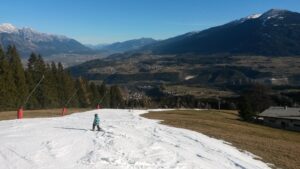
During the last two summers, a new challenge on the schedule of Eastern Alpine glaciologists appeared: mapping glacier casualties. With traditional glacier inventories having been compiled in decadal intervals, the envisaged loss of one third of glaciers in the main glacier covered regions of Austria within the next five years sets a hard limit for monitoring changes. With the aim that a glacier inventory should be able to represent glacier area changes of about 5%, the temporal resolution needs to be annual – but what about related uncertainties? The increasing debris cover and number of and size of nunataks increase mapping complexity, and demands on spatial resolution of remote sensing data. In case of late season fresh snow cover, the area of patchy glaciers could be overestimated. Time lapse cam images point out that the disintegration of glacier parts can take place within a couple of days and weeks, so that the simultaneous data recording and similar period length is increasingly important for comparing glacier area change rates. Summarizing all those demands and limitations, a high resolution, easy to use tool suited for annual data recording is needed. Visual satellite remote sensing data can fulfil the criterion in case the spatial resolution is sufficient to resolve the glacier area topology and texture. Airborne low cost sensors can be an alternative for quick time lapse orthophotogrammetry data. Airborne surveys allow to cover large areas (> 100 km²) in one flight. Drone data have higher spatial resolution, but are restricted to smaller areas (a few km²) within one survey. The need to be on-site for the survey can be time consuming and generate costs for personnel. Drone imaging is so far the simplest method to produce high resolution 3D data of small-scale processes as the evolution of collapse features. Ground based time lapse images are well suited for longer monitoring of sites, for example glacier collapse over several years. Using multiple perspectives can allow a photogrammetric post processing. Generally, the smaller the scale of records, the more accurately the predictions should be of what should be monitored and when the event is going to take place.

ID: 3.10386

Monitoring of Alpine environment with geomatics techniques
Myrta Maria Macelloni
Abstract/Description

Alpine mountainous and cryosphere are key elements for the future and its environment will be subject to strong modifications and more frequent hazards, hence monitoring it will be fundamental. Their complex systems need different and integrated techniques, different arising problems such as the difficulty in accessing with the classical methods and the large areas to cover. Remote sensing tools will be increasingly important in environmental monitoring and the prevention of climate change risks, especially in the next future. The use of visible images is what we usually use applied to the alpine cryosphere, but the cloud coverage and the necessity to monitor the movements led to the use of active sensors. Synthetic Aperture Radar (SAR) technology has been increasingly utilized for glacier monitoring due to its ability to penetrate clouds and operate in all weather conditions, providing high-resolution images of the Earth’s surface. Hence, the multifrequency SAR data can be used going towards monitor the snow parameters (e.g. snow liquid water content) thanks to the response of soil and snow to the microwave response. Moreover, the Interferometric Synthetic Aperture Radar (InSAR) allow the measurement of the displacement of surface deformation with millimetric precision so it can be used for risk prevention in mountainous areas, detect crevasses under snow bridge and glacier dynamics. Therefore, the deformation detected from the SAR can be useful for monitoring landslides and subsidence and other geological hazards. An integrated approach in Earth Observation (EO) between passive and active sensors for environmental monitoring especially to deal with the climate change hazards. Combining satellite and ground observations together with physical based and data driven models, to monitor the environment developing a new approach, and focusing on mountainous areas analyzing the dynamics of the processes are the goal of my PhD project.

ID: 3.10955

Quantifying heterogeneous glacier dynamics in Lunana, Bhutan, using high-spatiotemporal resolution satellite imagery
Alex Hyde
Carr, Rachel; Dunning, Stuart; Maximillian, Van Wyk de Vries
Abstract/Description

Quantifying the response of lake-terminating glaciers in High Mountain Asia to climate change is crucial for forecasting glacial hazards and future water resource availability. The Lunana region in Bhutan, which hosts four large glacial lakes with significant hazard potential, is an important area of study. Using the PlanetScope CubeSat constellation (3m spatial resolution), we mapped ice velocities at monthly intervals from 2017 -2023 . We reveal that the disintegration of Thorthormi Glacier’s ice tongue in 2022 coincided with year -on -year acceleration at its terminus and increased seasonal variability in surface velocities. This acceleration is attributed to reduced basal drag due to thinning, which resulted in an increasing proportion of the terminus reaching flotation, evidenced by the calving tabular icebergs. While the other three lake terminating glaciers; Bechung, Raphstreng, and Lugge exhibited similar retreat rates, Bechung and Raphstreng showed notably higher seasonal variability compared to Lugge. At higher elevations, all glaciers showed a decelerating velocity trend, this is attributed to surface thinning and reducing driving stresses. We show that accelerating trends in surface velocity can be a precursor to accelerated rates of retreat and rapid lake expansion, highlighting the importance of continuous monitoring of lake terminating glacier ice velocities in the Himalayas

ID: 3.10956

Integrating CARTOSAT-1 and ASTER Digital Elevation Models to Refine and Enhance Long-Term Geodetic Glacier Mass Balance: A Case Study of Chhota Shigri Glacier, Western Himalaya
Tarang Patadiya
Vijay, Saurabh
Abstract/Description

Glacier mass balance is a key parameter for assessing glacier health and understanding its response to climate change. Previous studies have utilized various satellite-based techniques, such as stereo imaging, InSAR, and altimetry, to estimate geodetic glacier mass balance. However, these methods are often limited by either temporal constraints or sensor resolution. In this study, we combined time-series elevation data from CARTOSAT-1 and ASTER (Advanced Spaceborne Thermal Emission and Reflection Radiometer) to provide an up-to-date geodetic glacier mass balance estimate for the period of 2002-2024. While ASTER, operational since 2000, offers spatial (30 m) and radiometric (8 bit) resolutions, CARTOSAT-1, which operated from 2005 to 2018, had superior spatial (2.5 m) and radiometric (10 bit) resolutions. To improve the accuracy of ASTER-based elevation change (dh/dt) data, we corrected the ASTER trend using the CARTOSAT-1 data from 2006-2018. We then applied this correction function to update ASTER observations from 2002-2024. When compared with in-situ glaciological mass balance measurements, our approach showed improved accuracy for ASTER-based geodetic mass balance estimates. Our study emphasizes the value of combining dh/dt time-series from different datasets to enhance the accuracy of glacier mass balance estimates with high temporal resolution, applicable across entire regions.

ID: 3.11124

Changing ablation patterns on glaciers in the Alps and Karakoram observed by means of Sentinel-2 data
Gabriele Schwaizer
Nagler, Thomas
Abstract/Description

Glaciers, being one of the essential climate variables, are reflecting the effects of changing climate conditions, such as increased temperatures or changes in the precipitation. High-resolution optical satellite data provide an excellent data base to observe multiple glaciers at the same time. Based on high-resolution optical satellite imagery, the main glacier surface classes snow, clean glacier ice, and snow-free debris cover can be automatically separated on small and large glaciers. The automated retrieval of firn areas on mountain glaciers from optical satellite data is still a challenge and requires more research and development to account for the multiple reflectance variations from the multi-annual snow surface. Clouds obscure the Earth’s surface in optical satellite data and are masked.
With the improved observation cycles of the Sentinel-2 missions since 2015, glacier surface conditions can be mapped on multiple dates during the melting season, supporting the monitoring of changing ablation extents on glaciers. Sentinel-2 data over the Alps and the Karakoram were used to generate time series of glacier surface classifications during the melting season of every year between 2015 and 2023.
Analysing these classifications revealed that on glaciers in the Alps, snow areas remaining at the end of summer tend to decrease in recent years. Further, a second minor melt phase after the first winter snow fall is observed in some of these years on glaciers in the Alps. In the Karakoram, the extent of the main snow areas on glaciers in the same years is more stable, but year-to-year variations are mainly observed at the transition zones from snow to ice.
In this presentation, changes in the snow patterns on glaciers in the Alps and Karakoram during the melting period derived from Sentinel-2 data will be demonstrated. Aiming at enhancing our understanding of a changing climate and its impacts on glaciers in different climate zones, the benefits and current limitations of satellite-based glacier surface observations for use in climate models, or in combination with other datasets, will be discussed.
Parts of this work are supported by ESA EXPRO+ AlpGlacier, ESA CCI Glaciers, ESA DTC Glaciers and the ESA X-ECV Karakoram Anomaly.

ID: 3.11146

Integrating remote sensing and ground-based observations for glacier melt modeling in remote high-altitude regions
Blanka Barbagallo
Fugazza, Davide; Diolaiuti, Guglielmina
Abstract/Description

Understanding glacier melting dynamics is critical for assessing the impacts of climate change on mountain cryosphere and water availability. This study presents the results from the application of an enhanced T-index melt model on the whole surface of the Passu glacier (Pakistan), integrating multi-sensor remote sensing data with in situ observation from Automatic Weather Stations (AWS), being part of the project “Glaciers & Students” network, and ablation stakes to improve the estimation and distribution of radiative energy fluxes and glacier melt for the entire year 2023. We leverage Harmonized Landsat Sentinel-2 (HLSL30) imagery on Google Earth Engine to derive high-resolution spatiotemporal albedo distributions, providing key inputs for the melt model. Incoming shortwave radiation fluxes (SWin) are distributed using astronomical, topographic and meteorological corrections. The model to estimate longwave radiation fluxes (LWin and LWout) is validated using thermal remote sensing imagery and AWS data, providing a robust assessment of the glacier’s radiative fluxes. Additionally, in situ ablation stakes data further strengthen the model’s accuracy by offering direct validation of ice melt rates. Our results demonstrate the crucial role of integrating remote sensing with ground-based measurements for improving glacier melt modeling, particularly in data-scarce, remote high-altitude regions like the Third Pole. This study highlights the potential of such comprehensive analysis for refining melt estimations and advancing cryosphere monitoring methodologies.

ID: 3.11317

Impact of spectral resolution on automated surface classification at Mendenhall glacier, Alaska
Lea Hartl
Schmitt, Carl; Stuefer, Martin; Rajabi, Roozbeh; Di Mauro, Biagio; Winiwarter, Lukas
Abstract/Description

Remote sensing based classification of glacier surfaces has long been used to map glacier facies, debris cover, surface hydrology and different kinds of light absorbing impurities. Since the optical properties of the glacier surface affect the energy and mass balance, accurate characterizations of surface types are important for melt estimates that can take into account the impacts of impurities (e.g. mineral dust) on surface albedo. Surface classification in multispectral optical imagery is often based on empirical relationships between reflectance at particular wavelength bands or band combinations. In recent years, hyperspectral imagery has increasingly become available for environmental monitoring applications (e.g. PRISMA, EnMAP, EMIT satellite missions), although applications on ice and snow remain relatively rare. The higher spectral resolution and narrow bandwidths of hyperspectral data allow for classification and anomaly detection approaches that leverage the distinct spectral signatures of different surface types and impurities at much greater detail than in multispectral data. We use airborne hyperspectral imagery (VSWIR) of Mendenhall glacier, obtained during the 2020 melt season, and a Sentinel-2 acquisition from the same day to explore how spectral resolution affects surface classification results, focusing particularly on unsupervised classification. By varying the amount of spectral information supplied to the classifiers, we assess the sensitivity of the classification to spectral resolution and benchmark the output of several unsupervised methods against supervised classification. We present initial results from the Mendenhall Glacier case study and aim to discuss application-dependent strengths and limitations of different classification approaches.

ID: 3.11543

Classification of supraglacial landslides based on geometry, location, potential geomorphological impact, and preservation potential
Marek Ewertowski
Tomczyk, Aleksandra
Abstract/Description

Supraglacial landslides can impact glacier behaviour by affecting ice flow, ablation rates, and overall mass balance. The extent of this impact depends on various factors, including the size of the landslide (measured by area, volume, and thickness), its location relative to the glacier’s geometry, and its own geometric characteristics. The long-term goal of this research is to develop a global-scale database of supraglacial landslides, with the initial step focusing on establishing a comprehensive classification system. This study proposes a classification of supraglacial landslides based on their geometry, location, potential impacts, and preservation potential. We mapped over 900 landslides across various climatic regions, including New Zealand, Iceland, the Southern Andes, Alaska/Yukon/BC, and the Karakoram. Mapping was conducted by two independent operators following a systematic workflow: extracting glacier outlines from the Randolph Glacier Inventory (RGI), initially identifying landslide locations through point-based mapping, manually vectorizing landslide shapes using high-resolution satellite imagery, identifying source areas when possible, and calculating morphometric parameters of each landslide. Our classification identifies different morphological types of landslides, including large, widely spread landslides, small supraglacial debris accumulations associated with medial or lateral moraines, and debris “waves” on pre-existing debris-covered glaciers. Landslides were further categorized based on absolute area (small: 0.2-0.5 km², medium: 0.5-5.0 km², and large: >5.0 km²) and relative glacier coverage (ranging from minimal to complete glacier coverage). Deposits were mapped in both ablation and accumulation zones, and this location strongly influenced their preservation potential and geomorphological impact. Geomorphological consequences depend also on the type of the glacier: landslides on land-terminating glaciers may contribute to the formation of large moraine ridges, whereas in the case of lake-terminating or tidewater glaciers delivered debris will be deposited in the basin or removed by currents. Only large landslides that are deposited in the ablation zone are likely to be preserved and significantly alter glacier dynamics. The research was funded by the Polish National Science Centre, Poland – Project number 2021/42/E/ST10/00186

ID: 3.11780

On sub-seasonal glacier snowline dynamics in Central Asia
Dilara Kim
Mattea, Enrico; Callegari, Mattia; Kenzhebaev, Ruslan; Azisov, Erlan; Saks, Tomas; Hoelzle, Martin; Barandun, Martina
Abstract/Description

Snowline on a glacier marks the transition between snow and bare ice surfaces and is particularly suitable for mapping during the melt season using remote sensing. Traditional approaches of monitoring the snowline rely on Landsat or Sentinel-2 missions; however, the long revisit time and short observation periods of these missions limit their glaciological applications. This is particularly crucial in data-sparse regions, such as Central Asia. We designed a novel method to retrieve snowlines from the MODIS surface reflectance products, covering the period since the beginning of the 21st century. To bridge the coarse spatial resolution of MODIS, we established a statistical relationship between its reflectance in NIR band and high-resolution glacier snow cover data of Sentinel-2. This integration produces a time series with both high spatial and temporal resolution. We validated our results against manually derived snowlines from Landsat imagery. Our results provide unique insight into the glacier snowline dynamics. The high density of snowline observations enabled us to capture the snow depletion throughout the melt season, including the end-of-summer snowline. By applying this method to selected glaciers representing different mountain regions of the Pamir and Tien Shan, we analysed the snowline variability over the last 24 years. The annual rate of snowline change reveals an accelerating trend in annual snowline retreat. Our results provide insight into the onset and duration of the melt season, intra-seasonal snow cover changes and sub-seasonal to monthly snowline variability. Our work also investigate the relationship between seasonal snowline evolution and air temperature. To link snowlines to glacier meltwater contribution, we used time series to constrain a surface mass balance model at sub-seasonal to daily scale and found that the model appears to deplete the glacier snow cover faster than indicated by MODIS-based snowlines. This has significant implications for estimating glacier runoff. The presented snowline time series provide a unique tool to improve melt modelling at unprecedented temporal resolution, especially relevant during the growing season for Central Asia. It ultimately has the potential to be integrated into operational, near real-time glacier monitoring, which is thus of great benefit for water resource management in the region.

ID: 3.11995

MODIS (2001-2022) snow cover variability over the Italian territory: a focus on the Alps and Appennines chain
Cecilia Delia Almagioni
Diolaiuti, Guglielmina Adele; Fugazza, Davide; Manara, Veronica; Maugeri, Maurizio
Abstract/Description

Snow cover plays an essential role in regulating the Earth’s climate but it has significant impacts on human well-being in several parts of the world (e.g. source of freshwater for agriculture and human consumption, source of energy for hydroelectric power). In this study the distribution of snow cover variables over the whole Italian territory which includes the southern part of the Alps and the Apennines chain between 2000 and 2022 using MODIS data acquired from Terra and Aqua platform are analyzed. After preprocessing the data to obtain a binary snow/no-snow field, the start (SOS), length (LOS), and end (EOS) of the snow season were calculated. The LOS mean values which range from 0 to 365 days show the highest values over the Alpine chain with a mean value of about 90 days for elevations above 500 m a.s.l. Conversely, the lowest values are seen over the Po Plain area with about 5 days for elevations lower than 500 m a.s.l. Moving to the south, the Apennine region show higher values again for higher elevations with a mean value of 6 days in the West region and to 10 days in the East region. For all regions LOS clearly depends on elevation, but the large variability in values at the same altitude highlights the influence of other factors (e.g., slope, aspect, latitude, and longitude). Regarding the temporal evolution, the east region of the Apennines is the only region where the series shows a significant trend of -3.2 days per decade. When different elevation bands are considered the LOS series shows a significant negative trend only at elevations higher than 3500 m a.s.l. especially due to the signal observed over the Alps of about -5.1 and -0.6 days per decade. To further explore snow cover changes, ERA5-Land reanalysis snow cover was analyzed. A good correlation between MODIS-derived snow metrics and reanalysis over the 21-year period was found. Given this, ERA5-Land snow cover trends across its entire time (1951-2022) was further evaluated, offering a longer-term perspective on snow cover variability in the region.

ID: 3.12035

Snow cover variability and trends over Karakoram, Western Himalaya and Kunlun Mountains: Insights from MODIS (2001–2024) and Reanalysis Data
Cecilia Delia Almagioni
Manara, Veronica; Diolaiuti, Guglielmina Adele; Maugeri, Maurizio; Spezza, Alessia; Fugazza, Davide
Abstract/Description

Monitoring snow cover variability and its trends is critical for understanding its role in river formation and sustenance, as well as its response to climate change and its broader impact on the cryosphere. In this study, we utilized gap-filled MODIS snow cover data (2001–2024) to investigate the spatial distribution and temporal evolution of snow cover metrics: the length, start, and end of the snow cover season. Our analysis focused on fourteen regions encompassing the Karakoram, Western Himalayas, Kunlun Mountains, and part of the Tibetan Plateau. The results revealed a highly complex pattern of variability in the metrics, with elevation emerging as the primary factor influencing their spatial and temporal distribution. Nevertheless, a single explanatory factor for the observed variability remains elusive. The average length of the snow season varies considerably across the study area, ranging from approximately 14 days in arid desert regions to about 185 days in the Karakoram. Despite high interannual variability, no significant trend was detected for the metrics across the entire study area; however, region-specific trends were identified. This can be addressed to the Karakoram Anomaly problem, highlighted in literature. To deepen the understading of snow cover changes, we also examined meteorological variables and snow cover data derived from ERA5 and ERA5-Land reanalysis. Our findings indicate a good correlation between MODIS-derived snow metrics and reanalysis data over the 24-year period. Notably, the Taklamakan Desert and Kunlun Mountains exhibited a significant decrease in snow cover extent, likely driven by rising temperatures and declining precipitation found in these regions. Conversely, the Karakoram and Western Himalayas showed a positive trend in precipitation, which could at least partially explain the lack of trends in snow metrics and in snow cover extent. Unlike the global trend of declining snow cover, our findings reveal no significant decrease in snow cover extent over the Karakoram and Himalayas, underscoring the unique climatic and cryosphere dynamics of this region. Given the good correlation between MODIS-derived snow metrics and ERA5-Land reanalysis data, we further evaluated ERA5-Land snow cover trends across its entire time period (1951-2024), offering a longer-term perspective on snow cover variability.

ID: 3.12069

Andean glacier mass balance through the last six decades
Owen King
McNabb, Robert; Ghuffar, Sajid; Falaschi, Daniel; Dussaillant, Ines; Carrivick, Jonathan; Bhattacharjee, Sutapa; Bravo, Claudio; Davies, Bethan; Ely, Jeremy
Abstract/Description

Meltwater from Andean glaciers sustains river flow heavily relied on by ecosystems and communities downstream, particularly during periods of drought. However, contemporary rates of glacier recession in the Andes are accelerating and the yield of freshwater from the high mountain environment here is forecast to decline in coming decades, increasing water stress in the region. Water resource management policies rely on robust hydrological and glacier modelling, which themselves require accurate, long-term records of glacier ice loss rates. Prior to the contemporary satellite era (2000-today), records of glacier mass balance are patchy in the Andes, with available data lacking temporal resolution or covering small glacier samples and our knowledge of glacier behaviour during this period can be improved. Here, we have assembled geodetic glacier mass balance records for 10 glacierised river catchments containing ~3200 glaciers and spanning different climatic zones between 9°S (Rio Santa) and 50°S (Rio Santa Cruz). We have generated glacier surface elevation change data using DEMs generated from regional aerial photography surveys, from three archives of declassified American spy satellite imagery (Corona KH4, Hexagon KH9 mapping camera and Hexagon KH9 panoramic camera) and from contemporary optical stereo archives (ASTER). Our geodetic time series captures considerable inter-catchment variability in glacier mass loss rates across different climatic zones, but clearly indicates accelerating glacier mass loss rates throughout the Andes since the 1960s. Alongside our mass balance time series, we compute surface temperature and solid precipitation anomalies over comparable periods using ERA5-Land reanalyses data. We use these to discuss climatic drivers of glacier mass balance change across the various climatic zones of the Andes. Collectively, these results will be used to calibrate glacier and hydrological models which will simulate meltwater flux from the same 10 catchments towards 2150 as part of the NERC Highlights Project ‘Deplete and Retreat: the Future of Andean Water Towers’.

ID: 3.12073

Monitoring dust depositions and their radiative impact on snow dynamics in North-Western Alps
Giacomo Traversa
Ravasio, Claudia; Garzonio, Roberto; Gatti, Olga; Pogliotti, Paolo; Norouzi, Sepehr; De Michele, Carlo; Gilardoni, Stefania; Colombo, Roberto; Di Mauro, Biagio
Abstract/Description

The cryosphere is a key indicator of climate variability and an essential component of the Earth’s climate system. Spectral remote sensing data enable the precise retrieval of different snow and ice properties, as well as the concentration of Light-Absorbing Particles (LAPs). LAPs, including organic impurities (e.g., cryospheric algae) and inorganic particles (e.g., mineral dust), are recognized as significant drivers of cryospheric change. These particles absorb solar radiation, darkening snow and ice surfaces and enhancing the snow-albedo feedback mechanism. This radiative forcing impacts the timing and volume of meltwater, with significant implications for ecosystems and human communities. Here, we present an analysis conducted in the European Alps (Plateau Rosa, Aosta Valley) by means of remote sensing, modelling and field campaigns, aiming at describing the LAP (Saharan dust) effect over seasonal snow cover. With the aim of spatialise the analyses in space and time, images acquired by Sentinel-2 and PlanetScope satellites were utilised. This approach allowed the monitoring of dust deposition and related radiative impact estimation on the snow cover of the study area, by applying different existing indices and parameters (Snow Darkening Index – SDI, Green-blue normalized index – GBNI, Impurity Index, albedo, NDSI). Moreover, we focused on the retrieval and validation of snow parameters using hyperspectral data from the PRISMA satellite, a radiative transfer modelling, and field campaigns (reflectance measurements and snow samples useful to measure density, liquid water content, grain size and dust concentration). As for the model, we advanced the HyS snow model from a melt-freeze temperature-index to an energy budget model. We evaluated LAP effects on snowpack dynamics, including snow depth, SWE, density and runoff, by capturing its impact on albedo and snow surface temperature as key factors influencing the energy fluxes of the snowpack specially during melting period. This research highlights the critical role of integrating remote sensing, field validation, and modelling to overcome challenges in snow parameter retrieval, to support climate research and promote sustainable water resource management. This work has been supported by the “Light-Absorbing ParticleS in the cryosphere and impact on water resourcEs (LAPSE)” project funded by MUR in the “PRIN22” program.

ID: 3.12631

First inventory of the paraglacial activity in the Venosta Valley (Italy) in relation to the recent glacial recession
Michele Di Biase
Crippa, Chiara; Callegari, Mattia; Fugazza, Davide
Abstract/Description

Glaciers are effective indicators of climate change and their constant loss in size and volume, is considered an undoubtable sign of global warming. Glacier shrinkage is worsening the geotechnical and mechanical properties of rocks in high mountain areas consequently affecting the slope stability and increasing risks for both alpinists and society at large. A high number of phenomena is consequence of the paraglacial dynamics whose intensity is directly linked to the rate of glacier melting and debuttressing. Within this context it is necessary to increase knowledge of the areas most subjected to slope instabilities to understand their predisposing conditions, the relationship with glacier melt and the effect they can exert on alpine paths and infrastructures. By means of orthophotos, Digital Elevation Models (DEM) and satellite data we investigated the glaciers of the Venosta Valley in South Tyrol. Firstly we focused on their evolution between 1997 and 2020. The outlines for the years 1997, 2005 and 2017 were retrieved from the official South Tyrol data portal, for the year 2020 we manually digitized all the glaciers on an updated orthophoto provided by the Bolzano Province and with InSAR data to detect debris covered portions of glaciers. Then we focused on the paraglacial events that discharged debris over glaciers. We manually digitized all the slope instability events, creating an inventory of the high altitude glacial related instabilities. These events were detected and analysed with orthophotos, DEMs and Google Earth 3D viewer of the last decades data. This study highlights that between 1997 and 2020 these glaciers suffered a strong area contraction (-38% in the Ortles-Cevedale group and -38.9% in the Ötztal group) and in these sectors it is possible to count a total of 500 instability events. With this research we investigated, for the study areas, the relationship between topography, glacier regression and slope instabilities providing insights to further investigate the connection between climate change and paraglacial dynamics in alpine regions. The slope instability inventory allowed us to compute statistics of rockfall main parameters in order to identify particularly vulnerable areas and evaluate the exposition of high alpine paths to climate related hazards.

ID: 3.12689

Potentials and challenges of the free SPOT 5 HRS stereo archive to derive glacier elevation changes: an evaluation in the alpine region and Iceland
Francesco Ioli
Mattea, Enrico; Clare, Webster; Livia, Piermattei
Abstract/Description

Satellite stereo photogrammetry is widely used to quantify glacier elevation changes and compute geodetic mass balances on regional to global scales. Several satellite sensors support stereo imaging for DEM generation, including Terra ASTER, SPOT 5 HRS, SPOT 6-7 NAOMI, Pléiades HiRI, and Pléiades Neo Imager. Each has trade-offs in spatial resolution, temporal coverage, and data availability. ASTER, launched in 2000 and still operational for a few years, provides the longest freely available global stereo archive, but the coarse ~30 m DEM resolution limits its ability to capture changes in small glaciers. SPOT 6-7 and Pléiades offer finer resolutions (1.5 m–0.3 m) but are constrained by shorter time series, higher costs, and limited stereo archives. The Pléiades Glacier Observatory provides 2 m DEMs for 140 glacierized areas with ~5-year revisit intervals, though its time series begins only in 2016. SPOT 5 HRS, operational from 2002 to 2015, offers global coverage enabling 10 m resolution DEMs, ~4.5 times finer than ASTER. Since 2021, CNES has made SPOT 5 imagery freely available via the SPOT World Heritage program, yet it remains underutilized in glaciology.
This study assesses the capabilities and challenges of the SPOT 5 HRS archive for glacier elevation changes. We analyzed SPOT 5 spatial and temporal coverage in two RGI glacier regions: the Central European Alps (small to medium mountain and valley glaciers) and Iceland (large ice caps and low-elevation glacier complexes). SPOT 5 DEMs were generated using Ames Stereo Pipeline, then post-processed for co-registration, filtering, and void filling. Glacier elevation changes were estimated by DEM differencing. Multi-decade trends are assessed by integrating SPOT 6-7, Pléiades and ArticDEM data and analyzing time series of changes. Results were compared with ASTER-derived estimates.
Challenges with SPOT 5 imagery include 8-bit radiometric resolution, irregular revisit times, lack of Rational Polynomial Coefficients (RPC) camera models, and rectangular pixels (10 m image resolution with 5 m along-track oversampling).
Despite these limitations, the SPOT 5 HRS archive is a valuable resource for the glaciological community, providing high-resolution elevation change estimates for the early 2000s and filling a critical data gap.

ID: 3.12974

Estimation of Snow Water Equivalent in the Maipo river basin in central Chile
Paloma Palma
Premier, Valentina; Marin, Carlo; McPhee, James
Abstract/Description

Paloma Palma Riveros1, Valentina Premier2, Carlo Marin2 and James McPhee1

Mountainous areas, such as the Andes Cordillera, are essential for the supply of fresh water due to their capacity to accumulate snow and release water during the warmer seasons. This process directly influences the provision of water for human consumption, irrigation, hydroelectric power generation, and ecosystem preservation. In the context of climate change, a reduction in the duration and extent of snow cover is projected, making it crucial to improve the models for predicting snowmelt and Snow Water Equivalent (SWE). High-resolution, distributed estimates of past SWE are valuable for evaluating predictive models, streamflow forecasting, and other applications. This study seeks to develop readily updated historical SWE based on remotely sensed data and melt models of varying complexity. We demonstrate this methodology on the mountainous sector of the Maipo River basin, where the main sub-basins exhibit hydrological regimes ranging from snow-dominated to mixed snow-rain. Three snowmelt estimation models are evaluated: one based on energy balance (Cornwell et al., 2016) and two based on a temperature index (Pellicciotti et al. 2005, Premier et al., 2023). These models are fed with meteorological data collected from snow monitoring stations within the basin, as well as Sentinel-2 satellite imagery, integrating variables such as temperature, solar radiation, and albedo. It is observed that all three approaches adequately or acceptably reproduce the SWE dynamics in the basin. However, each model exhibited specific strengths and limitations: the energy balance-based models demonstrated higher precision in short periods, while the degree-day factor model performed better in representing overall trends. The results highlight the importance of combining approaches based on meteorological and satellite data to model snowmelt, optimize water resource management, and respond to the challenges of climate change.

ID: 3.12978

A Ground Motion Sensitivity Index (GMSI) to facilitate the interpretation of satellite-based radar measurements in alpine terrain
Mylène Jacquemart
Manconi, Andrea
Abstract/Description

The availability of regional deformation maps generated from differential interferometric synthetic aperture radar (DInSAR) data is rising rapidly, but the use of these products still presents a challenge for many practitioners. Here we present a novel ground motion sensitivity index (GMSI) map that combines information data reliability, measurement sensitivity, and radar visibility. Interferometric coherence provides information about the data reliability; the measurement sensitivity represents the degree to which DInSAR data from the Sentinel-1 satellites are capable of detecting slope-parallel motion; and the radar visibility component identifies areas that are affected by geometric artifacts. Combined into the GMSI index (available for all of Switzerland at 10m resoltuion), these data can serve as a planning tool to evaluate the suitability of an area of interest for DInSAR analyses and support interpretation.

ID: 3.13067

Snow melt dynamics of an Alpine snowpack from multitemporal Sentinel-1 backscattering, high-resolution ground measurements, and radiative transfer modeling
Francesca Carletti
Marin, Carlo; Ghielmini, Chiara; Bavay, Mathias; Lehning, Michael
Abstract/Description

The spatiotemporal evolution of snow melt is fundamental for water resources management and risk mitigation in mountain catchments. Synthetic Aperture Radar (SAR) images acquired by satellite systems such as Sentinel-1 (S1) are promising for monitoring wet snow due to their high sensitivity to liquid water content (LWC) and ability to provide spatially distributed data at a high temporal resolutions. While recent studies have successfully linked S1 backscattering to various phases of snowpack melting, a correlation with detailed snowpack properties is still missing. To address this, we collected the first dataset of detailed wet snow properties tailored for SAR applications over two consecutive snow seasons at the Weissfluhjoch field site in Switzerland. First, our dataset enabled a better distinction of the melting phases and the validation of previous methods relying on multitemporal SAR backscattering to characterize melting snowpacks. Then, the dataset was used as input to the Snow Microwave Radiative Transfer (SMRT) model to reproduce the S1 backscattering signal. Using the detailed field data, we were able to reproduce the S1 backscattering signal, generally with a negative bias, and showed that treating wet snow as a pure absorber is inappropriate for the C-band. The results also highlight several key challenges for reconciling S1 signals with radiative transfer simulations of wet snow: (i) the discrepancy in spatiotemporal variability of LWC as seen by the satellite and validation measurements, (ii) the lack of fully validated permittivity, microstructure and roughness models for wet snow in the C-band, (iii) the difficulty of measuring relevant wet snow properties for C-band scattering such as internal snowpack structures and large scale surface roughness.

ID: 3.13120

Structural, glaciological, and geomorphological mapping of Himalayan glaciers
Gunjan Silwal
Davies, Bethan; Carr, Rachel; King, Owen; Buzzard, Sammie
Abstract/Description

The Himalayan water tower, vital to 240 million people, faces a growing threat as glaciers in the region are thinning and retreating rapidly in recent decades. This thinning is driven by accelerated warming at higher elevations, strongly influenced by topography, and mass balance sensitivity that accelerate melt. This glacier recession, persistent thinning, and rising regional Equilibrium Line Altitude (ELA) are increasingly intersecting the steep icefalls and driving glacier disconnection and fragmentation in the region. However, studies on the drivers and glaciological impacts of these processes remain scarce. This study attempts to bridge this research gap by quantifying the timing and occurrence of glacier disconnection and fragmentation, their drivers and impacts on ice masses in the Himalaya. We employ high-resolution satellite imagery to conduct a multitemporal structural, glaciological, and geomorphological analysis in the Langtang Catchment, Nepal Himalaya from 1964–2023, to study this. Here we present preliminary findings on glacier evolution in Langtang Catchment including changes in glacier surface area, structural and geomorphological features (e.g., crevasses, icefalls, exposed bedrock, moraines, trimlines, debris cover, proglacial lakes, and supraglacial ponds). This multitemporal mapping provides key insights into flow regimes and glacier dynamics while identifying the processes behind glacier fragmentation and disconnection. We also show how fragmentation and disconnection impact glacier mass balance and surface flow velocity using long-term mass balance and surface velocity data from regional studies on Himalayan glaciers. The findings from this study will be useful in improving our ability to accurately predict both near and long- term glacier behaviour and evolution in the region. This is crucial for assessing future meltwater availability, sustainable water resource management, and preparedness for increasing cryospheric hazards.

ID: 3.13244

Assessment of Snow and Vegetation Cover Dynamics in alpine ecosystem in Uttarakhand, Central Himalaya
Arvind Pandey
Palni, Sarita; Parashar, Deepanshu; Singh, Ajit Pratap
Abstract/Description

Geospatial science is crucial in monitoring snow cover and vegetation dynamics in high-altitude regions such as the Himalayas. Various factors, including temperature variations, changes in precipitation patterns, and human activities, influence ecological shifts in this region. While previous studies have explored the impact of a warming climate on plant functional traits, the role of snow cover in these ecological changes has received limited attention. This study investigates the relationship between vegetation dynamics and snow cover changes in the Uttarakhand Himalaya, located in the central Himalayan region, by integrating vegetation data with detailed climate and snow cover information. The Moderate Resolution Imaging Spectroradiometer (MODIS) datasets, known for their high temporal resolution, are utilized for large-scale spatial analysis. To address the coarse resolution of MODIS datasets, the study employs regional climate models and downscaling techniques. Specifically, the analysis incorporates: (i) Snow cover data: MODIS/Aqua Snow Cover 5-Min L2 Swath (500m Near Real-Time, MYD10_L2), and (ii) Vegetation cover data: MODIS Near Real-Time (NRT) Level-3 Vegetation Indices (8-Day Rolling Data, MOD13Q4N). The study spans a two-decade period (1999–2024), with two primary objectives: monitoring snow cover dynamics in the Uttarakhand Himalaya and analyzing long-term patterns of vegetation cover changes in response to these dynamics. Findings indicate a significant impact of snow cover depletion on vegetation patterns, with a noticeable upward shift in vegetation lines. The results reveal a steady decline in snow cover area and an increase in vegetation cover. These changes have critical implications, particularly for water resources, potentially leading to economic and social disruptions in the near future.

ID: 3.13267

Times series of digital elevation models based on TanDEM-X radar data of Fedchenko Glacier, Pamir Mountains – Insights into glacier elevation changes and radar penetration properties
Anja Wendt
Mayer, Christoph; Floricioiu, Dana
Abstract/Description

The two TanDEM-X satellites have been acquiring X-band radar data for the generation of digital elevation models (DEMs) starting in late 2010. For Fedchenko Glacier, one of the longest glaciers outside the polar regions and the largest glacier of the Pamir Mountains, an abundant sequence of elevation data is available with several acquisitions per year distributed over all seasons. Making use of the data of the Shuttle Radar Topography Mission the observations can be extended back to the year 2000.
This wealth of data can be used two-fold: firstly, annual elevation change rates can be derived using data with comparable properties regarding geometry and season in order to minimise systematic effects, which can be, secondly, analysed making use of the complete data base. In the first decade of the 21st century, Fedchenko Glacier experienced a typical elevation decrease in the lower parts and an elevation increase in the upper accumulation zone. In contrast, the glacier has thinned over its whole extent since the first TanDEM-X acquisitions. One of the main error sources for the determination of surface elevation changes is the effect of radar penetration into ice and snow. In order to assess its magnitude, especially the repeated acquisitions in late summer/early fall reveal valuable insights into short term changes in penetration properties due to the transition from melting to freezing conditions.

ID: 3.13753

Earth Observation-Based Spatio-Temporal Analysis of Surface Dynamics in High-Altitude Wetlands
Ishita Sharan Srivastava
Behera, Mukunda Dev
Abstract/Description

High-altitude wetlands (HAWs) in the Indian Himalayan Region (IHR) serve as a crucial link between mountain ecology and regional hy- drology. This study examines the seasonal fluctuations in surface water dynamics and water quality of the HAWs in Sikkim, an Indian state in the eastern Himalayan area. This study examines seasonal variations in surface water extent in the HAWs from 2016 to 2023 us- ing remote sensing-based indicators, including the normalized difference water index (NDWI), modified normalized difference water in- dex (MNDWI), and normalized difference turbidity index (NDTI). While occasional storms may cause temporary surges in turbidity, ele- vated summer temperatures and increased evaporation rates result in diminished NDWI and MNDWI readings, signifying reduced water levels, and lower NDTI values indicate improved water clarity. Elevated precipitation during the monsoon season results in heightened water levels, thus leading to a substantial rise in the NDWI and MNDWI. Concurrently, NDTI readings increase, signifying heightened tur- bidity due to sediment-laden runoff. During the winter season, NDWI and MNDWI values vary; diminished readings indicate enhanced water conditions, whilst unfrozen regions have markedly elevated values, and frozen parts provide reduced ranges. The results illustrate the dynamic nature of these wetlands throughout time and underscore the necessity for continuous monitoring and adaptive manage- ment to preserve ecosystem health, ensure sustainable water resource utilization, and mitigate the impacts of climate change in this susceptible high-altitude region.

ID: 3.14029

Rwenzori glaciers: sentinels of climate change in Central/East Africa
Denis Samyn
Uetake, Jun
Abstract/Description

Numerous studies have emerged in the last decade aimed at unraveling the intricate relationships between energy conditions, moisture circulation, and biogeosystems in tropical regions. However, the response of the climate in tropical Africa, particularly concerning its glaciers, to ongoing global changes remains poorly understood. The Rwenzori Mountains, located along the equator, serve as a critical area for understanding the sensitivity of tropical glaciers to historical, current, and future climatic changes. This region, whose glaciers are often regarded as one of the primary sources of the Nile, also offers valuable insights into how temperature and moisture influence ice mass and energy dynamics.
This research utilizes extensive field mapping conducted over several years, along with multi-decadal satellite imagery, to analyze the retreat patterns of Rwenzori glaciers and to provide updated estimates of their current and historical ice budgets. Given the generally small size of tropical glaciers, accurately delineating their contours is crucial for correlating glacier extent data with other environmental indicators. The study also addresses atmospheric correction and the application of various ice and snow detection algorithms to enhance monitoring efforts. Weather station data and time-lapse imagery are also utilized for the reconstruction of micro-meteorological conditions. Finally, the impact of glacier shrinking on local biodiversity are discussed based on field experiments.