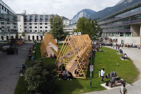
NAME:
SOWI - Garden
BUILDING:
SOWI
FLOOR:
0
TYPE:
Garden
CAPACITY:
2000
ACCESS:
Public Access
EQUIPMENT:
---
The Dösen rock glacier in the Hohe Tauern National Park, Central Austria, is a pilot area of permafrost research in the Eastern Alps with initial measurements in 1993. This rock glacier is active, tongue-shaped, ranges from 2620-2340 m asl, and covers an area of 0.2 km². Rock glacier surface velocity and its relationship to environmental parameters is of particular research interest against the background of changing global environments. The explanation of seasonal variations in their movement is paramount for understanding permafrost-climate relationships in this regard. Currently, only GNSS based point observations on seasonal velocity variations exist at this site and a remote sensing-based, rock glacier-wide, sub-seasonal approach is missing. Respective studies are also scarce on a global level. Therefore, we established a robust UAV based monitoring framework over an area of approximately 1000 m x 300 m targeted at capturing sub-seasonal surface changes and velocities. Methodologically, we utilize RTK-GNSS UAV imagery, state of the art image correlation algorithms (e.g. CosiCorr3D), and an existing geodetic measurement network for independent evaluation of airborne results. Thereby, a particular focus is on key factors for methodological automatization and repeatability. Preliminary results using 2023 and 2024 data document the applicability of the approach showing low errors (UAV based velocities vs. RTK-GNSS velocities) at the sub-centimeter level and strong spatial velocity variations throughout the rock glacier. Annual velocity values (08.2023-08.2024) show a doubling of rock glacier velocities in several parts of the landform compared to existing photogrammetric surveys 1997-2010, which confirms field based geodetic measurements indicating a general rapid increase in velocities since 2010. Upcoming field campaigns will include temporally higher resolutions, i.e., using monthly UAV surveys, to analyze sub-seasonal variations on the background of locally measured environmental variables. Thereby, the contribution will summarize key findings and challenges of a high-resolution UAV mapping approach of rock glacier velocities at a key site of the permafrost research in the Eastern Alps.

We and use cookies and other tracking technologies to improve your experience on our website. We may store and/or access information on a device and process personal data, such as your IP address and browsing data, for personalised advertising and content, advertising and content measurement, audience research and services development. Additionally, we may utilize precise geolocation data and identification through device scanning.
Please note that your consent will be valid across all our subdomains. You can change or withdraw your consent at any time by clicking the “Consent Preferences” button at the bottom of your screen. We respect your choices and are committed to providing you with a transparent and secure browsing experience.