Marie Schroeder

FS 3.508

Atmosphere – Cryosphere Interactions

Details

  • Full Title

    FS 3.508: Atmosphere-Cryosphere Interactions: Micrometeorological processes and their influences on the cryosphere
  • Scheduled

    TBA
  • Location

    TBA
  • Co-Conveners

  • Assigned to Synthesis Workshop

    ---
  • Thematic Focus

    No focus defined
  • Keywords

    glaciology, boundary layer, micrometeorology, mass balance, energy balance

Description

The interaction between the atmosphere and the cryosphere at micrometeorological scales is a key factor in understanding the large-scale changes occurring in snow and ice-covered regions. Micrometeorological processes in these environments are inherently complex, particularly in mountainous areas where terrain and atmospheric dynamics interact. These challenges are further complicated by the rapidly changing cryosphere, making accurate representation of such processes in models critical for understanding and predicting changes in surface energy balance.

This session focuses on the cryosphere-atmosphere dynamics, emphasizing the importance of observational methods and modeling techniques. We want to look at current approaches in measuring micrometeorological phenomena over snow and ice, including turbulent fluxes, radiative exchanges, and surface-atmosphere coupling. The session also explores recent progress and challenges in modeling the cryosphere, including point-scale and distributed energy and mass balance modeling, as well as atmospheric modeling approaches for the surface boundary layer over snow and ice. The session seeks to enhance process-level understanding and improve the predictive capacity of models under changing climatic conditions.

Submitted Abstracts

ID: 3.7478

Mass loss estimations in Patagonian glaciers and their relationship with ENSO events

Ailin Sol Ortone Lois

Abstract/Description

Patagonian glaciers located in Los Glaciares National Park, in Argentine, have currently a total surface area of around 600000 ha and are responsible for feeding the Santa Cruz river basin with melting water. This meltwater then converges into one river and flows more than 250 km, crossing arid Patagonia to finally end at the Atlantic Ocean. Some glaciers have suffered great surface retreat in the last 40 years, and this can be easily measured through satellite images. Other glaciers are considered stable because their fronts and sides show no visible changes over decades. This work demonstrates that the visual stability of a glacier’s front and surface, observed both in satellite images and in situ, is not sufficient to evaluate its condition. Instead, it becomes necessary to resort to other study tools, such as volumetric analysis. Mass balances were calculated using the geodetic method with free Digital Elevation Models from missions such as SRTM, ALOS, TanDEM, and ASTER, from different dates. Corrections were made using lidar data from the ICESat-2 mission. An analysis methodology was developed, and the necessary corrections were generated to ensure correct comparisons in the same vertical and horizontal reference systems. Additionally, meteorological and ENSO data from space missions were used to determine a relationship between climate variables and mass balance. Preliminary results show a positive relationship between meteorological data and mass balance, with pooled analysis being essential for understanding the dynamics of these formations. This review denotes that there is a loss of mass throughout the National Park, which can be measured from space at a very low cost. The methodology was replicated in several glaciers within the National Park, yielding similar results. As a further goal, a repository on GitHub is being developed for storing and sharing source code and methodologies.

ID: 3.9683

High-resolution climate simulations over High-Mountain Asia: Focus on the Central Himalaya and Karakoram

Tika Gurung
Chen, Liang

Abstract/Description

High Mountain Asia (HMA) region, often referred as the Third Pole, plays a crucial role in the global water cycle, as it contains the largest reserves of freshwater outside polar regions, providing water supplies to the millions of people downstream. Accurate modeling of hydroclimatic dynamics in HMA is crucial at higher elevations as it regulates these pristine water resources, where orographic gradients and peculiar climate system create substantial variations in precipitation and temperature. Data from lower elevations may not accurately reflect the unique climatic conditions above 3000 m elevation as there is limited observational data at these high altitudes, and the region’s steep terrain requires finer spatial resolution to effectively represent hydroclimatic variables. This study presents the high-resolution simulations of high-altitude hydroclimatic conditions using the Weather Research and Forecasting (WRF) model forced with the ERA5 reanalysis data at a horizontal grid spacing of 12 km and 4 km, span two hydrological years from October 2016 to September 2018. The simulations are evaluated using data collected from observed stations above 3000 m elevation and available gridded products (CHIRPS, CMORPH, ERA5L). The analysis focuses on precipitation and temperature variations across annual to daily scales in the Central Himalaya and Karakoram regions, known for their contrasting glacial environments. The model reasonably captures temperature and precipitation’s spatial and temporal variability, focusing on monsoon and winter periods for the Central Himalaya and Karakoram, respectively. In general, WRF outperforms ERA5L, providing more realistic spatial patterns. Inter-comparison of precipitation gridded products and WRF outputs show inconsistencies with over-and-underestimation depending on the reference dataset. Performance metrics (R2 and RMSE) indicate station-specific variations in WRF and ERA5L. Overall, probability density function and quantile comparison of daily precipitation and temperature demonstrate WRF outputs align better with in-situ data than ERA5L. These means that integration of multiple-data sources with advanced statistical techniques to better evaluate the model output to capture the regional complexities.

ID: 3.10339

Hyper-resolution decametric modelling of alpine catchments : development of a data processing framework to represent small scale-snow hydrological processes, over complex topography

Alix Reverdy
Cohard, Jean-Martial; Voisin, Didier; Gupta, Aniket; Vermaut, Sarah; Liger, Lucie; Arnaud, Laurent; Barral, Hélène; Coulaud, Catherine; Matthieu, Le Lay

Abstract/Description

Mountain socio-ecosystems are under increasing pressure from anthropogenic forcings (warming, precipitation change and nutrient inputs). Understanding and projecting the consequences of these changes for local biodiversity and downstream water resources, requires to be able to model transfer of energy and water by vertical and lateral fluxes. The determination of these water paths is particularly challenging in mountain terrains, where small scale snow, topographic and geomorphological processes drive hydrology. Conceptual and semi-distributed hydrological models fail to represent the complexity of these water paths and land surface model often neglect lateral fluxes, making both approaches limited in studying trajectories of mountain socio-ecosystems. To overcome these limitations, we applied the data-intensive and calibration-light critical zone model ParFlow-CLM3.5, to a highly instrumented alpine catchment (6.2 km², 1950-3100 m.a.s.l) near the Lautaret Pass, in the French Alps. Specific efforts were directed toward the representation and definition of small-scale snow hydrological processes, modifying significantly the timing, amount, and location of water fluxes above and below the surface. Limitations of the initial snow scheme were overcome by refining the snow/rain transition dependencies on meteorological factors, by improving the snow albedo aging routine, by accounting for Saharan dust events and by selecting relevant spatial distribution methods for meteorological forcings. The snow/rain transition was evaluated with a disdrometer. Meteorological forcings are distributed based on topography (slope effect on radiation and windspeed, shading, reillumination by longwave radiation), altitude (precipitation, temperature and humidity gradients), and remote sensing measurements (snow redistribution). In this presentation we will focus on these snow scheme improvements, and the ability of the model to represent the dynamic of the snow cover during the season at decametric resolution. This will be evaluated spatially with drone, Sentinel-2, and Pleiades images (snow height, snow cover), locally with albedo, snow height and Snow Water Equivalent, and hydrologically with streamflow observations. Further on, this work aims to show that distributed and physics-based hydrological modelling is feasible over complex alpine terrain, with reduced field data needs, and to provide a reproducible framework.

ID: 3.12217

High-Resolution Simulations of Atmosphere-Cryosphere Interactions on Alpine Glaciers Using HICARsnow

Maximilian Sesselmann
Reynolds, Dylan; Asemann, Patricia; Haugeneder, Michael; Mott-Grünewald, Rebecca

Abstract/Description

Alpine glaciers play a critical role in year-round water resource management, influencing flooding events, drinking water resources, and base-load capable green energy production. Their rapid melting contributes to global sea-level rise and is an important marker of ongoing climate change. For precise predictions of glacier responses to evolving climatic conditions, it is imperative to have a detailed description of the glacier boundary layer and understand the intricate interplay between micro-to-synoptic scale atmospheric processes. This comprehensive understanding allows for more accurate modeling of glacier behavior under changing climatic scenarios. However, simulating these multiscale atmospheric processes with traditional numerical models demands significant computational resources, leading to limitations in spatial resolution, domain size, and run-time, neglecting crucial small-scale atmospheric processes. This study aims to investigate the thermal wind driven glacier microclimate and its impact on the glacier’s surface energy balance by utilizing the High-Resolution Intermediate Complexity Atmospheric Research (HICAR) model forced with COSMO1 data. HICAR has proven effective in downscaling conventional numerical models, forcing data to hectometer resolutions, and resolving topographically induced effects on the atmospheric boundary layer. HICARsnow has been further enhanced by coupling the Factorial Snow Model 2 oshd variant (FSM2trans), incorporating modules for snow redistribution. The high efficiency of the model facilitates the investigation of microclimate evolution in the time frame of entire seasons. It also allows for a significant increase in vertical and horizontal resolution. With this, HICARsnow now resolves small-scale processes that are essential to the glacier microclimate, as e.g. the katabatic glacier winds. By calculating seasonal snow dynamics, we gain insights into the intricate interplay between the glacier’s spatially and temporally varying surface characteristics, such as surface roughness and albedo, and the processes within the near-surface boundary layer. This analysis provides a deeper understanding of how these factors influence the dynamics of snow accumulation and glacier melt. Simulations are conducted for two alpine glaciers, Hintereisferner and Silvretta glacier, sites of various experimental studies on glacier microclimate, including HEFEX I and II. Experimental data are employed to validate the simulation results, testing their fidelity and reliability.

ID: 3.12496

Characterizing Near-Surface Turbulence Over Valley Glaciers Using Multi-Level Eddy Covariance and Infrared Imaging

Patricia Asemann
Sesselmann, Maximilian; Haugeneder, Michael; Stiperski, Ivana; Lehning, Michael; Mott-Grünewald, Rebecca

Abstract/Description

Micrometeorological processes at the glacier surface play a critical role in energy exchanges that drive melting and mass balance changes, yet accurately capturing turbulence dynamics and surface fluxes remains challenging. Sparse observational data and the complexity of the terrain limit our ability to identify the key atmospheric boundary layer processes that drive the microclimate over glaciers, and how these processes impact hydrology in glacierized catchments.
A key focus of current research is the characterization of the low-level wind speed maximum present in glacier winds. Determining its exact position and variability is integral for improving our understanding of the glacier microclimate and the extent of surface energy exchange processes. We present findings from past field campaigns on two valley glaciers in the Alps, the Silvretta glacier and the Hintereisferner, utilizing multi-level sonic anemometer measurements alongside high-resolution thermal infrared (TIR) imaging. By directing a TIR camera at large synthetic screens aligned with the glacier wind, we capture near-surface air temperature dynamics and stratification during katabatic flow conditions. The high temporal and spatial resolution of this approach allows for a more detailed characterization of the wind speed maximum and heat exchange dynamics within the glacier wind. The sonic anemometers measure turbulent fluxes under varying atmospheric conditions, complementing the TIR data. Lastly, clustering turbulence data from both sites allows us to explore how glacier wind characteristics vary with topography and surface type.
We discuss the potential and the limitations of the described measurement techniques, as well as the challenges in interpreting and processing turbulence data in complex terrain. This work offers detailed insights into glacier boundary layer dynamics, improving our ability to quantify and understand atmosphere-cryosphere interactions in alpine environments.

ID: 3.13234

Climatic and morphological factors controlling the development of glacial lakes in High Mountain Asia

Sheharyar Ahmad
Traversa, Giacomo; Salerno, Franco; Guyennon, Nicolas; Calciati, Luca

Abstract/Description

Glaciers in High Mountain Asia (HMA) play a crucial role in modulating the release of freshwater into rivers and supporting ecosystems. However, the glacier changes not only impact the water supply for the downstream area, but also alter the frequency and intensity of glacier-related hazards, such as glacial lake outburst floods (GLOFs). An increasing frequency and risk of GLOFs is threatening the Asian population. In this context, glacial lake inventories benefit the disaster risk assessment and contribute to predicting glacier–lake interactions under climate change. Studies in glacial lake inventories using satellite observations have been heavily conducted in the Tibetan Plateau. However, a recent glacial lake mapping is still absent for the overall HMA, although the recent availability of Sentinel-2 satellite with a resolution of 10 m. Here we present the GLACIAL LAKE INVENTORY for the entire HMA regions based on more than 1300 images of Sentinel-2 collected during the 2022 year. A semi-automated lake mapping method have been developed and validated in order to assess and reduce the uncertainty. This study aims to present: (1) an up-to-date glacial lake inventory using Sentinel-2 images for the overall HMA; (2) the rigorous validation methodology adopted to check and reduce the uncertainty; (3) the morphological factors, derived from the Randolph Glacier Inventory (4) and the climatic parameters, considering reanalysis products. Generally, this work updates the current knowledge on distribution of glacial lakes and on factors responsible for their development in High Mountain Asia.

ID: 3.13310

Energy Balance Modeling of Glacier Albedo Evolution and Mass Balance on Gulkana Glacier, AK

Claire Wilson
Rounce, David

Abstract/Description

Glacier mass loss in Alaska is accelerating in part due to albedo feedbacks which have not yet been methodically incorporated into glacier models. For example, wildfires deposit black carbon which darkens snow and accelerates melt rates. We present a new glacier energy balance model with a 1D snow layer scheme that allows accumulation and percolation of black carbon and dust and calculates albedo using a fully coupled aerosol radiative transfer model, SNICAR. The model is first applied to Gulkana Glacier, Alaska where a robust in situ dataset exists for forcing, calibration and validation. To enable regional scale-up, the model’s performance is compared under two forcing scenarios: first, using in situ meteorological measurements from an on-ice automatic weather station, and second, using statistically downscaled climate reanalysis data. The model is then assessed against seasonal and annual point mass balance, end-of-winter snow depth and density, and daily surface height change over the 2024 melt season. By performing a grid search on two parameters, we assess tradeoffs between error metrics and validate the model on the 2024 melt season observations. The model framework allows for analysis of albedo feedbacks and their impact on glacier mass loss in Alaska.

ID: 3.13403

Towards improved understanding of spectral processes on the surface radiation balance in snow covered mountains

Anja Mödl
Lehning, Michael; Dadic, Ruzica

Abstract/Description

Surface radiation drives the energy balance on earth and so plays a crucial role in climate change. Here, snow surfaces are of particular interest due to their high reflectivity. In complex alpine terrain, radiation reflected from surrounding slopes significantly impacts the local radiation balance through multiple scattering and the forward scattering properties of snow. The anisotropy largely varies within the solar spectrum, thus leading to a spectral shift within the reflected radiation. Multiple reflections within the terrain further enhance this effect. In this study, we investigate the impact of anisotropic reflection on the spectral albedo and its local differences in complex terrain. We conducted ground-based spectral albedo measurements using a handheld ASD spectrometer on 14th March 2024. Note that scattered clouds during the observations add uncertainty due to non-uniform sky radiation. The measurements were compared with albedo calculations for a flat surface without terrain reflections using the Snow TARTES model. Our findings show enhanced albedo in specific near-infrared wavelength bands, which correlate for large viewing zenith angles positively with the anisotropic reflectance factor. These results suggest that the anisotropic scattering of snow surfaces creates the detected spectral shifts in reflected radiation, varying with viewing angle and terrain complexity. The observed anisotropy appears to preferentially enhance higher energy wavelengths. This effect may increase energy absorption by dark outcropping rocks and potentially accelerate local snow melt. With this study we want to show the importance of considering anisotropic reflection and multiple scattering in complex terrain when assessing surface radiation budgets and snowmelt processes. To validate and expand our results, we plan to conduct additional measurements under various snow and atmospheric conditions in this winter season.

ID: 3.13471

Aerosol Driven Radiative Forcing and Feedback Processes Promoting Glacial Melt in the Himalayas

Satyajit Singh Saini
Arya, Dhyan Singh

Abstract/Description

Whereas temperature anomalies are major factors behind the retreat of glaciers, aerosol influence in regulating local radiative forcing is largely unexamined. The deposition of black carbon (BC) and dust over glacier surfaces diminishes albedo of the snow and boosts absorption of shortwave radiation and fastening the process of melting. This study investigates the interaction of aerosol and glacier in the Himalayas using Aethalometer data from high-altitude observation stations, satellite-based Aerosol Optical Depth (AOD) retrievals from Giovanni, and numerical modeling approaches. BC concentrations derived from Aethalometer-based measurements yield high-resolution information on aerosol variability and its seasonal pattern of transport, diagnosed through the HYSPLIT model in terms of tracing the long-range sources of the pollutants. Quantification of albedo loss through BC and dust loading is made using the SNICAR model to estimate the direct contribution to increased melting. Additionally, meteorological reanalysis data are used to quantify aerosol-induced changes in near-surface temperature and wind patterns. These changed wind patterns can enhance a feedback cycle, encouraging further aerosol transport and further enhance glacier melting. This research provides a quantitative framework to assess how anthropogenic aerosols influence Himalayan glacier retreat beyond global warming alone. By integrating observational data with transport modeling and radiative transfer simulations, we highlight the need for emission mitigation strategies targeting BC sources. The study also underscores the necessity of localized climate action to protect water resources dependent on Himalayan cryosphere stability.

ID: 3.13822

Assessing the Environmental Impacts of Mining Activities on Glacier Systems

Fakhra Muneeb
Werner, Tim; Drysdale, Russel

Abstract/Description

Climate change significantly impacts highly sensitive glacier systems, causing accelerated mass loss, altering freshwater availability, and enhancing natural hazard risks. The study also intends to assess the environmental impacts of mining activities on glacier systems, particularly the role of mining dust deposition in accelerating glacier ablation. Using satellite and site-specific operational data, this study will explore how dust characteristics, such as particle size and thickness, influence melting rates and investigate the relationship between mining activities, dust concentration, and climate conditions to quantify their combined effect on glacier retreat. These findings will provide insights to support the development of climate-smart mining practices and sustainable management strategies, aiming to mitigate environmental impacts while ensuring sustainable resource use.

ID: 3.13917

Multi-decadal Changes of Snow Cover Characteristics in the Mountain Regions of the Earth

Julien Cuzzocrea

Abstract/Description

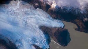
In recent years, the need to assess the quantity and quality of water resources around the world has gained a prominent role in the scientific community, because due to climate change, the amount of available water resources has impacts on the development of human, ecological, and industrial activities. It is in this regard that this dissertation can play an important role, as snow is one of the forms in which water can be stored, especially during the winter season. Its subsequent melting, mainly occurring in spring and summer, is responsible for the release of water, and thus influences water supply, agriculture, and hydroelectric energy production, amongst others.
The focus of this dissertation and related papers is therefore the analysis of the recent evolution of the snow cover characteristics (e.g. depth, snow water equivalent, etc.) in mountainous areas of the Earth, through different data sources and methods, and its relationship with temperature and precipitation changes. So far, various studies have tried to understand the relationship between snow depth changes and global warming, based on in-situ measured data, reanalysis data or satellite data, but generally with spatial limitations, e.g. to a specific region or hemisphere. It is therefore appropriate to extend the scope of previous studies by conducting a uniform analysis of the available snow cover observations in mountainous regions around the world. This should allow to identify and compare trends in snow depth, snow cover duration, etc. at a global picture, to find out which regions are experiencing the most significant changes and how these impact local runoff and water resources, which in their turn can impact local environment, population and activities.