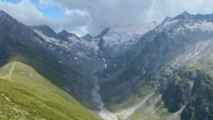
The Ötztal, at the far end of which the venue of our summer school is located, is a 65-kilometre-long Alpine valley running north-south. The advances of glaciers and several rock avalanches have shaped today’s landscape. The advancing ice was repeatedly dammed up by debris, which caused a number of catastrophic floods. Today, the glacier melt is still the most important source for drinking water supplies and local agriculture: livestock farming in the highlands, fruit growing in the lowlands. Nontheless, agricultural production has always been challenged by low precipitation. Due to its geographical location, the Ötztal belongs to one of the driest territories in the European Alps (average annual precipitation in the municipality of Umhausen: 692 mm). The people who settled and cultivated the valley therefore had to adapt to these conditions. This situation gave rise to what is today referred to as traditional irrigation systems, the so-called “Wasser Waale”. “Waale” are man-made irrigation channels along mountain slopes that transport water from its source to the fields and meadows where it is needed. In the past, the construction elements were accompanied by sophisticated social rules determining which farmer received how much water at what time. Many of these irrigation systems are meanwhile destroyed. But they are regaining prominence and are being reconstructed, not only for irrigation, but also for tourist purposes.