Lucas, A.
Walter, F.; Kang, J.; Mangeney, A.; Allstadt, K.; Toney, L.; Gaume, J.; Hibert, C.; Gaume, J.; and Hibert, C.
Abstract/Description
On May 28, 2025, a massive rock-ice avalanche struck near Blatten (Lötschental Valley, Switzerland), triggering seismic waves equivalent to a magnitude 3.1 earthquake. While the 300 residents were evacuated in time, one shepherd was killed and 90% of the village was buried. The event underscores rising alpine hazards linked to permafrost thaw and glacier destabilization, and the need for effective monitoring and early warning systems.
To better understand the dynamics of such events, we conduct research that combines seismic signal analysis, geomorphological observations, and numerical simulations. Since the pioneering work of Kanamori and Brodsky, it has been well established that landslides, including rock, debris, and snow avalanches, generate seismic waves that contain critical information about the source: flow duration, mobilized mass, granular friction, particle impacts on the ground, and interactions with water.
These seismic waves, recorded by dense sensor networks at distances of up to 1000 km depending on landslide volume and frequency content, exhibit a broad spectral range. High-frequency waves are primarily generated by grain-scale flow processes, while long-period waves are linked to the overall accelerations and decelerations of the flow. High-frequency signals are significantly distorted by topography and subsurface heterogeneities, making their interpretation challenging. In contrast, long-period waves are less sensitive to such effects and can be used to retrieve the force exerted by the landslide on the ground through seismic waveform inversion.
This force is obtained by deconvolving the low-frequency seismic signal with the Earth’s Green’s function and provides a means to interpret the mechanical characteristics of the flow. It can be analyzed using physical models ranging from single-block approximations to more advanced granular flow models. However, the inverted force is inherently limited by the bandwidth of the seismic instruments, which may distort its amplitude, duration, and even polarity.
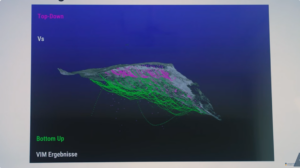
To overcome these limitations, we incorporate additional constraints from independent observations, such as deposit geometry and volumes derived from differential digital elevation models, as well as from numerical simulations, which provide both physical constraints and a means to explore plausible scenarios of the flow dynamics. In this contribution, we introduce the general principles of our combined approach, using the Blatten avalanche as a case study and as an entry point to the more specialized analyses conducted by our research group.