Private

WS 3.124

Fieldwork Fails: Lessons from Unexpected Outcomes in Mountain Research

Details

Description

The content was (partly) adapted by AI

Scientific research in mountainous environments often presents unique challenges, and not all experiments or field studies yield expected results. Yet, these unexpected outcomes can provide valuable insights, highlight methodological challenges, and stimulate new hypotheses. This workshop aims to bring researchers together to discuss “failed” or unpredictable experiments, field-based studies that did not turn out as planned, and results that contradicted initial hypotheses. We invite scientists from various disciplines in Earth sciences who have encountered unanticipated results in their mountain research. Examples might include field experiments hindered by unforeseen environmental factors, measurement devices that malfunctioned due to extreme conditions, or studies that yielded data contradictory to well-established theories. We encourage participants to share their experiences, hypothesize why the outcomes deviated, and discuss lessons learned. This workshop will foster an open and supportive space to explore the scientific value of “failure” and the insights gained from unpredictable outcomes. By examining how these situations challenge existing assumptions and push us to refine our methodologies, we aim to encourage a culture that values learning from unexpected results as a path to advancing mountain science. Ultimately, this workshop seeks to empower researchers to approach unforeseen results as a core part of the scientific process, encouraging innovative thinking, collaboration, and the development of more resilient methodologies in the complex environments of mountain research.

Submitted Abstracts

ID: 3.9347

Challenges in monitoring snow topography using terrestrial LiDAR on a subarctic mountain snowpack (Yukon, Canada)

Eole Valence
Charonnat, Bastien; Baraer, Michel; McKenzie, Jeffrey

Abstract/Description

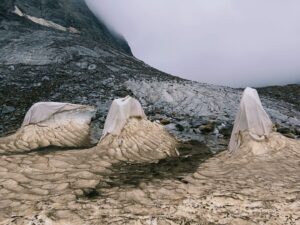
In June 2022, we monitored snow topography changes and preferential ablation for 10 days on a subarctic mountain snowpack in the Shár Shaw Tagà Valley (Yukon, Canada), using a ground-based terrestrial laser scanning system. Our objective was to capture high-resolution, hourly time-series data on snow height variations. However, the results revealed an unexpected diurnal pattern in snow surface elevation, characterized by consistent nighttime decreases and daytime increases. This pattern was not observed in control measurements on nearby boulders, suggesting that the diurnal changes were not caused by misalignment or instrumentation error but were instead linked to snow surface properties. We hypothesize that two potential mechanisms could explain these anomalous observations: (1) the LiDAR’s 905 nm laser measurements may have been influenced by near-infrared sunlight reflected off the snow surface, with the angle of reflection changing throughout the day, or (2) diurnal variations in the snow surface’s liquid water content due to melting and refreezing cycles altered the laser’s interaction with the snow. These findings align with previous studies highlighting the sensitivity of LiDAR measurements to snow grain size and liquid water content under marginal melting conditions. This observation raises broader concerns for snow studies that rely on similar LiDAR systems. Considering the hypothesis (1): Drone-based LiDAR measurements may face comparable biases as the sensor’s angle and solar position vary during flights, potentially affecting snow surface measurements without being explicitly recognized. Additionally, studies utilizing daily or periodic LiDAR surveys might inadvertently overlook such biases due to insufficient temporal resolution, resulting in unvalidated or inaccurate snow depth data. Correction based on relative position of the LiDAR to the Sun may resolve or attenuate this bias. On the other hand, the hypothesis (2) emphasizes the importance of supplementing LiDAR measurements with additional observation techniques, such as photogrammetry, ground-truthing or surface energy budget, to validate LiDAR results and ensure robust data interpretation. This study underscores the indispensable role of in-situ fieldwork and continuous monitoring in identifying potential biases and ensuring the reliability of remote sensing techniques for studying snow processes.

ID: 3.10387

No-Shows in Field Monitoring: Aufeis Non-Formation Leading to Methodological Shifts and Broader Findings

Bastien Charonnat
Baraer, Michel; Valence, Eole; Masse-Dufresne, Janie; McKenzie, Jeffrey

Abstract/Description

Aufeis are multi-layered ice formations that develop in mountain catchments due to winter groundwater or subglacial flow. They serve as valuable indicators of winter hydrological processes. As part of our research on winter groundwater circulation in a mountainous catchment, we initially focused on a proglacial aufeis in the floodplain of the Shár Shaw Tagà (Grizzly Creek) catchment (Yukon, Canada), near a rock glacier. Our team had already established time-lapse monitoring and field observations to assess its annual formation. In 2021, we continued time-lapse monitoring and introduced terrestrial LiDAR to track surface topography changes. Hydrochemical sampling, isotopic analysis, and cryogenic precipitate studies were planned for summer 2022. However, the aufeis failed to form in winter 2022 and has not reappeared despite continued monitoring in 2023 and 2024. This unexpected interruption led to a lack of field data and posed challenges for my PhD research. However, it also opened an opportunity to investigate a critical question: what drives the cessation of aufeis formation? Consequently, we adapted our methodology, expanding the study’s spatial and temporal scope. Using remote sensing, we analyzed aufeis formation trends from 1984 to 2024 across the broader Shä́r Ndü Chù (Duke River) catchment, a 654 km² watershed with 9% glacier coverage, encompassing the Shár Shaw Tagà subcatchment and the original aufeis site. This shift in approach revealed heterogeneous aufeis formation patterns across different sites. These patterns are linked to glacio-hydrological and meteorological changes in rapidly deglaciating mountain catchments. The unexpected non-formation of the targeted aufeis, while initially a challenge, ultimately led to a broader study, providing new insights into mountain hydrology and water resources in cold regions.

ID: 3.11609

Measuring Infiltration Capacity in frozen Soils: Challenges and Advances

Lisa Michaud
Baraër, Michel; Kinnard, Christophe; Poulin, Annie; Wespy, Thomas

Abstract/Description

Seasonal ground frost limits water infiltration and promotes surface runoff at the local scale. Research on this topic does not converge toward a single model of hydrological behavior for seasonally frozen soils. These soils are alternately described as significantly increasing runoff rates, increasing them in an uncertain manner, or not increasing them at all. We found very few studies that attempted to characterize infiltration in frozen soil, and only one has proposed a relationship between soil ice content and infiltration capacity. Collecting more data about that relationship across various soil types would significantly improve our understanding and modeling of winter and cold hydrological processes. Data collection of infiltration capacity in frozen ground is a challenge because the fact that the soil is frozen causes most standard methods to be ineffective.

Over the past two years, we have been developing a method to measure soil infiltration capacity when frozen, a challenging task with many obstacles. This data is crucial for understanding the relationship between soil ice content and infiltration capacity. Currently, most hydrological models assume that frozen soil prevents infiltration entirely. However, field observations of groundwater recharge during frozen periods suggest otherwise. Our hypothesis is that infiltration remains possible even in frozen ground, and we aim to determine the extent to which this occurs.

To collect infiltration capacity data, we used a double-ring infiltrometer but encountered several challenges. Since frozen soil prevents infiltrometer insertion into the ground, they must be installed weeks or months in advance, when the soil is unfrozen. Given the high cost of traditional infiltrometers, we designed more affordable alternatives using flexible plastic. However, these lacked sharp edges, causing slight soil disturbances around the rings and leading to leakage when collecting data. After testing multiple solutions, we found a promising method to mitigate this issue.

When facing important challenges like this one, we found that sharing thoughts and exchanges of ideas are a great help to overcome difficulties and make advancements in science.