Private

FS 3.227

Tales of the Earliest Human Uses of the World’s Mountain Ranges

Details

Description

Contributors to this session discuss the earliest human uses of the mountain ranges of the world. Collectively, they seek to identify commonalities and differences in the motivations that led people to explore and ultimately populate montane environments. They ask, among other things, which resources initially enticed people to ascend to higher elevations; whether people used distinctly different kinds of mountains in different ways; and whether and how early mountain occupants construed mountains and places therein as sacred. Contributors synthesize data from multiple sites, when possible, rather than reporting on single localities or assemblages, to create interesting narratives about the people who first recognized and realized the potential of the myriad mountain ranges of the world.

Submitted Abstracts

ID: 3.8908

Transitional Colonization of Colorado’s Southern Rocky Mountains from the Latest Pleistocene into the Early Holocene

Robert Brunswig
Doerner, James

Abstract/Description

Earliest archaeological evidence of Native American Hunter-Gatherers in the mountains and valleys of North Central Colorado dates to a rare but growing presence of Clovis (13,200-12,800 cal yr bp) and Folsom (12,800-12,160 cal yr bp) hunter-gatherers in Terminal Pleistocene and earliest Early Holocene times. By ca. 10,900 cal yr bp, significantly warmer Early Holocene climate led to development of annual seasonal transhumant migrations of Late Paleoindian hunters and game animals to the region’s high tundra and construction of built game drives, a Native American subsistence pattern which persisted through early historic times. Two decades of high altitude archaeological and paleoenvironmental research by the authors provided substantive documentation of cultural contexts and chronologies of that transitional period through large-scale survey, excavations, and dozens high and low elevation lake and fen sediment core studies.

ID: 3.9463

Tales of the Early Human in the Hindu Kush-Himalayan region of Chitral (Pakistan): Traditional stories and Archaeological facts

Abdul Hameed

Abstract/Description

Chitral, one of the secluded valleys of Pakistan is located on the westernmost part of the Himalaya and on the southern slope of the Hindu Kush Mountain ranges. The valley is counted among the highest regions of the world ranging from 1094 metres at Arundu to 7726 metres at Tirich Mayer. Chitral occupies the northwesterly part of the present Khyber Pakhtunkhwa Province of Pakistan. It has the Badakhshan province of Afghanistan to the west, Wakhan to the north, The Gilgit Baltistan region of Pakistan to the east and Dir and Swat districts to the south. The mountainous nature of the valley is extreme, with over forty peaks exceeding 6000 metres. Between these tall mountains, there are small but fertile valleys along the rivers and smaller streams that provided sufficient resources for human population for survival since the prehistoric time. The mountain passes also played a significant role in human migration and traveling. Archaeological field investigations in the Hindu Kush-Himalaya region of Chitral has revealed tales of the early peoples, ranging from the prehistoric to the 21st century. The remains of these stories are found in the form of rock art, cemeteries, ancient forts & fortresses, tombs and shrines along with portable artefacts including households, ritual and trade objects. Apart from the archaeological remains, there are also interesting tales about the early humans still preserved in the memory of the local community. The present research is based on the archaeological findings collected through explorations and excavation and traditional stories, orally transferred from one generation to the others, which are often neglected by archaeologists while narrating the human past of this mountainous region. The present research is thus aimed at considering the anthropological knowledge of the local communities along with the archaeological data to understand the tales of human past. It highlights the significance and limitation of anthropological knowledge to understand and interpret the archaeological data to complete the tales of early humans. This present research also elaborates the exceptional features of the early human tales found in the Hindu Kush-Himalayan region of Chitral.

ID: 3.9548

Go to the Tibetan Plateau and stay there: who and when?

Hongliang Lu

Abstract/Description

The question of which human species was the first to enter the high-altitude areas of the Qinghai-Tibet Plateau and to occupy the plateau landscape on a permanent basis is probably not the same question, and we need to separate them. We are increasingly confident that one or more members of the human species entered the Qinghai-Tibet Plateau by at least the Upper Pleistocene, based on recent newly discovered archaeological records. But apart from the Denisovans in the northeast of the plateau, there are still too many gaps to fill. Thus, the earliest evidence may continue to set new records. Many recent studies have focused on when humans permanently occupied the plateau. However, it is difficult to answer the question of how permanent each site really was. But it is worthwhile to pay more attention to the sites that have been repeatedly occupied, and especially to their settlement landscape. Finally, I would also like to emphasize that the pressures of high altitude may not have been as difficult as we think.

ID: 3.9845

Familiar or Foreign: Evidence for Clovis People in the Rocky Mountains, USA

Noah Powell
Pitblado, Bonnie

Abstract/Description

Co-author Bonnie Pitblado argued in a 2017 paper that the Rocky Mountains were an earlier and more important part of the initial peopling of the western hemisphere than most archaeologists had traditionally believed. In this presentation, we summarize evidence for the earliest occupation of the Rockies, beginning in Clovis time (13,400 – 12,600 cal BP) and increasing in the immediately subsequent Folsom era (12,800 – 12,300 cal BP). We use this big picture to contextualize the very recent findings of co-author Powell in the Upper Gunnison Basin (UGB) of southwestern Colorado, where he has documented Clovis artifacts in contexts where they have previously not been known to occur. We also touch on the method Powell used—partnering with local UGB residents who possess artifact collections from their ranches—to detect traces of that very rare early material. We end with the suggestion that in places like the western United States, where private land owners legally possess most of the material record of the past, understanding Clovis and other difficult-to-detect components of the archaeological record requires such collaboration.

ID: 3.10508

Engraved and ochre art from the Telem Fezza cave (Tassili-Tan-Ahaggar, Central Sahara, Algeria)

Yasmina Damouche
Berkani, Hayette; Amara, Iddir

Abstract/Description

The Telem Fezza massif is located upstream of the Ti-n-Tarabin Wadi in the Tassili-Tan-Ahaggar region, southeast of the town of Tamanrasset (southern Algeria). It is thought to be of primary age and features a remarkable cave bearing the same name. The cave has two openings. On the north side, it reaches a depth of over 50 m and is some 20 m deep.
The second is a corridor, 10 m long and 1 m wide. This cave overlooks the Telem Fezza Wadi, which flows from east to west to join the Ti-n-Qaren Wadi, which joins the large Ti-n-Tarabin Wadi to the north.
From an archaeological point of view, the main cave we are currently has been extensively filled in by man. This long occupation may suggest the successive expression of different culture heritage during the holocen. These ancient traces of human activity and richness of its rock representations, the subject of multiple interpretations, represent a subject for reflection of great interest.
The walls of this cave an other small rock shelter in the vicinity feature numerous rock figures, mainly from the pastoral period, but we have also noted wild animal figures ( elephants, rhinoceros, giraffes, ostriches) and around 400 vulvar-shapes figures of various forms an sizes at the mouth of the corridor. It is this iconographic ensemble that we have chosen to present to you in this communication.

ID: 3.11137

Core or Periphery? Human utilization of the Kashmir Himalayas from Antiquity to Early-Historic period

Mohammad Ajmal Shah

Abstract/Description

The Himalayan mountains, one of the most formidable natural barriers on earth, have long shaped human migration, adaptation, and cultural exchange. Archaeological and paleoenvironmental evidence suggests that humans began utilizing these high-altitude landscapes tens of thousands of years ago, navigating through a complex web of routes that connected diverse ecological and cultural zones. Early hunter-gatherers traversed the region in search of resources, gradually adapting to its extreme conditions through physiological and cultural innovations. The discovery of Pleistocene-era stone tools and genetic adaptations in Tibetan and Himalayan populations, points to a long-term human presence in the region. Beyond mere survival, the Himalayas facilitated early trans-regional networks, with the Kashmir Himalayas serving as a crucial corridor between Central Asia, the Indian subcontinent, and the Tibetan plateau. Ancient trade and pilgrimage routes, such as the Silk Route and various mountain passes, enabled the movement of goods, ideas, and technologies. Rock art, scared religious shrines, and structural remains along these routes further highlight the cultural and economic significance of these networks. Contrary to the perception of an isolated periphery, the region thrived as a dynamic hub, fostering the exchange of people, goods, and ideas while shaping cultural and economic interactions across the Himalayan and transregional landscapes. This study integrates archaeological, artistic, and environmental research to highlight the Kashmir Himalayas as a dynamic core region, central to networks of mobility, adaptation, and exchange from prehistory to historic times.

ID: 3.11475

Societal ecosystem interactions across East African mountains: Past, present and future

Rob Marchant

Abstract/Description

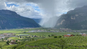
Mountains are crucial for supporting life. More than half of humanity relies on the 60– 80% of the world’s freshwater that is accumulated, stored and distributed from mountains. The relationship between the physical environment, biodiversity and people who live on mountains and interact with these ecosystems can be summarized as mountain socio-ecological systems (MtSES). Exploring how East African MtSES have been shaped by interactions in the past, and how they might develop in the context of future climate change, is a highly complex and truly transdisciplinary venture made possible by a growing quantity and quality of information about the drivers of past change and response to this change. Paleoecological and archaeological data provide crucial information on ranges of variability, cycles, processes, responses and feedback that occur over timescales that are too long to be captured by observational studies and historical archives. The late-Holocene, particularly from around 3000 years BP, was a time of profound cultural transition; Settled agrarian societies emerged as part of the wider Bantu migration that originated from west Africa and quickly spread eastwards and southwards with new technologies, crops and land management practices. During this time a broad range of species were domesticated and their distribution dramatically altered, new technologies were developed and various complex societies emerged and collapsed. Forest degradation, due to agricultural expansion and rising temperatures, led to a reduction in montane forest, with globally important biodiversity hotspots such as the Eastern Arc Mountains of Tanzania losing some 90% of the forest extent Human activities such as deforestation, expansion of agriculture and pastoralism thus significantly transformed ecosystem composition and distribution. This long-term perspective is essential to assess the resilience of ecosystems and to maintain but also as having a key role in designing more sustainable futures that remain within planetary boundaries. By understanding “nature’s contributions to people”, at the most basic level, food, energy and water, we can understand the past, present and future of MtSES within new framings such as the Nature Futures Framework that characterizes how societies exploit, co-exist with or enhance nature through the past, at the present and how this could evolve in the future.

ID: 3.11762

Terminal Pleistocene peopling of the Andes

Kurt Rademaker

Abstract/Description

Once upon a time, at the end of the Pleistocene (between 13,000 and 11,700 years ago), cold conditions in the North Atlantic pushed the Intertropical Convergence Zone southward over the central Andes. The South American Summer Monsoon, which brings precipitation to the Andean highlands, was strengthened. Rainfall increased, lake levels rose, and biotic productivity was boosted, just as the first people were setting foot on the last major continent where no human had gone before. Archaeological sites between 2500 and 4500 meters above sea level in Colombia, Ecuador, Peru, Bolivia, Chile, and Argentina attest to extensive human presence in the mountains by 12,000 years ago, soon after, or perhaps at the same time as, the earliest sites in adjacent lowlands.

How and why did people choose to engage with the high Andes so soon after initial arrival to South America? The answer may lie in deep-time cultural knowledge of mountain systems, their challenges, resources, and opportunities. In this talk I will examine some probable reasons why people chose to explore and reside in the Andes, drawing on geographic, ecological, and archaeological lines of evidence. Early transfers of obsidian from many geologic sources in the Andes provide a temporal baseline for thorough knowledge of the topographically complex highlands by early South Americans. How this knowledge was acquired so quickly currently confounds explanation, although I will suggest some possibilities.

ID: 3.11856

Presenting the highest elevation Pleistocene site so far identified in Australia

Amy Mosig Way

Abstract/Description

Australia’s Eastern Highlands have traditionally been viewed as a cold-climate barrier to Late Pleistocene mobility, with older evidence restricted to elevations below the periglacial zone. However, this model has not been adequately tested with regionally specific, high-resolution archaeological data. Here we report new excavation results from a high-altitude (1,073m) cave, Dargan Shelter, in the upper Blue Mountains, which indicate that occupation first occurred ~ 20,000 years ago, during the last glacial maximum (LGM), making this the highest elevation Pleistocene site so far identified in Australia. We provide evidence for previously undetected interactions along the mountain range and the repeated use of this cold-climate landscape during the Late Pleistocene. Our results align the Australian continent for the first time with global sequences which indicate that cold climates were not necessarily natural barriers to human mobility and occupation.

ID: 3.13237

Adaptive trajectories in temperate mountains: new research at Likonong and Ha Soloja, Lesotho

Brian Stewart
Pazan, Kyra

Abstract/Description

Africa contains some of the earliest evidence for humans living in high mountain systems, both near the equator but also at higher latitudes. The latter – temperate mountain systems with pronounced cold seasons – are important analytical settings because they pose severe resource stresses and logistical challenges that demand flexible, creative solutions. However, the processes by which humans came to first utilize and eventually master them are only beginning to be untangled. Pilot research at Likonong and Ha Soloja, two contrasting rockshelters in southern Africa’s highest mountain system, the Maloti-Drakensberg Mountains of highland Lesotho, suggests that early forager entanglements with these seasonal mountains were focused on the systematic and repeated exploitation of resource extraction sites. We suggest that over time, these visits led to landscape learning and the generation of cultural adaptive strategies eventually allowing for more sustained highland occupation and leading to the highly structured seasonal rounds characteristic of ethnohistoric hunter-gatherers. Importantly, the stresses placed on foragers by sub-freezing temperatures, snow, and extreme resource stress would have required more innovative and collaborative solutions that were unachievable to earlier hominins with lower levels of behavioral plasticity living at higher altitudes but in less seasonal locales.

ID: 3.13579

Middle Pleistocene to the Early Holocene human occupation of the northeastern Tibetan Plateau

Dongju Zhang

Abstract/Description

Recent studies reveal that human occupation of the Tibetan Plateau is much older than we thought, since the late Middle Pleistocene. During the past 200 ka years, Denisovans and modern human successively occupied or even overlapped for several thousand years in some parts of the plateau. The northeastern Tibetan Plateau is the place where the majority prehistoric archaeological sites found on the plateau, thus providing richest information about how human first spread to the plateau and how they adapted to the high-elevation environment. Studies in Baishiya Karst Cave site suggest that Denisovans occupied this region from around 200 ka to about 30 ka. In the late Denisovan occupation period, traces of modern human started to appear in the southern plateau. In the northeastern plateau, some new sites dated to 40-20 ka have been found, but still hard to say which human species the inhabitants were. From 15 to 6 ka, microblade populations intensively occupied the eastern and southern part of plateau. So far, the earliest microblade sites on the plateau were found in the northeastern plateau, indicating that microblade populations spread from the North China through the northeastern margins of the plateau. Our recent excavations and multidisciplinary studies in many Paleolithic and Epiplaleolithic sites in the northeastern Tibetan Plateau provides more new information on the early human occupation of and adaptation to the Third Pole on the earth.