Private

FS 3.202

Multi-Hazard Risk in Mountain Systems

Details

Description

Mountains are complex social-ecological systems where natural processes and human activities are intricately connected. This session focuses on advancing our understanding of how multi-hazard interactions, their cascading effects, and societal dynamics and processes shape risks in mountain environments. Managing these risks effectively necessitates integrating both physical and social dimensions. We invite contributions that explore innovative and interdisciplinary approaches for assessing and modelling multi-hazard dynamics, as well as approaches investigating exposure and vulnerability to multi-hazards, and addressing risks by combining physical and social perspectives. The session emphasises complex system-based perspectives that focus on the interplay between geomorphological, climatic, and anthropogenic factors in shaping hazard and risk scapes. By fostering cross-disciplinary dialogues, this session aims to generate holistic and actionable insights for risk reduction in mountain systems and to identify possible pathways for adaptation, resilience and sustainable development.

Submitted Abstracts

ID: 3.10056

Glacier and permafrost hazard management in the Italian Alps

Marta Chiarle
Bosso, Davide; Allasia, Paolo; Baldo, Marco; Barbani, Mario; Dematteis, Niccolò; Giordan, Daniele; Godone, Danilo; Leone, Francesco; Mortara, Giovanni; Nigrelli, Guido

Abstract/Description

Following the catastrophic failure of the Marmolada Glacier on 3 July 2022, the Italian Department of Civil Protection (DPC) and the Research Institute for Geo-Hydrological Protection of the Italian National Research Council CNR-IRPI) have signed an agreement aimed at developing reference documents on the nature of glacial and permafrost hazards in the Italian Alps and on the expected scenarios based on climate trends, on the methods of hazard assessment and on the strategies for monitoring critical situations.
The main products of this collaboration were: a review of the main hazards for the glacial and periglacial areas of the Italian Alps; the translation into Italian of the “Guidelines for the risk assessment of glaciers and permafrost” (drafted in 2017 by the international working group GAPHAZ), accompanied by a glossary, a literature update and an adaptation to Italy. Moreover, the growing need for innovative solutions for the study of the evolution of instabilities affecting the Alpine glacial and permafrost environment, created the opportunity for the drafting of the “Guidelines of low-cost monitoring solutions for glacial and periglacial instabilities”.
The outcomes of this collaboration will also be used in the framework of the working group on “Risk associated with instability processes in glacial and periglacial environments”, established on 20 May 2024 by Decree of the Head of DPC and which includes representatives of all the institutions involved in the management of glacial and permafrost risks. The aim of this working group is to share guidelines for the implementation of knowledge, training, information and awareness-raising activities on risks in the Alpine area, in the context of climate change.
This collaboration is one of the few examples worldwide of an attempt to apply in a structured way and on a national scale the most up-to-date scientific and technological knowledge to the definition of an approach to glacier and permafrost risks shared with the public bodies responsible for various aspects of risk assessment and management.
This contribution aims to illustrate the methodological approach used and the main results, in the hope of offering useful insights to those in charge of mountain risk management in other countries.

ID: 3.10441

LiDAR-based modeling of the interaction between natural disturbances and wildfire behaviour: new outcomes for Italian Alpine forests

Luca Mauri
Taccaliti, Flavio; Lingua, Emanuele

Abstract/Description

Insect outbreaks, windthrows and wildland fires are among the most relevant natural disturbances affecting forested ecosystems worldwide. The storm Vaia occurred in October 2018 affected many Norway spruce (Picea abies (L.) Karst.) forests in the Eastern Italian Alps. Successively, a severe outbreak of bark beetle (Ips typographus) involved the same area leading to economic and social issues. The interaction between windthrows, bark beetle outbreaks and alterations in wildfire behaviour is scarcely investigated, especially for Italian forests. This research aimed to detect the effects of windstorm and bark beetle proliferation in the alteration of wildfire behaviour in two forested areas (Veneto region, northern Italy), respectively affected by windstorm (first scenario) and bark beetle proliferation (second scenario). The semi-empirical FlamMap model was used to simulate fire behaviour, and Airborne Laser Scanning (ALS) data was processed to derive the spatial distribution of forest attributes and fuels within each study area. 5 meters-resolution Digital Terrain Models (DTMs), Canopy Height Models (CHMs), topographic data and forest metrics were extracted for each scenario, to model alterations of wildfire behaviour over time. The contribution of storm Vaia and bark beetles in altering wildfire behaviour was explored using ALS point clouds acquired before and after the occurrence of the two natural disturbances. Differences in Rate of Spread (RoS), flame length (FL), midflame windspeed (WS) and arrival time (AT) were assessed looking at the first case study (windthrown forest), while differences in RoS and Burn Probabilities (BP) were investigated concerning the second one (bark beetle-affected forest). An increase of RoS, FL, and WS greater than 30 m/min, 3 m and 1.1 m/s were estimated in windthrown areas, as well as a decrease of AT greater than 30 min. An increase in RoS over 25m/min and in BP greater than 0.5 were estimated in forested areas affected by bark beetle outbreak, confirming the key role of windstorm and Ips typographus in altering the spatial behaviour of potential wildfires. This type of analysis could serve as a starting point to explore similar issues using ALS data and mathematical models, aiming to propose effective management solutions for forests affected by different natural disturbances.

ID: 3.10489

Replicability of a Community co-built Glacier Lake Outburst Flood Risk Management Support System: Feasibility and Challenges

Rodrigo Fuster
Silva-Urrutia, Katherinne; Valdés-Negroni, José; Bórquez, Roxana; Moya-Jofré, Hilda; Escobar-Avaria, Cristian; Irarrazabal, Iñigo; Astorga-Vega, Karla; Cuevas, Marcela; Amigo, Catalina; Fleischmann, Matías; Rauld, Javiera

Abstract/Description

This work addresses the challenge of replicating a Risk Management Support System (RMS) co-built with the community associated with the Glacier Lake Outburst Flood (GLOF) hazard. This system was developed as a proof of concept in Villa Cerro Castillo, Patagonia, Chile. Its elaboration required forming a working group of people who lived in the village and/or had some relationship with local, municipal, or regional disaster risk management. This group was called the Local Reference Group (LRG), and it was the group in which the system was built and in which scientific knowledge dialogued with local knowledge, experiences, and memories of past events in Villa Cerro Castillo and its surroundings. The system comprises a comprehensive GLOF risk assessment tool, which considers monitoring elements associated with GLOF hazard, exposure, and vulnerability through a battery of indicators. The system developed in Villa Cerro Castillo is currently being tested in two locations in Chilean Patagonia, Puerto Rio Tranquilo, and Villa O’Higgins, in order to evaluate its replicability to new territorial contexts. This replicability process implies a series of challenges associated with local capacities to implement this system without or with minimal support from risk-competent agencies and related to the specific territorial context of resilience and sensitivity assessment. The research team has addressed the replicability of the system by seeking a balance between replicability and context specificity to effectively generate a system that allows for comprehensive monitoring of GLOF risk while adapting to different realities. To this end, a flexible tool and an adaptation guide are being developed to accompany the process. At the end of the ongoing research, it is expected to prove that the system is replicable and to identify the elements that should be considered in this process.

ID: 3.10649

Complexity as key perspective to link mountains, multi-hazards, and human-landscape modelling.

Andreas Mayer
Polderman, Annemarie; Keiler, Margreth

Abstract/Description

Mountain regions are warming faster than the global average, resulting in a higher frequency and magnitude of extreme hazard events. These changes, combined with socio-demographic and economic dynamics in mountain communities, affect vulnerability and exposure to natural hazards for both residents and visitors, such as tourists. The interactions between biophysical and human factors drive hazard risk, either reduce (e.g. through appropriate adaptation measures) or increase if mitigation efforts are too narrowly focused. While some scientific communities have adopted integrated approaches to studying hazard risk in coupled socio-ecological systems, a comprehensive and dynamic integration of both geomorphic and human aspects is still lacking. Additionally, many studies fail to adequately incorporate the concepts of learning, co-evolution, and social change. Complexity sciences and the school of Social Ecology provide valuable frameworks for understanding these dynamics, emphasizing the importance of societal responses to short-term challenges and long-term stressors in maintaining socio-ecological resilience. The theory of complex adaptive systems views learning, adaptation, and societal change as ongoing processes within these systems. The concept of the “colonization of natural ecosystems” highlights the continuous interventions of social systems into natural systems and their feedback. By combining these approaches, we can create a conceptual framework for explaining the evolution of risks. This framework forms the basis for modeling tools that are place-based, capable of capturing emergent phenomena, and able to address risk cascades and multi-hazards. This presentation builds on a conceptual model that explores risk and resilience in mountain communities and lays the foundation for integrating cellular automata and agent-based models into a numerical framework. This integrated modeling approach enhances our understanding of the factors, relationships, and interventions within coupled socio-ecological systems in mountain environments. Such frameworks provide crucial insights for decision-makers addressing natural hazards risks in increasingly uncertain and changing contexts.

ID: 3.11376

Assessing Climate Risks and Adaptation Plans in Mountain Regions: A Global Synthesis of National Climate Action Plans

Dipesh Chapagain
Ukatu, Nkemakonam Naomi; Schneiderbauer, Stefan

Abstract/Description

Mountain regions, vital for freshwater supply, biodiversity, climate regulation, and other ecosystem services, face escalating climate risks. These highly vulnerable socio-ecological systems are increasingly exposed to multiple climate hazards, including rising temperatures, accelerated glacial retreats, permafrost loss, and extreme weather events. Despite recognition in global policy frameworks, mountain risk assessments remain fragmented, limiting the holistic understanding necessary for effective adaptation and resilience-building. Under the United Nations Framework Convention on Climate Change (UNFCCC), country parties periodically assess and communicate their climate risks, vulnerabilities, and adaptation needs through Nationally Determined Contributions (NDCs), National Adaptation Plans (NAPs), and Biennial Transparency Reports (BTRs). These national climate action plans provide valuable information for a bottom-up global synthesis of climate risks and adaptation priorities. Using the IPCC AR6 risk assessment framework, this study systematically reviews and synthesizes climate hazards, exposure, vulnerability and adaptation measures prioritized by mountainous countries in their most recent NDCs, NAPs, and BTRs. To structure the policy analysis, this study applies the MOVE (Methods for the Improvement of Vulnerability Assessment in Europe) framework for vulnerability analysis, and the UNDRR Hazard Information Profiles (HIP) for hazard classification. This study maps and compares climate risk components and adaptation strategies trends across major mountain regions worldwide, including the Hindu Kush Himalayas, Andes, Alps, Carpathians, and others. It identifies key trends in climate hazards, vulnerabilities, exposure and adaptation responses across geographic regions, sectors, and other analytical dimensions. Additionally, it examines adaptation plans across climate change impact sectors and seven thematic targets of the UAE framework for Global Climate Resilience. Through this integrated and bottom-up approach to mountain risk assessment, this study aims to inform future policy development and strengthen resilience-building efforts in these critical regions.

ID: 3.11881

Cascading effects of GLOFs and permafrost thaw in the Kashmir, western Himalaya

Ulfat Majeed

Abstract/Description

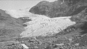
The melting of cryospheric reserves in high mountainous regions has heightened the risk of cryosphere-related hazards which could cause cascading hazards downstream. The western Himalaya, including Kashmir, are increasingly vulnerable to such hazards due to ongoing temperature warming and anthropogenic pressures. The study investigates cryospheric hazards in the Kulgam District of Kashmir, focusing on the relationship between glaciers, proglacial lakes, and permafrost and the cascading risks they pose to downstream communities. The analysis integrates satellite data to monitor glacier and lake changes from 1990 to 2024, assesses permafrost distribution, and identifies potential mass movement zones that could trigger outburst floods. Preliminary results show significant glacier retreat (~28%) and lake expansion (>100%), which increase the risk of GLOFs, exacerbated by the destabilizing effects of permafrost thaw. Hydrodynamic modelling suggests that two glaciers, their associated proglacial lakes, and downstream rock glaciers could pose GLOF risk downstream. Given the high vulnerability of downstream communities and infrastructure, urgent mitigation measures, including better flood defence infrastructure, early warning systems, and awareness programs, are necessary. The study highlights the critical need for integrated monitoring and disaster risk reduction strategies to address cascading cryospheric hazards in the region.

ID: 3.12508

Advancing Risk Evolution Monitoring: Challenges and Opportunities form Flood Risk to Multi-Hazard Risk

Margreth Keiler
Rindsfüser, Nele; Zischg, Andreas

Abstract/Description

The spatial-temporal evolution of natural hazards in mountain systems presents complex challenges for effective risk management. Climate change, land-use change, human interventions, and socio-economic development contribute to dynamic shifts in key flood risk components—hazard, exposure, and vulnerability—necessitating adaptive management strategies supported by systematic risk monitoring. Understanding these evolving risks is crucial not only for flood management but also for developing comprehensive multi-hazard approaches in mountain environments. This study evaluates the application of a flood risk monitoring framework at the national scale in Switzerland, focusing on its capacity to support adaptive risk management. Over a 10-year period (2014–2023), we collected and analyzed data streams for hazard (continuously updated flood hazard maps), exposure (e.g., number of buildings in hazard-prone areas), and vulnerability (degree of potential loss). By calculating potential damage annually, we established risk trend curves, revealing both temporal changes and spatial variability in flood risk across Swiss administrative units. The results indicate a 26% increase in total flood risk over the decade, with hazard areas expanding by 32% and exposure rising by 35%. Disentangling the contributing factors provided critical insights into the drivers of risk evolution, including land-use changes and socio-economic developments. Beyond flood-specific findings, this study highlights the broader potential of applying the risk monitoring concept to multi-hazard contexts. The principles of systematic data collection, periodic evaluation of risk components, and integration of evolving hazard dynamics offer a strong foundation for comprehensive multi-hazard risk monitoring. In a second step, we discuss the opportunities and challenges of extending this approach to include other hazards such as landslides, avalanches, and debris flows, emphasizing the benefits of a unified monitoring framework for adaptive multi-hazard risk management. By fostering a more holistic understanding of risk evolution, this approach can significantly enhance resilience and inform proactive risk reduction strategies in mountain systems.

ID: 3.12756

“Acts of God” or avoidable political hazards: The making of Sikkim’s catastrophic dam-break disaster and learning from it.

Rinchu Doma Dukpa

Abstract/Description

Dams are often lauded as “engineering marvels”, but dam breaks are conveniently clubbed into the category “acts of God” occurring under “force majeure”, shifting accountability from human to non-human causes. The recent dam break disaster in the Teesta valley of Sikkim on the 4th of October 2024 falls neatly within this category. Current public and academic discourse on dams in high mountain regions is largely centered around dam development and their removal, but discourse on dam-disaster and dam hazards including dams-as-hazards has gone missing after Vajont. The Eastern Himalayan region is recently witnessing a burgeoning of dam development, dam induced ecological change and increasing natural calamities across its headwaters, which occupy a unique riverine niche. These headwaters are located in seismically active zones that runs between steeply descending slopes, escarpments and gorges, making the flow of water a powerful but risky resource to harness. Discussing the breaking of Sikkim’s largest dam – the 1200 MW Teesta Stage III, this paper will shed light on the flow of Himalayan waters as being the real hazard in-itself, while unpacking the dam-break disaster as the making of a political hazard. The focus here is to draw attention to the politics of (dam) development and its resultant politics of (dam) disaster or hazards, that has taken heavy toll on lives and properties of communities across the Teesta Valley. I shall argue through the dam-disaster linkage that dam development and dam disaster/hazard act as two sides of the same coin, both of which perpetuates and exacerbates environmental injustice in the region.

ID: 3.13070

A Data-agnostic Framework for Multi-Hazard Events: Integrating Process Interactions and Sediment Connectivity

Md. Sudman Kabir Ishmam
Gems, Bernhard; Rutzinger, Martin; Keiler, Margreth

Abstract/Description

Analysing multi-hazard events is inherently complex, often involving a vast array of processes with varying degrees of interdependency. Sediment connectivity, increasingly investigated in natural hazard and risk research for its substantial influence on hazard occurrence and characterization, remains largely underexplored in multi-hazard contexts – perhaps due to the added complexity of integration. Extensive data requirements, along with its non-uniformity and scarcity – create further challenges for systematic analysis. By introducing a holistic framework, this study aims to systematically integrate sediment connectivity into multi-hazard analysis, providing a comprehensive foundation for future research in this domain. Our approach deconstructs complex multi-hazard events into unitary process segments to enable a systematic assessment of their roles in hazard propagation from a sediment connectivity perspective. The data-agnostic design of the framework allows analysing hazard events with limited and non-uniform sets of data. We make use of a fuzzy-logic based framework to derive weights of sediment connectivity and probabilities to the deconstructed process-segments for event-tree analysis. This allows scenario-based comparisons of event propagation, such as assessing how protective measures or extreme environmental conditions might have influenced process dynamics and the event as a whole. The modular and adaptive design is the key strength of this approach, providing a structured yet flexible method for holistic analysis of multi-hazard events. Its interoperable and adaptive framework allows seamless integration of fragmented data sources, ensuring meaningful analysis even with incomplete and non-uniform datasets. The primary objective of this study was to not only establish a foundation for holistic multi-hazard analysis, but also to encourage further research on sediment connectivity and its role in multi-hazard dynamics.

ID: 3.13248

Linking community ties and public leadership: How social capital and village cadres shape rural community disaster resilience in Wenchuan County, China

Jifei Zhang

Abstract/Description

Rural communities frequently bear the brunt of natural disasters due to limited infrastructure and scarce economic resources—a vulnerability that sharply contrasts with urban areas where economic capital predominates. Recent disaster events have exposed the shortcomings of conventional top-down risk management systems in these settings. To address this gap, this study develops and empirically tests a novel measurement scale designed to quantify how social capital—encompassing personal networks, trust, and reciprocity—bolsters rural disaster resilience across three critical phases: pre-disaster preparedness, in-disaster response, and post-disaster recovery. Drawing on survey data from 349 households in six debris-flow–prone villages of Wenchuan County, China, and employing Structural Equation Modeling (SEM), our findings indicate that personal networks (standardized coefficient = 0.279), trust (0.165), and reciprocity (0.124) each exert a significant positive effect on overall resilience (all p < 0.05). Moreover, the village cadre system emerges as a crucial institutional node, complementing top-down approaches by facilitating swift communication and coordinated resource allocation. These results advance our theoretical understanding of social capital’s role in rural disaster governance and offer practical insights for developing community-focused, policy-relevant strategies in high-risk rural areas.

ID: 3.13537

Developing a Multimodal Approach for Multi-Hazard Monitoring in the Nepal Himalaya

Austin Lord
Eyler, Brian; Thapa, Saraswati; Kwan, Regan; Khadka, Jeevika; Adhikari, Basanta Raj

Abstract/Description

Across the Himalayan region, new tools are needed to evaluate and monitor multi-hazard risk as climate change shifts the dimensions of intersecting hazard regimes in the mountain environment. Since 2022, our team from the Stimson Center has been developing a toolkit for near-real time multi-hazard monitoring and analysis that is designed to identify high risk areas where cascading hazard chains might generate extreme flow events – such as the 2021 Melamchi Disaster in Nepal or the 2023 South Lhonak GLOF in Sikkim. The analyses, alerts, and information products we create are designed for governmental and non-governmental users, to inform both disaster risk reduction programs and anticipatory action efforts. Going forward, we hope that our multi-hazard monitoring systems can help provide early warning for potential extreme flow events. Our multimodal approach utilizes a blend of impact-based forecasting and dynamic hazard assessment techniques, remote sensing data and earth observation tools, and localized hazard monitoring activities to gain a better understanding of emergent risks. Our goal is to model potential cascading hazard scenarios and create disaster risk scores at the sub-watershed scale – helping to anticipate the risk of potential interactions between multiple hazards and landscape features under extreme flow conditions, demonstrating how, where, and under what conditions cascading disasters could occur.

This paper will reflect on lessons learned over the course of three monsoon seasons in Nepal, sharing insights from the process of multi-hazard risk assessment, conducting near-real time analysis of disaster events like the 2024 Thame GLOF, engaging with government stakeholders and local officials, and promoting localized community-engaged hazard monitoring programs. This includes discussion of our efforts to an integrated model for simulating extreme flow events in high-risk basins, empirical findings on best practices for risk communication, and reflections on the challenges of governance, interoperability, and sustainability that arise while working with government partners in Nepal. Given Stimson’s unique position as a think tank, we will also analyze the politics of knowledge production in the context of transboundary disaster risk management in the Himalayan region, and highlight the value of knowledge sharing in this rapidly evolving space.