Private

FS 3.192

Generating and integrating interdisciplinary data

Please log in to add items to your favorites.

Details

  • Full Title

    FS 3.192: Generating and integrating interdisciplinary data to understand mountain socio-ecological dynamics and support multi-scale policy formulation
  • Scheduled

    TBA
  • Location

    TBA
  • Assigned to Synthesis Workshop

    ---
  • Thematic Focus

    Adaptation, Monitoring, Policy
  • Keywords

    Data and monitoring, Interdicplinary, Global, GEO Mountains

Description

Integrated understanding of the Earth’s crucial (yet complex) mountain regions is essential for more effective science-policy dialogue and guiding decision making across multiple scales, from local to global. However, because scientific investigations in mountains are still often conducted within narrow disciplinary silos through short-term research projects, comprehensive long-term data spanning multiple components of mountain socio-ecological systems (SES) frequently remain limited. In particular, the practical integration of socio-economic and bio-physical data typically remains lacking, leaving key interactions and feedback mechanisms poorly understood and/or represented in predictive models. This session therefore encourages contributions from across the world’s mountain regions involving interdisciplinary, long-term approaches to the collection, assembly, and/or integration of mountain data and information (including in situ, remotely sensed, Indigenous knowledge etc.). Presentations applying or building upon the concepts of “Essential Mountain Variables” and networks of “Mountain Observatories” are especially welcomed, as are modelling studies that capitalise on existing diverse observations to inform decision-making processes, for instance via the delivery of operational services. Open Science principles should be followed where applicable. The session represents a contribution to GEO Mountains. During the associated workshop, we anticipate a rich discussion on opportunities associated with working across traditional disciplinary and methodological boundaries.

Submitted Abstracts

ID: 3.8835

Building resilience to climate change through mountain nature-based community enterprises in Africa

Yvonne Bigengimana

Abstract/Description

Africa Mountains cover 3 million km² of Africa surface, with heights varying between 1,500 m and over 5,000. Africa mountains are hotspots for biodiversity conservation and essential sources of food, medicine, raw materials, and water (water towers). Mountains play vital role in climate monitoring, offering favorable conditions compared to the drier lowlands. Mountains serve also as home to most of Africa communities. In return, mountain communities have a notable role in sustainable mountain ecosystems conservation and development. They are key actors, reliable partners and implementers, source of knowledge and best conservationists. However, Africa mountains and communities, face significant challenges such as vulnerability to climate change, land degradation, unsustainable agriculture, limited access to sustainable finance, and poverty. As contribution to the sustainable mountain ecosystems and community development, the Albertine Rift Conservation Society (ARCOS) is implementing an Africa Mountains Programme, aiming to promote policies and knowledge-based activities for sustainable mountain development in Africa. This poster will particularly focus on ARCOS’ initiatives to build mountain communities resilience to climate change through mountain nature-based community enterprises. We will showcase how an integrated approach called BEST (B: Building leadership and sustainable community institutions; E: Enhancing environmental resilience; S: Sustainable business solutions and T: Transforming and inspiring others), developed by ARCOS, is successfully transforming mountain community livelihoods and build their resilience to climate change

ID: 3.10336

Toward essential socioeconomic variables for understanding societal change in mountain regions

Lina Rodriguez
Romagnoli, Federica; Cruz Maldonado, Nereyda Nathalie; Clark, V Ralph; Delves, Jess L; Drenkhan, Fabian; Heeks, Richard; Maharjan, Amina; McDowell, Graham; Schneiderbauer, Stefan; Steiner, Jakob F; Thornton, James M.; Viviroli, Daniel; Wymann von Dach, Susanne

Abstract/Description

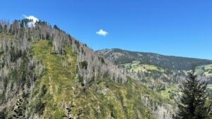
Mountains host intricate socio-ecological systems where human populations interact within diverse social, cultural, economic and environmental contexts. While research advances our understanding of bio-physical phenomena, societal dimensions (i.e., demographic trends, rural-urban dynamics) often receive less attention. The lack of comprehensive data collection and identification of societal indicators hampers efforts to track transformative processes in mountain systems. Having access to socioeconomic variables across mountain regions —such as income and physical infrastructure— and analyzing them in conjunction with bio-physical changes, is crucial for assessing and monitoring socio-environmental interactions. Gaining deeper insights into these dynamics helps inform and guide decision-making that promotes sustainable development, reduces poverty, and strengthens resilience to socioeconomic and environmental challenges.
Mountain regions are diverse, varying greatly in terms of geography, culture, and economic activity. Capturing the full complexity of these interactions remains a major challenge for data collection that requires creating and integrating knowledge that reflects both common characteristics and the unique realities of mountain regions. For this, researchers, policymakers, and international agencies must ultimately adopt an interdisciplinary approach that combines local perspectives with global insights.
Here, we introduce a preliminary set of Essential Socioeconomic Variables (ESVs) that have undergone a prioritization assessment. The identified ESVs resulted from a joint effort involving experts from different mountain regions, who outlined variables relevant at the global and regional level during multiple virtual and in-person interactions. This set is presented as a tool to provide a foundation for ongoing discussions on the specific and general characteristics, vulnerabilities and needs of mountain communities. Given the constraints of time and resources, prioritization was essential. To navigate the complexity given by the multiplicity of dimensions, we focused on variables that provide the most valuable insights into the key aspects and processes shaping mountain systems. This required challenging discussions and compromises among scientists working on different topics in different regions and highlights the need for significantly enhance funding for mountain-specific socioeconomic data collection and analysis in the future.

ID: 3.10828

Carbon dioxide fluxes in glacier forelands: patterns, drivers and temporal trends

Silvio Marta
Mainetti, Andrea; Gennaro, Simona; Ficetola, Gentile Francesco; Provenzale, Antonello

Abstract/Description

Glaciers shrinkage, primarily due to human-induced climate change, is altering mountain landscapes globally, and retreat trends are expected to accelerate in the near future. In the European Alps, more than one century of glacier retreat left wide areas available for the colonization of initially barren substrates, leading to the establishment of complex biotic communities, and the development of new ecosystems. The colonization by microbes and plants, leading to increased structural diversity through time, guarantees fundamental services, such as mountain slope stabilization, control of surface runoff and soil erosion, and reduction of surface albedo. One of the key services of these ecosystems, yet still largely unexplored, is their role in carbon cycling and carbon dioxide fluxes. Depending on the balance between gross primary production and ecosystem respiration (i.e., the net ecosystem exchange), these systems might indeed act as either sinks or sources of greenhouse gases. Increasing time from deglaciation increases plant diversity and productivity (usually proxied by vegetation indices, such as NDVI); this in turn generates positive feedback loops with soil nutrients (i.e., P, N), SOM and SOC. However, the relative importance of primary production vs respiration, as well as their drivers and trends over the succession, are still poorly investigated. By combining information on time since deglaciation, duration of the growing season, productivity, plant functional groups and climate from five Alpine glaciers, we aim at identifying the main drivers and trends of primary production and respiration along the chronosequence at the local and regional scales.

ID: 3.10855

Modeling social-ecological interactions in the Pyrenees and beyond: a systems approach to support sustainable decision-making

Anaïs Jolivet
Claramunt, Bernat; Lurgi, Miguel

Abstract/Description

Mountain regions are currently undergoing significant climatic and socioeconomic changes. A comprehensive understanding of these ongoing processes is necessary to diagnose sustainability issues and to support decision-making in mountain areas. Ostrom’s social-ecological system (SES) framework facilitates the consideration of human and natural components, and their interactions and outcomes, as parts of a same system. Despite a wide range of applications of the framework to specific case studies, interactions among SES components are often given less importance than system drivers or outcomes. Moreover, among the multiple challenges encountered in SES science, the integration of different types of data at suitable time and spatial scales remains a challenge in multi-, inter- and transdisciplinary studies.
This study focuses on the Southeastern Pyrenees, where a shift from an agriculture-based economy to a focus on tourism has taken place over the past century. This transition has promoted urbanization and immigration, counteracting population decline. In addition, the already difficult issue of water availability is expected to further intensify due to climate change.
We propose a modelling approach to explicitly model social-ecological system interactions using quantitative multidisciplinary mountain data available from public databases. The application of this approach to diagnose sustainability issues in a Pyrenean SES will be presented, as well as its integration in a broader modelling framework potentially serving as a tool to inform decision making. Challenges and limitations encountered during data collection and modelling, and the replicability and comparability of the analyses in other mountain areas will be discussed.

ID: 3.10949

Impact of Development Assistance on Environmental Sustainability in Kyrgyzstan: Scoping Review

Daler Kaziev

Abstract/Description

Background: There is a wide gap in effectiveness of aid and development assistance on social, economic, and environmental policies and practices, especially in lower-middle income countries. Taking a synthesis approach to aid (in)effectiveness, this scoping review focuses the impact of development assistance on environmental sustainability policies and practices in Kyrgyzstan. Based on the analysis of selected academic publications for the period of 2000-2023, this study provides a qualitative and quantitative synthesis of policies and practices. Methods: A scoping review has been applied as main methodology for data collection, analysis and synthesis. The study found (n= 80) academic publications eligible. Inclusion/Exclusion Criteria, Protocol, and the PRISMA flow chart for Scoping Reviews (ScR) have been applied. Besides the standard study characteristics this scoping review has extracted results by means of mapping policies, aid projects, locations, and organizations/agencies, impacts (negative, positive), and recommendations. Results: The output indicators or evidence found in the studies were mapped to SDG goals and targets. Due to limitation of SDG as an analytical framework, the study further suggests to better integrate an asset-based approach on integrating evidence mapping practices in aid (in)effectiveness research. Despite the political instabilities in the country in the last two decades, the statement that aid and development assistance have failed to improve social, economic, and environmental policies simply is not accurate. Without development assistance, Kyrgyzstan would not have achieved numerous national and international policies such as ‘poverty mainstreaming’, ‘mountain agenda’, ‘green economy’, some of which have been implemented with tangible outcomes for socio-ecological indicators. Substantial efforts have been made by aid agencies to improve environmental policies and practices in the country. This is vivid in improvement of social, human, natural, and economic assets.

ID: 3.11077

Measurements and models of water and carbon dioxide fluxes in Alpine grasslands: the Nivolet Observatory at the Gran Paradiso National Park, Italy

Marta Magnani
Avogadro di Valdengo, Francesca; Baneschi, Ilaria; Baronetti, Alice; Catania, Maurizio; Giamberini, Mariasilvia; Gennaro, Simona; Goiran, Silvana; Marta, Silvio; Parisi, Angelica; Raco, Brunella; Vivaldo, Gianna; Provenzale, Antonello

Abstract/Description

The Gran Paradiso National Park (GPNP), Western Italian Alps, is the oldest National Park in Italy and extends over about 710 square km with an elevation range between 800 and 4,061 m a.s.l. The Park, created in 1922 for the conservation of the Alpine ibex (Capra ibex) and its habitat, is characterized by a high bio- and geodiversity and hosts open semi-natural areas resulting from centuries of human activity. At high elevations, grasslands forage alpine ungulates, provide the support system to pastoralism, act as regulators of the hydrological cycle and have a fundamental role in the nutrient and carbon cycling. To understand the dynamics of Alpine grasslands and to explore the impact of the ongoing climate change on the Park’s habitats, which is part of the European LTER network, IGG-CNR started a long-term monitoring programme of the water and carbon dioxide fluxes in the Nivolet plain (2,600-2,800 m a.s.l.). Since 2016, Gross Primary Production (GPP), Ecosystem Respiration (ER), Net Ecosystem Exchange (NEE=GPP-ER) and Evapotranspiration (ET) have been measured at the interface between soil, vegetation and atmosphere using portable flux chambers. Four sites, characterized by soils with different bedrock, elevation and aspect have been identified within the Nivolet plain to study the spatial and temporal variability of the fluxes. An eddy covariance station, affiliated to the ICOS network as Associated station (IT-NIV) has been installed at one of these sites in 2018. Since 2020, two automated chambers were also installed at the same site. The flux monitoring is complemented with measurements of meteoclimatic variables and ecological descriptors that allowed for the study of flux drivers via multi-regressions models of GPP, ER and ET. The different measurement methods were combined to build a robust framework for describing flux patterns across scales, from small-scale variability obtained with chamber method, to site-scale patterns provided by the eddy covariance method, and landscape-scale estimates that include in-situ and satellite-derived information. Such monitoring and modelling efforts can inform the identification of threats to Alpine grasslands, as well as efficient conservation and management strategies.

ID: 3.11462

Understanding the dynamics of moutain socioecosystems: integrated long-term monitoring in the Venezuelan Andes

Luis Daniel Llambi
Smith, Julia K.; Salas-Bourgoin, María Andreina; Melfo, Alejandra

Abstract/Description

There has been significant progress in the last two decades in long-term monitoring in the Andes. However, existing initiatives have worked mostly independently and emphasized biophysical over social dynamics. The recent consolidation of the Andean Network of Socio-ecological Observatories (ROSA) aims to address this limitation. ROSA proposes a bottom-up approach to integrate existing monitoring initiatives across the Andes, using a transdisciplinary approach, in which the impacts of key transformation drivers (climate and land-use change) on environmental and social variables, are studied. Here, we report results from an integrated analysis of research and monitoring initiatives in the Mérida Observatory of the ROSA Network in Venezuela. We combined an analysis of the environmental history in the region in the last centuries, with a synthesis of results from the last decades of monitoring of climate, hydrology, water quality, glacier retreat, vegetation dynamics, land-use change and socio-economic conditions. Results indicate that climate change, reflected in increased temperatures and reduced precipitations, can be linked with accelerated glacier retreat and the assembly of novel ecosystems during primary succession, as well as changes in vegetation composition and species richness in high elevation páramo summits. At lower elevations, diverse land-use systems with different histories have shown contrasting impacts. Wheat cultivation over more than 300 years resulted in severe degradation of vegetation and soils in drier areas, while more recent long-fallow agriculture for potato production in more humid areas, has allowed a more effective process of secondary succession and vegetation regeneration. The last 50 years have seen a significant increase in market oriented agricultural intensification, resulting in very significant increases in farmers incomes, but also increased conflicts for water use and agrochemical pollution, with important effects on sanitary conditions. Surprisingly, the last decade of severe economic crisis in Venezuela did not result in a decline in agricultural production, farmers responding with increased efficiency in labour and agricultural inputs. However, there has been a clear increase in rural poverty. A key open challenge is to integrate the analysis of climate and land-use change impacts, and promote a more effective use of this information for land-use planning and decision making.

ID: 3.12238

Mapping Socioeconomic Variables in Mountain Areas: A GIS-Based Approach

Calum Kitching
Schneiderbauer, Stefan; Romagnoli, Federica Romagnoli; Rodriguez, Lina

Abstract/Description

Socioeconomic variables are essential for assessing and monitoring the interactions between human populations and the unique environmental conditions of mountain regions. Understanding socioeconomic changes in these areas requires a comprehensive set of essential socioeconomic variables (ESVs), and visualizing these variables is crucial for identifying future trends and developing targeted policies. Nonetheless, mapping these variables in mountain regions presents distinct challenges, particularly in data sourcing, processing, and visualization, leading to inconsistencies in availability and comparability, especially in transboundary regions where socioeconomic variables may be measured differently. To overcome the frequent unavailability, outdated nature, or incompleteness of census data, particularly in mountain regions of the Global South, we identified Gridded Population Datasets (GPDs) such as WorldPop as valuable alternatives for mapping population distribution and related indicators (e.g. access to essential services). We tested our methodology in the EUREGIO regions of Tirol, South Tyrol, and Trentino, a data-rich region, combining GPDs with GIS techniques to map ESVs. Specifically, our study integrates GPDs with road network data, facilitating spatial analyses that identify disparities in service access. We applied this methodology to develop a healthcare access matrix by combining spatial population data with road network distances to determine travel distances from residences to healthcare facilities. This approach identified high-population areas with limited healthcare access, highlighting regions most in need of intervention. An advantage of this methodology is its replicability for other ESVs, like education, employment opportunities, and infrastructure access. This approach provides valuable insights into socioeconomic dynamics, particularly in data-poor regions. This research highlights the need for standardized methodologies to ensure meaningful cross-regional comparisons of ESVs while enabling better visualization of indicators to identify vulnerable populations and support evidence-based decision-making. In mountain areas, where remoteness and topography influence service accessibility, GIS-based visualization offer a powerful tool for assessing socioeconomic vulnerability. By applying GPDs and spatial analysis, this research demonstrates an approach for visualizing and addressing socioeconomic challenges in mountain areas worldwide.

ID: 3.12312

Engaging Local Stakeholders to Enhance Climate Change Mitigation and Adaptation Strategies and Policies: A Case Study from the NEVERMORE Project

Sara Stemberger
Mencarini, Eleonora; Leonardi, Chiara; Massa, Paolo; Torre, Alessia; Viesi, Diego; Ronchini, Arezia; Tamanini, Lia; Bertò, Alessio; Barbera, Maria Serena

Abstract/Description

The Autonomous Province of Trento (Italy) participates as partner of the NEVERMORE project (Horizon EU 2022-2026), contributing to the development of innovative models and interactive digital tools that aim to assist policymakers and citizens in envisioning and assessing future scenarios and shaping more effective adaptation and mitigation policies. The Province is one of the Case Study regions together with four other European locations. The active involvement of these territories helps deliver and localize the project and its solutions to better understand and tackle climate change across different backgrounds and sectors. In Trentino, the chosen focus is on tourism and its interlinked sectors, water and energy management. One of the pillars of the project is to ensure the participation of local public and private stakeholders in the collaborative processes of co-design, co-creation and co-assessment of the activities planned. Therefore, a Local Council has been established to engage with and consult local key players. These stakeholders represent the diverse needs and the multiple perspectives of the tourism sector. The Local Council involves stakeholders from diverse fields, including representatives from academia, policymakers, natural parks, tourism boards, media, mountain professionals, private businesses and civil society. Consultations of the Local Council aim at i) understanding and collecting perceptions on the challenges posed by climate change, ii) examining policy measures of both mitigation and adaptation amidst measures collected in NEVERMORE activities for a catalogue of adaptation and mitigation measures, iii) determining and prioritizing immaterial and material assets vulnerable to climate change from an economic, social and environmental perspective iv) involving stakeholders in a questionnaire on drivers and barriers on the policies v) presenting the initial user experience for a digital tool of a catalogue of policies and in a prioritization exercise for possible measures to model. A set of consultations engaged around 40 stakeholders. Trentino’s experience highlights an approach that harnesses local knowledge and climate change insights to enhance the relevance of scientific findings for regional needs. By integrating diverse local perspectives, this process supports the implementation of tailored adaptation and mitigation measures, as well as the development of innovative digital tools for multi-sectoral climate impact assessment.

ID: 3.12588

Development of social-ecological standard observations for long-term social-ecological research platforms within the eLTER network

Veronika Gaube
Bertsch-Hörmann, Bastian; Egger, Claudine

Abstract/Description

In order to better understand the impact of societal drivers on biophysical systems – and hence changes in ecological indicators – it is important to understand society and its biophysical environment as an interconnected socio-ecological system that is co-evolving and adapting over time. Understanding the multiple impacts of global change on major European ecosystems, critical zones and socio-ecological systems requires an appropriately configured research infrastructure such as the eLTER RI, where scientists and research communities collaborate with policy-makers and society at large over the long-term. The unifying approach for the elements and structure of the eLTER RI is therefore based on four conceptual pillars: (1) long-term, (2) in-situ, (3) process orientation and (4) whole-system approach. The Wholes Systems Approach to In-Situ Research on Life-supporting Systems (WAILS) “combines research on horizontal interactions between social systems and their environments with research in macrosystem ecology with its vertical interactions and scaling”. Social-ecological systems consider systemic relations between human activities and ecological processes, which allows the identification of trends and feedbacks in their interaction. To represent both systems, it is important to integrate a variety of qualitative and quantitative data. We therefore collected 178 socio-ecological datasets for the Long-Term Socio-Ecological Research (LTSER) Platform Eisenwurzen and provide an overview of the availability and accessibility of these data. We then cross-referenced these datasets with the current list of eLTER sociosphere Standard Observations for the period 1970-2023. We observed an increase in the availability of all quantitative data, as well as their level of resolution, over the observation period. The evaluation showed that datasets exist for all Standard Observations studied, but their coverage varies considerably, especially for long time series. While information on land use systems and resource use was quite abundant, data on consumption, livestock and regional economy were rather scarce. As no qualitative data were publicly available, we included an exemplary sample and developed a data scheme that allows the integration of qualitative datasets into the eLTER information management framework.

ID: 3.12722

Empowering Territorial Climate Resilience and Local Communities through a Nature-Based Climate Adaptation Knowledge Repository

Parveen Kumar
Keizer, Marlies de

Abstract/Description

Local communities, especially mountain communities in Europe, are increasingly vulnerable to climate risks such as extreme weather events, ecosystem degradation, and resource scarcity. This research introduces a Nature-Based Knowledge Repository: a comprehensive, meta-analysis–based repository that consolidates scientific research, policy frameworks, best practices from EU funded projects (e.g., Horizon Europe, Adaptation Mission, ESPON), and case studies on nature-based solutions (NbS) from across Europe, including applications tailored for mountainous regions. By mapping European NbS policies and synthesizing practical experiences from diverse stakeholders, and by building the repository based on FAIR data management practices, this knowledge hub delivers actionable insights into ecosystem restoration, sustainable land management, and climate risk mitigation and adaptation. It also highlights critical governance enablers and resource allocation strategies for effective implementation within territorial and place-based policies. The repository accumate evidence from academic sources, grey literature, and implemented case studies, and translates complex research into accessible, policy-relevant knowledge. It provides policymakers, local practitioners, and community stakeholders with a dynamic tool to identify opportunities, overcome barriers, and integrate NbS into regional development strategies. By fostering interdisciplinary knowledge exchange and supporting evidence-based decision-making, this initiative helps to enhance the resilience of local communities and support policy development across Europe, supporting inclusive climate adaptation efforts.

ID: 3.13141

Essential Variables for the rEmote characterisation and monitoRing of mountain EcosystemS along a biogeographical gradienT: from data to decision making (EVEREST).

Beatriz P. Cazorla
Alcaraz-Segura, Domingo; Postma, Thedmer; Navarro, Carlos Javier; Guerrero, Pablo; Mellado, Ana; Zamora, Regino; Martínez-López, Javier

Abstract/Description

Under the ongoing global change scenario, the functioning, vulnerability, and resilience of mountain ecosystems must be comprehensively studied and monitored using essential variables to develop integrated management strategies that mitigate emerging threats. The EVEREST project brings together scientists and managers in the co-design, co-production, and validation of a standardized methodological framework to provide meaningful remote-sensing essential biodiversity variables. These variables will support the development of management strategies according to requirements of the European directives: conservation status of species and habitats (Habitats Directive), monitoring of water quality (Water Framework Directive), and recovery and resilience of ecosystems after disturbance and restoration (Nature Restoration Regulation). EVEREST study areas will be across different mountain environmental contexts, i.e. a set of Mountain National Parks (7 Spanish and 1 Portuguese), covering four biogeographical regions. The specific objectives of the EVEREST project are: 1) Establish a science-management network to foster collaboration among scientists, managers, and decision-makers, ensuring that project outcomes align with real-world needs. 2) Identify and implement essential remote sensing variables and metrics relevant for EU reporting requirements. 3) Analyze baseline conditions, spatial variability, and temporal dynamics of these variables to assess the functioning and resilience of mountain ecosystems across environmental gradients. 4) Validate the ecological relevance of these variables in collaboration with local scientists and managers, integrating expert knowledge, public datasets, and field observations from each national park. 5) Develop MonitorEO, an online tool providing near real-time of biodiversity essential variables to support scientists and managers with decision-making, management strategies, and public awareness initiatives. Final results will be disseminated through scientific publications, conferences, training activities and nationally and internationally recognized public platforms, such as OAPN, GEOBON and LifeWatch-ERIC.

ID: 3.13142

Austria’s Cryosphere in Focus: KryoMon.AT – a new initiative to present the state of the cryosphere to stakeholders and the public

Iris Hansche
Schöner, Wolfgang

Abstract/Description

Mountain regions are highly dynamic socio-ecological systems in which the cryosphere plays a central role. As an Alpine country, Austria is particularly affected by climate-induced changes in the cryosphere, impacting water resources, ecosystems, and economic sectors such as tourism and hydropower. Consequently, Austria developed measurement programs at an early stage to monitor changes in the cryosphere.

However, heterogeneous funding and administrative structures have led to considerable variability in the accessibility, presentation, and visualization of measurement results. The added value of standardized and jointly processed data has not yet been fully utilized. Similarly, the Austrian research community has lacked a commonly accepted representation of the state and changes of the cryosphere for research, policy, and the public. Despite numerous monitoring programs, developments in the Austrian cryosphere have therefore remained difficult to track.

To address this gap, the Cryosphere Monitoring Austria (KryoMon.AT) initiative was launched in 2022, funded by the Federal Ministry for Climate Protection. The goal is to systematically collect, standardize, and provide all climate-relevant long-term measurements of glaciers, snow, lake ice, and permafrost in an accessible format for science, policymakers, and the public. The initiative particularly promotes networking within the research community, harmonization of measurement parameters, and a coordinated presentation of monitoring results.

A significant milestone was the publication of the KryoMon.AT Report in 2023, which for the first time systematically compiled monitoring methods, measurement sites, and changes in Austria’s cryosphere. The results were presented in scientific and public forums to raise awareness and support political decision-making processes. The initiative adheres to Open Science principles, ensuring broad accessibility of reports and all information and datasets used within them.

A follow-up funding by the Federal Ministry for Climate Protection secured in 2025 allows the initiative to continue. Two additional KryoMon.AT reports are planned, which will document the latest developments in Austria’s cryosphere in a clear and comprehensible manner. With this, KryoMon.AT makes a crucial contribution to improving the integration and communication of cryosphere data, fostering evidence-based interaction between science and policy.

ID: 3.13242

Aren’t ethnographic materials on mountain communities qualified as mountain information? Can they be assembled? And How?

Chi Huyen (Shachi) Truong

Abstract/Description

Ethnographic materials consist of written field notes, journals, correspondence, still photos, audio and visual recordings, that were generated during the long-term field research of an anthropologist. By extension, journals, autobiographical accounts, and audio-visual materials generated by a scientist while conducting expeditions or fieldwork have ethnographic quality because they recorded live observation of an event as it happened. Would ethnographic materials about mountain communities – in the forms of text, audio, and visual – be qualified as information worth being assembled and integrated as one, or more, components or layers of long-term comprehensive multi-scientific data and information? What are the possible uses of such qualitative information for understanding the key interactions and feedback mechanisms of socio-ecological dynamics and policy formulation? What are the pitfalls?

Before CARE principles for Indigenous data governance (Collective Benefit, Authority to Control, Responsibility, and Ethics) were adopted, ethnographic materials have always belonged to their author. Can they be collected and made accessible, and how? The talk raises more questions than it answers. The purpose is to gauge the interest of the mountain research community in acknowledging, appreciating, and potentially making use of, with the assistance of innovative technologies and sound ethics, a wealth of qualitative information about the mountain and its people embedded in ethnographic materials that have been generated over the past century and will continue to be generated in decades to come.

ID: 3.13440

The Reality of Citizen Participation in the Development of Moroccan Mountain Regions

Aziz Ddich Said

Abstract/Description

This study explores citizen participation in the development of Moroccan mountain regions, focusing on the interaction between civil society and public decision-makers. It examines the available mechanisms for communication and consultation, highlighting both opportunities and constraints in participatory governance. Through a case study of the “Civil Coalition for the Mountain.” the paper analyzes the role of civil society as a driving force in shaping policies for mountainous areas. It also explores the legal and institutional frameworks that influence this participation. The study underscores the importance of inclusive participation in achieving sustainable development, fostering social cohesion, and balancing community needs with governmental strategies.