Private

FS 3.130

Andean Climate Change

Please log in to add items to your favorites.

Details

  • Full Title

    FS 3.130: Andean Climate Change: Observation, Research & Discovery
  • Scheduled

    TBA
  • Location

    TBA
  • Assigned to Synthesis Workshop

    ---
  • Thematic Focus

    Atmosphere, Cryo- & Hydrosphere, Multi-scale Modeling, Policy, Water Resources
  • Keywords

    Andes, climate change, water resources, extreme events, cryosphere

Description

The Andes mountains provide critical freshwater resources to downstream communities, yet they are also particularly vulnerable to climate change and deemed a “high risk” region for social-environmental systems due to increasing drought and projected future water scarcity. Rapid glacier retreat and reduced seasonal snowpack threaten water supply for domestic use, agriculture, mining, hydropower production and biodiversity. The increased frequency and intensity of extreme events, such as strong storms or long-lasting droughts, further add to increasing and cascading risks. In many parts of the Andes, the current level of adaptation is inadequate to withstand this challenge, as resources, institutional capacities, political stability and scientific understanding are insufficient to support timely action. The lack of a high-quality observational climate database or useful projections of future climate scenarios, in particular, are major roadblocks that in many cases prevent implementing proper adaptation measures in the region. This session aims to bring together scientists working in the many areas of climate change detection, attribution and adaptation in the Andes, to foster dialogue and share experiences and expertise. The session welcomes studies based on theory, observations, modeling, downscaling, climate reconstructions and other methods. Presentations of new datasets, multidisciplinary approaches, novel methodological advances, or policy- and education-based aspects and outreach components are equally welcome.

Submitted Abstracts

ID: 3.9805

Streamflow generation and wetland sustenance in the High and Dry Andes: The role of permafrost and high elevation cryosphere moisture sources

David Boutt
Moran, Brendan; King, Rachel; Dar, Tanveer Ali

Abstract/Description

The Dry Andes of South America (Argentina, Bolivia, Chile) is characterized by high elevation, endorheic basins with precipitation amounts less than ~300 mm/yr and regional wide averages of ~100 mm/yr. These low precipitation amounts prevent high elevation peaks (~6000 meters) from development of ice-glaciers and permanent snow fields. Permafrost, isolated rock glaciers, and some snow does accumulate during summer periods when moisture flow from the Amazon basin occurs. Therefore, downstream waters and wetlands are of small extent and extremely localized to regions with ample recharge and seasonal precipitation. Significant water pressure on the region is now occurring due to mineral extraction with broad regional exploration and development of groundwater resources that are not well understood or characterized. Generally, there is a regional wide lack of precipitation gauge stations and streamflow and groundwater level monitoring network which has led to significant uncertainty in water availability, occurrence, and impacts associated with water extraction and climate change. In a highly instrumented watershed with elevations ranging from 3700 to 6000 masl we have documented a strong correlation between perennial stream baseflow and the percentage of upgradient contributing areas with elevation above 5000 meters. Additionally, local and regional analyses of tritium in water samples show that streamflow and groundwater are dominated by old (tritium-dead) waters – but remain flowing year round. Stable isotopic composition is depleted in heavy isotopes consistent with high elevation or cold moisture sources. Although, lack of high-elevation precipitation samples prevent a direct comparison to those water isotopic compositions. Waters are old implying significant delay from input to output that could be due to storage in aquifers or perhaps storage in high elevation cryospheric water (permafrost and snow fields). Long-term changes in water yield from these catchments are hard to document but regional change suggest a trend towards lower yields perhaps associated with climate related warming. Our results suggest the importance of high elevation precipitation and storage. Warming and loss of surface storage mechanisms have the potential to impact water yield in this region with no significant surface ice.

ID: 3.10135

Reduction of Glacier Cotopaxi coverage related with volcanic activity 2015-2016 and 2022-2023

Bolivar Caceres
Rabatel, Antoine; Berthier, Etienne

Abstract/Description

The glaciers located on Cotopaxi an active volcano in the Ecuadorian Andes, have lost a total ice area of 55% in the last 47 years. This long term trend is well correlated to observed climate change in the region. However, the area losses have been enhanced by the activity during 2015-2016 and more recently, by the last volcanic pulse 2022-2023. The main effect of this volcanic activity is glacier surface albedo change due to ash deposition. During the last eruption of Cotopaxi between august 2015 –January 2016, near 50% of the total glacier area was covered by ashes.. Apart from the ash deposition effects, several new hot spots have been detected near the top of Cotopaxi which are also affecting ice melt. The ice cover of Cotopaxi volcano has been frequently monitored using aerial photos and Pléiades images, including seismic, thermal photos, gas emissions . New insights of this monitoring program related with the evolution of glaciers will be presented in this work.

ID: 3.10177

Seasonality and Trends of Water Availability in the Tropical Andes: Insights from Vegetation Dynamics

Lorenz Hänchen

Abstract/Description

Developing effective climate adaptation and mitigation strategies in the tropical Andes remains a challenge due to data scarcity and scale-related uncertainties. While significant progress has been made in recent decades, hydro-meteorological records on climatological timescales remain limited, often affected by data quality issues. These challenges, combined with the pronounced small-scale climate variability of high-mountain environments, complicate the assessment of past and present hydrological changes and the validation of climate models.

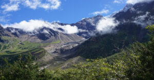
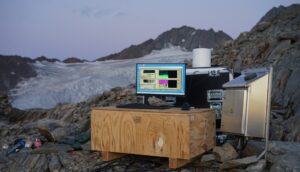
This contribution summarizes efforts of the past years to address these limitations by leveraging remote sensing-derived vegetation proxies to analyze water availability at multiple temporal scales. By establishing robust relationships between vegetation dynamics and both gridded and station-based precipitation data, we provide insights into intra- and inter-seasonal variability, recent trends, and future projections. Focusing on case studies from the Río Santa basin (Callejón de Huaylas), we present key findings and methodological approaches that enhance our understanding of hydroclimatic changes in the tropical Andes. The presented work offers tools and perspectives relevant for climate impact assessments, water security planning, and sustainable adaptation strategies in high-mountain and semi-arid environments.

ID: 3.11248

Snow cover and precipitation extremes in the Andean mountains

Emily Potter
Li, Sihan; Jones, Julie; Bhattacharjee, Sutapa; McNabb, Bob; Bradley, Sarah; Irarrázaval, Iñigo; Matthews, Tom; Perry, Baker; Bravo Lechuga, Claudio; Ely, Jeremy; Davies, Bethan

Abstract/Description

The Andes is the longest mountain range in the world, stretching over 7000 kilometres from Colombia in the tropics to the bottom of Chile in the extratropics. Millions of people depend on water supply from the Andes for their consumption, agriculture, hydropower, and ecosystem services. Often, this water comes from snow and glacier melt, and these water stores can be especially important in times of drought, or during dry seasons for regions with strong annual cycles of precipitation. The inaccessibility of the higher regions in Andes makes setting up weather stations difficult, and the extremely complex topography leads to sharp gradients in weather and climate with varying altitudes of snowline, therefore requiring very high-resolution models to accurately capture the small-scale processes occurring. Due to these challenges, snowfall and snow cover in the Andes remain poorly understood and difficult to model, which are critical to address in the face of a changing climate, with potential for future precipitation occurring in fewer, more extreme snowfall events.

Here we present results from the Weather Research and Forecasting (WRF, version 4.6) regional climate model run at convective-permitting scale (4km) over the entire Andes from 2000-2024. Comparing with MODIS satellite data, we assess the model’s ability to capture the timing and spatial extent of snow cover and determine the climatic influences on snow cover change and their variation over the Andes. We further investigate precipitation and snowfall extremes over a short timescale, and the spatial variation in climatic drivers. Lastly, we determine how these snowfall extremes at different spatial and temporal scales will vary in the future, by dynamically-downscaling a CMIP6 model.

ID: 3.11279

Climate change projections in the Andes: what is new after the IPCC AR6?

Paola A. Arias
Rivera, Juan; Vera, Carolina

Abstract/Description

Weather and climate in South America is influenced by a large variety of processes, including land-atmosphere and ocean-atmosphere interactions, orographic effects, and land use changes. In addition, human-induced climate change is affecting the region in a wide variety of manners. The contribution of the Working Group I (WGI) to the Sixth Assessment Report (AR6) of the Intergovernmental Panel on Climate Change (IPCC) provides a comprehensive assessment of the scientific evidence published up to 2021, regarding the observed and projected changes in the region in association with climate change. This talk presents an updated synthesis of the main projections of climate change for South America, particularly in the Andes, according to studies published after the IPCC AR6 WGI. It is clear that the amount of published scientific studies for South America has considerably increased during the last few years. The most recent literature confirms many of the projections presented in the IPCC AR6 WGI but expands on projections for different aspects of the regional atmospheric circulation and compound extremes not assessed in the IPCC AR6 WGI. However, despite the increasing amount of peer-reviewed literature during recent years, it is important to highlight that projections of annual and seasonal precipitation in South America still exhibit large spread and uncertainty. Therefore, the necessity of producing high-resolution projections in South America is key, as well as the importance of applying fit-for-purpose analysis focused on the models with physically consistent simulations of regional climate. This hopes to be helpful in the building of the assessment of the physical aspects of climate change in South America to be presented in the next IPCC Assessment Report (AR7).

ID: 3.11329

Deplete and Retreat: The Future of Andean Water Towers

Jeremy Ely
Davies, Bethan; Li, Sihan; Buytaert, Wouter; Jones, Julie; Matthews, Tom; Edwards, Tamsin; McNabb, Robert; Carrivick, Jonathan; Dussaillant, Aljeandro; King, Owen; Potter, Emily; Bhattacharjee, Sutapa; Bradley, Sarah; Lee, Ethan; Becker, Rike; Team, The Deplete and Retreat

Abstract/Description

Mountains act as water towers, capturing water from the atmosphere to later be released downstream. However, mountains are sensitive to climate change and their climatology is difficult to predict due to complex topography and elevational effects. The water security of 90 million people depends upon the water towers of the Andes, where the cryospheric components of the water cycle (snow and glacier ice) are rapidly changing. In “Deplete and Retreat: the Future of Andean Water Towers,” we aim to upskill our capability to project future change, by combining state-of-the-art regional climate, mass-balance, ice flow and hydrology models. Here, we present initial findings from our project. This includes progress in monitoring and modelling the climate of the Andes, observing and simulating glacier change, and understanding of how the changes occurring in our warming world are impacting Andean water resources.

ID: 3.11412

Mountain Transfer Recharge: Human-extended watersheds in coastal Peru

Aelis Spiller
Mark, Bryan; Postigo, Julio; McKenzie, Jeffrey

Abstract/Description

Serving as the headwaters for major river systems, mountains are an integral component of the upstream-downstream paradigm of watersheds. Over the past 30 years, the arid coast of Peru has emerged as an agro-industrial hub fed by abundant mountain-derived water resources.
The Río Santa watershed, which originates with the Cordillera Blanca, exemplifies the importance of mountain water resources to coastal landscapes and aquifers. In 2022, Peru exported 23 billion USD of agricultural products. In the southern coast of La Libertad, the number one agro-exporting region of the country, the canal system CHAVIMOCHIC draws water from the Río Santa for irrigation, industry, and domestic uses. Similarly, the canal system CHINECAS transports Río Santa water southward. These activities require massive amounts of water for growing water-intensive crops in desert valleys, including blueberries, sugarcane, and rice.
We construct a water budget of the Río Santa Watershed, incorporating the coastal canal system and agricultural activities. We consider the watershed to extend beyond its geographic boundaries, encompassing coastal regions that receive water from the Río Santa, transported hundreds of kilometers via canals. We create a hydrological and hydrogeological dataset of the region through archival government reports, fieldwork, and modeling. We estimate the contribution of mountain water to coastal irrigation regimes and aquifer recharge, called mountain transfer recharge. In addition to offering a comprehensive description of the current state of this extended hydrological system, our findings allow us to assess the vulnerability of the region’s hydroscape to future change, across the mountain to coast continuum. The research highlights the importance of mountain regions for coastal water resources and food production.

ID: 3.11582

Cascading impacts of climate change in the Andes attributed to anthropogenic influence

Ana Ochoa-Sánchez
Stone, Dáithí; Drenkhan, Fabian; Mendoza, Daniel; Gualán, Ronald

Abstract/Description

Mountain regions are particularly vulnerable to climate change, and the longest worldwide mountain chain, the Andes, is no exception. Monitoring the anthropogenic influence on the climate is vital to taking action for our mountains. We therefore systematically assessed 126 observed impacts of climate change on the natural and human systems of the Andes, including impacts on the cryosphere, water, ecosystems, food security, disasters, energy, tourism, human migration, human health and cultural values. We then performed a model-based attribution assessment of the impacts to anthropogenic influence. We found a cascading chain of impacts of climate change in the Andes across their natural and human systems where anthropogenic climate change has had at least a minor role while non-climate factors such as social, political and economic factors also interfere. Our findings provide a perspective of how humans are influencing the climate and thus changing the water, biodiversity and human lives in the extensive Andean region and highlight the need to understand the complex interactions of natural and human systems. This serves as support for policy and adaptation responses to face the climate crisis.

ID: 3.11709

A downscaling journey across the Andes: A systematic review from coarse regional models to state-of-the-art machine learning methods and beyond.

Santiago Núñez-Mejia
Villegas-Lituma, Carina; Crespo, Patricio; Córdova, Mario; Ochoa, Johanna; Guzmán, Pablo; Ballari, Daniela; Chávez, Alexis; Mendoza Paz, Santiago; Willems, Patrick; Ochoa-Sánchez, Ana

Abstract/Description

Ecosystems and inhabitants of the Andes mountains are vulnerable to warming and precipitation changes, requiring urgent adaptation measures. The standard procedure to design adaptation strategies relies on the use of climate projections and impact models. However, most projections are based on the outputs of coarse global climate models where the Andes cordillera is barely represented. Dynamical and statistical downscaling methods are used to overcome this issue around the world. However, the Andean region requires special analysis because on top of the complex orography, factors such as the observational scarcity, the vast latitudinal range and the diversity of climate regions influence the performance of these methods. To this end, we systematically reviewed downscaling applications covering the Andes mountains. More than 200 scientific articles were included as well as tens of grey literature documents mainly from National Communications. The downscaling journey began in the early 2000s, when regional models with a spatial resolution of around 80km were used. Progressively, dynamical methods have evolved, and spatial resolution has increased to allow convection-permitting simulations that investigate the impact of climate change. In parallel, the statistical downscaling community has grown and moved from multiple linear regression models to state-of-the-art machine learning methods and weather generators. Our review highlights promising advances in the downscaling community. The performance of regional models has improved thanks to optimized parametrizations. Unfortunately, evidence also suggests a disconnection between the methods used for process understanding and the methods used in national projections that are eventually considered for adaptation planning. Furthermore, even when the added value of dynamical simulations has been proven over the Andes, most impact models still rely on simpler bias correction techniques. Another identified barrier is the absence of a consistent evaluation over tropical Andean regions. We have come a long way in the downscaling pathway, but it might be time to consolidate the community, integrate as a region and aim to use the most reliable methods not only for evaluation studies but also for climate change projections and the design of adaptation strategies to improve the resilience of our mountainous countries.

ID: 3.12913

Spatial and temporal variability of carbonaceous impurities in snow samples on the Cordillera Blanca

Simone Meroni
Gilardoni, Stefania; Di Mauro, Biagio; Bonasoni, Paolo; Lasagni, Marina; Fermo, Paola; Borelli, Mattia; Suarez Salas, Luis Fernando; Sanchez Rodriguez, Wilmer

Abstract/Description

Mountain glaciers are melting rapidly, significantly impacting high-altitude ecosystems and human societies. In the Cordillera Blanca (Peru) accelerated glacier retreat raises concerns about potential glacier disappearance by 2080. Although increased temperatures and reduced snowfall are primary drivers (IPCC 2019, IPCC 2022), deposition of light absorbing particles (LAPs), including elemental and organic carbon, further accelerates melting by reducing snow albedo (Skiles et al., 2018).
This study investigates the spatial and temporal variability of elemental carbon and organic carbon in snow samples collected in the Cordillera Blanca. Three distinct glaciers were investigated: Shallap (N -9°29′21.3″, E -77°20′17.2″), Vallunaraju (N -9°25′55.9″, E -77°27’57.3″), and Yanapccha (N -9°01′44.0″, E -77°34′54.2″). Surface snow samples were collected once a month from May to December in both the ablation and accumulation zones during four consecutive years (2017–2020). Elemental carbon (EC) and organic carbon (OC) concentrations were determined using thermal-optical and thermal analysis. The first analysis established the EC/OC ratio, while the complementary thermal analysis quantified total carbon. Interference from hematite particles was corrected to avoid EC underestimation (Kau et al., 2021).
Surface snow samples revealed EC concentrations spanning from 0.030 (±0.003) to 4.81 (±0.16) ppm and OC concentrations between 0.48 (±0.04) and 32.72 (±0.77) ppm. EC and OC concentrations are higher in the ablation zone, likely due to melt-induced concentration, while seasonal variability in the accumulation zone, with elevated values during the dry season, was observed. Elemental carbon concentration was higher in glaciers nearby urban agglomerates (Shallap and Vallunaraju), highlighting the impact of local anthropogenic emissions.
Our findings underline the significant contribution of carbonaceous particles to snow darkening impurities in the Cordillera Blanca.

References
IPCC Special Report (2019) ‘The ocean and cryosphere in a changing climate’.
IPCC Sixth Assessment Report (2022), doi:10.1017/9781009325844.002.
Kau, D. et al. Atmos. Meas. Tech. 15, 5207–5217 (2022).
Skiles, S. M., et al. Nature Clim Change 8, 964–971 (2018).

ID: 3.13075

Insights from two-decades of climate observations sustained collaboratively with near-surface sensors vertically embedded along a tropical Peruvian Andean slope

Bryan Mark
Mazan, Emily; Hellstrom, Robert; Fernandez, Alfonso

Abstract/Description

For 20 years we have collaborated with Peruvian research engineers and university students to maintain a low-cost array of embedded sensors logging hourly measurements of air temperature and humidity spanning ~1km vertically to a maximum elevation of 4700 m in the tropical Peruvian Andes. These sensors have been complemented by additional weather stations and provide a unique data set to examine patterns of elevation dependent changes in key climate variables. We observe greater rates of warming at higher elevations, with variability between wet and dry seasons. An upward trend in daily temperatures at higher elevations is observed with daily minimum temperatures increasing more than 1°C at 4600 m. Minimum daily temperatures shows more pronounced warming rates in the dry season than the wet at the highest elevation site. Consistent with this increased warming at elevation, we see a significantly decreasing trend in the monthly mean ground-level temperature lapse rate. Using the Weather Research and Forecasting Model, ERA 5 reanalysis data is downscaled to 1km resolution to compare the simulated lapse rates with our ground observations. There were also increasingly positive rates of change in dewpoint and relative humidity with height. Just as the temperature trends, the increase in humidity was most apparent at higher elevations, especially above 4500 m. Absolute humidity increases generally, with a greater rate at higher elevation Stations at lower elevations exhibited more daily and seasonal variations in humidity trends than temperature trends. The most evident increasing humidity trends are associated with the higher elevation sites during the wet season. Notable extremes are also recorded including unprecedented maximum temperatures during the 2023-24 hydrologic year.

ID: 3.13196

Integrating Traditional & Scientific Knowledge for Andean Climate Adaptation

Carmen Chavez

Abstract/Description

Climate change is a highly complex global issue with unique challenges at local levels. The Andean mountains face severe effects, including glacier melting, unpredictable weather patterns, water crises, and declining crop productivity. Indigenous and rural communities at high altitudes face particularly challenging circumstances as their subsistence agriculture and pastoral practices confront an uncertain future. Creating collaborative spaces for climate change adaptation and informed decision-making is crucial for these communities to navigate current and future challenges. Research has shown that combining local traditional knowledge (LTK) with Western scientific knowledge enhances the effectiveness of place-based solutions. Success in implementing climate change adaptation relies heavily on understanding and integrating local community worldviews. Andean communities have developed their civilizations over millennia through close environmental interactions, passing down unique knowledge through generations. When combined with climate change research, this LTK creates a powerful ‘two-eyes-seen’ approach for developing locally effective adaptation solutions, emphasizing mutual learning, respect, and ownership by the community members, securing sustainability. Addressing climate change effects requires transdisciplinary approaches with strong community engagement and stakeholder participation. This research focuses on the challenges faced by rural and Indigenous communities in the Cusco region of south Peru’s Andes, a population often overlooked due to language and accessibility barriers. The study examines these communities’ perceptions and experiences of climate change, their current adaptation strategies, and how a transdisciplinary community-based approach can enhance adaptation measures based on their knowledge, values, and beliefs. Additionally, it identifies all stakeholders involved in climate change adaptation and their potential contributions to co-creating concrete, locally-based solutions. A mixed-methods research approach with explanatory sequential design (surveys and interviews) was employed, illuminated by Transformative and Indigenous paradigm worldviews. These bottom-up transdisciplinary interactions and iterative processes of knowledge construction have proven to establish a strong foundation for collaborative and sustainable climate change community adaptation actions and a model for other communities.

ID: 3.13200

Mountain bird communities in the temperate andes: risk and resilience

Tomás Altamirano
Cordero, Magdalena; Honorato, M. Teresa; Pizarro, Fernanda; Biscarra, Gabriela; Bravo, Camila; De Zwaan, Devin; Martin, Kathy

Abstract/Description

Mountain ecosystems comprise 24% of the land-base of world and represent distinct environmental gradients that can shape biological communities. Global warming is a major biodiversity threat, which is amplified in mountain ecosystems. Mountain birds can survive, or not, by degrees. Assessing the risk and resilience of these communities is crucial under rapid change scenarios. In 2017, we initiated a temperate montane bird study aiming to: i) determine both taxonomic and functional distribution across three habitats increasing in elevation: upper montane (UM, >50% tree cover), subalpine (SA, 5-50% tree cover), and alpine (AL, <5% tree cover), ii) quantify mountain bird vulnerability to climate change (based on climate exposure, sensitivity and adaptive capacity), and iii) assess the breeding strategies of high Andean birds. We conducted 1,500 diurnal bird point counts in 10 South temperate mountains (Chile; 39°S latitude), between 1,000 and 2,200 m elevation. We found 74 bird species (in 25 families and 12 orders) inhabiting Andean temperate mountains. Species composition among mountains was highly variable (Jaccard index < 0.5), indicating potential variation in drivers such as habitat structure. Overall, we found a gradient in bird communities from predominantly habitat generalists below treeline to mainly habitat specialist in the alpine (habitat specialist: UM=3%, SA=11%, AL=87%). Functional redundancy (i.e. co-occurrence of species with similar functional roles) increased until treeline and then decreased, suggesting a lower functional resilience of the alpine bird community under the loss of a given species. Climate change effects on birds increased with elevation, with top-mountain species showing the highest vulnerability. We found an alpine breeding community using exclusively rock cavities (90 nests), strategy that might protect them from extreme temperatures in those habitats. Elucidating both risks and resilience of bird communities in southern temperate mountain ecosystems, is critical for understanding the potential conservation value of mountains under an environmental change scenario.

ID: 3.13247

Taxonomic, functional and phylogenetic distributions across elevational gradients in temperate Andes

Tomás Altamirano
Cordero, Magdalena; Rubio, André; De Zwaan, Devin; Honorato, M. Teresa; Pizarro, Fernanda; Martin, Kathy

Abstract/Description

Mountains harbor a high diversity of habitats and bird species worldwide, with one-quarter of these ecosystems located in temperate latitudes. However, despite their high vulnerability to climate change, their distribution patterns and contribution to global biodiversity remain understudied. Over three breeding seasons (2017–2018, 2018–2019, and 2023–2024), we investigated bird diversity distribution across 10 volcanoes in southern Chile. We conducted 1,200 point counts to assess taxonomic diversity (species richness, Simpson index), functional diversity (functional richness, Rao index), and phylogenetic diversity (Faith index, Rao index). Mixed-effects linear regression models were used to evaluate the influence of elevation, habitat type, and structural heterogeneity on diversity patterns. Results indicate a strong positive correlation among the three diversity components, a decline in diversity with increasing elevation, and higher diversity in structurally heterogeneous habitats. This study underscores the importance of integrating multiple diversity components to understand mountain bird communities and inform conservation prioritization.

ID: 3.13519

Identification of changes in the snow accumulation area of the drainage basins of rivers Santa and Vilcanota, Peru

Ulisses Bremer
da Rosa, Kátia; Lorenz, Júlia; Costa, Rafaela; Ribeiro, Rafael

Abstract/Description

The hydro-geomorphological changes and water security scenarios in the face of climate change and ENSO events in the river basins of Southeastern Peru need to be better understood to analyse the socio-environmental impacts for communities that depend on local natural resources. This study investigates changes in glaciers that can increase problems with water availability, pasture quality, soil preparation for crops, and problems with maintaining the quality and way of life in rural communities in the Cordillera Blanca and Cordillera Vilcanota, Peru. Up until this point, 149 images were processed in Google Earth Engine – all available optical satellite images recorded by Landsat 5 TM, Landsat-8 OLI and PlanetScope covering the study area between 1988 and 2023 with low cloudiness were obtained. Results indicate losses in glacier areas and changes in the snow accumulation areas since 1987 in response to a warming climate in the higher altitudes of the Andean region. The observed retreat rates present a significant decrease of 21-22% of the glacier area (1988-2022), meaning a mean loss of -0.74 to -0.75%/year in the Cordillera Blanca. The same methodology is being used for the Cordillera Vilcanota, where previous work that found that migrations are a current problem in the Phinaya community, which has intensified in the last 2 decades. From semi-structured interviews and direct observation, the local people point out that depopulation in rural areas is considered a cause for concern for reasons as the water availability, the beginning of mining activities and, consequently, an increase in conflicts, violence, impoverishment and environmental degradation. Although this work is in progress, the results indicate that the decrease in snow cover area, snowfall, and air temperature increases indicate risks to the socio-cryosphere culture in high Andes rural communities. These factors may require greater attention regarding water resources and disaster prevention.

ID: 3.13803

Bird taxonomic, functional, and phylogenetic distributions across elevational gradients in the temperate Andes.

Magdalena Fernanda Cordero Pérez
Rubio, André; de Zwaan, Devin; Honorato, M. Teresa; Pizarro, Fernanda; Martin, Kathy; Altamirano, Tomás

Abstract/Description

Mountains harbor a high diversity of habitats and bird species worldwide, with one-quarter of these ecosystems located in temperate latitudes. However, despite their high vulnerability to climate change, their distribution patterns and contribution to global biodiversity remain understudied. Over three breeding seasons (2017–2018, 2018–2019, and 2023–2024), we investigated the distribution of bird diversity across 10 volcanoes in southern Chile. We conducted 1,200 point counts to assess taxonomic diversity (TD), functional diversity (FD), and phylogenetic diversity (PD), using Rao’s entropy index. We applied mixed-effects linear regression models to evaluate the correlation and variation of diversity patterns in the bird communities along the elevation gradient. Our results indicated that TD and FD were positively correlated, suggesting low functional redundancy, with each species making a significant contribution to ecosystem functions. In contrast, the weak correlation of PD with other components may be attributed to the predominance of closely related families, such as Tyrannidae and Furnariidae, which account for a large portion of the observed diversity. We found similar distribution patterns for TD and FD across the mountains, with both peaking at intermediate elevations, while PD showed an initial increase followed by a plateau, which declined toward the higher end of the elevation gradient. Additionally, we observed a higher turnover of species above the tree line, likely due to the heterogeneous distribution of productivity in high Andean environments. Our study underscores the importance of integrating multiple diversity components to better understand mountain bird communities and inform conservation prioritization.

ID: 3.14959

Management and governance strategies for resilient high-Andean tropical peatlands: A literature review

Giulia Curatola Fernández
Ifejika Speranza, Chinwe

Abstract/Description

Peatlands are crucial for local livelihoods, climate mitigation, biodiversity conservation, and water regulation. Despite their social and ecological importance, they face growing land use and climate change threats. While research on tropical lowland peatlands is well-established, studies on mountain peatlands in the Andean region remain limited. We conducted a literature review to assess governance and management strategies contributing to high-Andean peatlands’ social-ecological resilience. We searched the ISI Web of Science and Scopus databases and identified 288 peer-reviewed articles published between 1976 and 2024 related to high-Andean tropical peatlands. We classified the papers by the three high-Andean tropical ecoregions: the Paramo, Jalca, and Puna. Preliminary findings show that the different high-Andean ecoregions face various threats. In the Paramo, key threats include intensive cattle ranching, pine plantations, and agricultural expansion. Traditional camelid pastoralism supports sustainability in the Puna, but mining poses a significant risk. This area has also been found to be particularly affected by climate change. The Jalca ecoregion remains understudied, with peatland degradation related to overgrazing and fire. The results also highlight significant research gaps on the social aspects of peatland management and governance strategies, including land tenure system and local community engagement. With this review, we also plan to stress management and governance strategies linked to resilience. We underscore the need for holistic and transdisciplinary research on social-ecological dynamics in high-Andean peatlands to better inform land management practices and land use policies in the context of land use and climate change.