Private

FS 3.126

Spatial-led research, planning and design for Alpine transition

Details

  • Full Title

    FS 3.126: Which role of spatial-led research, planning and design in driving Alpine transitions?
  • Scheduled

    TBA
  • Location

    TBA
  • Assigned to Synthesis Workshop

    ---
  • Thematic Focus

    Adaptation, Policy, Spatial Planning, Sustainable Development
  • Keywords

    alpine transformations, antifragility approach, place-based approach

Description

The Alpine Region is at the forefront of a complex and multifaceted transition, shaped by intersecting crises, socio-economic shifts, and pressing demands of ecological and digital transformations. This region is particularly vulnerable due to disparities between remote and metropolitan areas, exacerbated by the impacts of climate change and ecosystem disruptions. These challenges intersect with dynamics of demographic polarizations and structural transformations across traditional and emerging productive activities in different sectors, such as manufacturing, logistics, energy, tourism, and agriculture. These phenomena are creating unprecedented demands on land use and resource management, emphasizing the limits of established spatial planning and design frameworks. Traditional approaches often struggle to address the multifaceted, cross-sectoral, and trans-scalar nature of these challenges, as well as to interact with supra-national and national policies for the Alpine space. Within this framework, the session discusses how spatial-led research, planning and design can return to play a central role in addressing the current processes of transformations in the Alpine Region according to the principles of sustainability, resilience, and antifragility. Specifically, we aim to gather contributions that cope with the ongoing transitions in mountain areas to decrease their territorial disparities, by focusing on the following questions:

  • what methods of spatial-led research?
  • what strategies and actions of spatial planning and design?
  • what innovative approaches, or successful tools and mechanisms of spatial planning and design?

Submitted Abstracts

ID: 3.7965

Implementation of Agenda 2030 in the Eastern Mountains of Galicia, Spain: an opportunity for rural development

Ignacio J. Diaz-Maroto
Conde-Fernández, Adriana

Abstract/Description

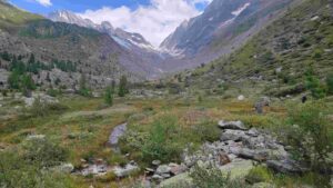
Mountains cover more than 25% of the earth surface, where some billion people live, provide a wide variety of ecosystem services and are essential for improving human well-being. However, they are home to about half of the global biodiversity focuses. SDGs 3, 11, 13 and 15 are the objectives most closely linked to mountain ecosystems. Mountains are “biodiversity hotspots” and, at the same time, they present very fragile ecosystems. The changing orography, i.e. the contrast between sunny and shady areas, the altitudinal difference, which influence the precipitation and temperature gradient, and the landscape heterogeneity, imply the environmental conditions provide a great variety of ecological niches, which helps to increase the biodiversity. So, mountains are very sensitive areas both to climate change and to socioeconomic and land-use changes. The higher Galician mountains are located on the border between eastern Galicia, western Asturias, and León and Zamora provinces. The land use system in the eastern Galician mountains was an agricultural-silvicultural-grazing model adapted to the variety of the mountain environment, based on cereal crops and extensive browsing with orchard crops or fruits. This socioeconomic pattern has shaped the current landscape. Agricultural land is located at the bottom of valleys and the villages in the middle slopes with a sunny orientation. The shady areas, located a great distance from population centres and with high humidity, after the intensive exploitation of the forests suffered from ancient times for the use of wood, are currently hardly affected by anthropogenic pressure and act as refuges for the best primary forest examples. The landscape dynamics in the last century were marked by the evolution of the forest area. So, to understand the current state and future predictions, it is necessary to know the history of these forests. The aim has been to analyse the natural evolution of deciduous broadleaved forests in the Eastern Mountains of Galicia. The historical data can be used now and in the future as a complementary tool to develop conservation strategies.

ID: 3.8602

Integrating spatial planning and ecological connectivity an imperative challange

Luisa Pedrazzini

Abstract/Description

The role of spatial planning in finding acceptable negotiated solutions for the protection and development of complex transnational territories, where different regional and local interests such as the Alpine space converge, is crucial. Under such conditions of spatial complexity, there are common issues that can act as drivers and catalysts for the achievement of the global goal of a Europe Carbon Neutral 2050 The green infrastructure system (GI), declined in the geographic articulation of the Alpine region, now recognised covering a huge area, from the Alpine Convention (14 M/inhabitants) to the macro region of the EUSALP (80 M/inhabitants), is an important matter for analysis and policy development, because it includes all that is complex and articulated characterising the mosaic of the Alps A number of research and activities such as the PlanToConnect Alpine Space project, the ESPON InterAlp research, the outcomes of the Working Group Spatial Planning and Sustainable Development of the Alpine Convention, have highlighted some common elements related to the role of GI also with the apparently paradoxical conflict between the need to environmental protection and the development of renewable energies in the context of ecologic transition. In the diversity of geography, culture and governance responsibilities that make up the Alpine territorial system a common structural matrix based on elements of GI in their complexity and transcalarity should be recognised the common challenge to find out shared solutions by spatial planning tools

ID: 3.9597

Operational principles and feasible design actions in driving Alpine transitions

Elena Solero

Abstract/Description

Planning, territorial design and applied research can play an important role in addressing the complex transformations that characterize the Alpine Region and fragile or marginal territories. This implies the search for regeneration mechanisms aimed at sustainability, resilience and antifragility in economic transition, capable of tackling the challenges of climate change while also addressing increasingly severe socio-territorial disparities. The proposed contribution identifies three possible operational principles, which can be articulated through three design actions intended as potential general recommendations.
Three operational principles
One. Be aware that geographical, environmental, and physical-territorial features shape the history and culture of local communities. This interconnection is an essential starting point for building programmatic development scenarios considering the characteristics and values of the places.
Two. Recognize landscapes, settlement environments, and the evolving lifestyles of contemporary Alpine communities, which are radically different from the recent past. Every successful regeneration project represents a relevant, place-based, and context-specific strategy.
Three. Listen to local knowledge by creating appropriate community biographies and maps that represent their needs, expectations, and requirements. Empowering communities, combined with a transitional and incremental approach to the inevitably long regeneration processes, constitutes the essential conditions for building feasible and shared hypotheses of possible futures.
Three design actions
One. Seize the phenomenon of Alpine decommissioning as an opportunity to enhance the unique characteristics of natural and historical-documentary landscapes, build robust ecological networks, and strengthen ecosystem services. This can be achieved by creating new cultural and environmental routes that promote active and conscious engagement with the territory (geographies as relational landscapes).
Two. Foster the growth of a locally oriented sustainable economy by exploring new employment opportunities and supporting skills and enterprises capable of addressing the social changes that an economic transition phase inevitably entails.
Three. Guide regeneration projects in the right direction by addressing and mitigating the effects of climate change and the natural risks inherent to the geological and environmental characteristics of Alpine regions.

ID: 3.9660

Interface areas in the European Alps: Defining functional regions between mountains and lowlands

Dominik Bertram
Chilla, Tobias; Schirpke, Uta

Abstract/Description

The European Alps are surrounded by highly urbanized areas that are located nearby vulnerable mountain landscapes. The transition areas between the mountainous core and peri-Alpine lowlands present a spatial context, where functional linkages and interdependencies are pronounced. Water supply to lowland populations and weekend tourism flows to mountain areas exemplify these connections. Despite their significance, interface areas remain an underexplored spatial category, with most studies focusing either on mountain or lowland areas. Our paper addresses this gap by conceptualizing and defining interface areas on a pan-Alpine scale. We pursue two key research objectives: (1) to define and analyze the spatial and functional characteristics of these areas, including their similarities and differences, and (2) to position them in relation to the more established categories of mountain and lowland areas. Our results reveal three spatial specificities of Alpine interface areas. First, interface areas show sharp contrasts with significant socio-economic and environmental differences in population density, ecological connectivity and recreational opportunities. Interface areas function as connectors, bridging the divide between high mountain regions and lowland urban areas. Second, interface areas act as geographic funnels, where spatial narrowing channels major transport and mobility flows through limited corridors. This results in hotspots of transport infrastructure demand. Third, policy implications arise from intense competition over limited land availability within interface areas. Strategic spatial development has to balance competing sectoral interests requiring multi-level governance and participatory processes. The recognition of Alpine interface areas as a specific spatial category provides a new lens for Alpine spatial development.

ID: 3.10302

Adaptive design strategies for changing mountain productive landscapes

Marcello Modica

Abstract/Description

Mountain regions, especially in the European context, have been largely shaped by various industrial development dynamics and associated territorial transformations. The landscapes of production generated through this complex and time-wide process are constantly changing under the pressure of global and/or regional economic trends, showing in many cases an inherent lack of resilience and evident limits in further, innovatively sustainable development. Either formed along the exploitation of natural resources, energy production or in the framework of regional development policies for lagging territories, mountain productive landscapes are complex spatial entities which show, and face, radically different spatial and aspatial conditions than their urban twins. Emerging concepts of re-industrialization and re-naturalization are here gaining an increasing relevance in determining development perspectives for either former or current productive infrastructures in peripheral regions, further distancing from “productive city” approaches fostering mixed-use refurbishment of industrial estates. In this context, new spatial-led design strategies are more and more necessary to support the adaption of mountain productive landscapes to the paradigms of the current socioecological transition. Spatial design can be seen in this specific case not only as a medium of representation and investigation on possible futures, but also as an effective platform for co-creation within regional and local planning frameworks, thus enabling the necessary and often lacking multilevel governance. The paper presents and discusses some recent research-by-design experiences focusing on the regeneration of productive landscapes in the European Alps.

ID: 3.11005

Territorial transition in Ligurian Alps. The case of BeyondSnow Alpine Space Project

Federica Corrado
Guerci, Giulia; Brunet, Emma

Abstract/Description

Due to climate change, studies show that snow cover in the Alps will continue to decline in the near future. The small mid-altitude winter tourism destinations and their communities are and will be the most affected by this phenomenon and must interface with the socio-economic consequences of this change, as well as with the ecological impacts.
The contribution refers to an innovative experience carried on in Monesi area, located in the upper part of Arroscia Valley (Ligurian Alpine Arc), once famous for being the only ski resort in the Liguria Region, today a place suspended between depopulation and abandonment and new forms of avant-garde design. This experience represents one of the pilot areas in the Alpine Space project, called BeyondSnow. This project deals with the process of territorial resilience in front of climate impacts in moutain territories located around 1000-1300 meters above sea level.
In the contribution, it is presented the theoretical and methodological approach of analysis and the co-design laboratorial activities applied in the research action developed in the pilot area. In this research action, different technical and political levels have been involved and particular attention is given to the co-construction of Arroscia Valley community and its perception on territorial regeneration. The illustration of the results provides an upgrade related the reflection of territorial transition in mountain areas, proposing a new paradigm of development and experimenting new instruments for the construction of appropriate territorial policies.

ID: 3.11173

Tackling Ski Infrastructure Evolution and Decline through Spatial Planning: Governance, Tools, and Practices in Lombardy

Francesca Mazza
Franco, Caterina

Abstract/Description

The scientific world, tourism stakeholders, media and the third sector seem to be increasingly interested in the problem of ageing, obsolescence and the decline of tourist facilities in the mountains. This problem is accelerated by global issues, including global warming, which accentuates the fragility of tourist resorts and ski lifts. However, the process of overgrowth of tourist infrastructure refers to a broader issue, namely the temporalities and life cycles of tourist architecture and infrastructure. Indeed, while tourist practices evolve in line with societal and economic changes, the physical transformations that occour in the landscape are hardely reversible. The massification of winter tourism, which has affected most Alpine countries since the 1960s, has left a heavy legacy, which has taken the form of the construction of thousands of ski lifts and hundreds of ski resorts on mountain peaks. After an introduction of the debate at the alpine scale, our presentation focuses on the case study of Lombardy Region in the Italian Alps, characterized by small-medium size ski resorts located at relative low altitude which experience problems of underutilization, disuse and financial loss. Given the physical legacy of the problem and the need of envisioning long-term territorial strategies for reimagining the future of these destinations, we argue that spatial planning could play a pivotal role in ensuring sustainable territorial development. This issue opens a broader investigation into the role of spatial planning in facing the challenges posed by tourism decline, analyzing the existing tools in Lombardy. It also invites reflection on the scale through which these challenges are tackled and where gaps occur within current frameworks. Alongside formal planning instruments, attention is given to the governance mechanisms for managing declining ski resorts, including how stakeholder involvement, financial support, and legal frameworks can either enable or constrain adaptive responses. Equally important is the consideration of informal practices, for activating alternative pathways where institutional responses may fall short. The contribute, through the Lombard case, provides a critical examination on the current role of spatial planning in addressing the problem of decline in high mountains, highlighting the main bottlenecks and opportunities for their effective integration.

ID: 3.11307

Beyond Traditional Governance: Exploring Non-Standard Institutional Geometries in the Alpine Arc

Donato Casavola
Berisha, Erblin; Cotella, Giancarlo

Abstract/Description

The complexity and the heterogeneity of the Alpine geography offer the ground for experimenting with different governance models, sometimes bottom-up and sometimes more top-down. The way in which territories are managed differs largely among the countries, influencing not only their spatial organisation but also the governance apparatus applied upon. This is because the countries part of the Alpine area are governed in different ways: to some extent Italy, Germany and Switzerland are largely decentralised with huge differences across them and within each country (see the autonomous regions in Italy), while France is considered instead a centralised system. Based on the evidence gathered from the ESPON INTERALP project, this contribution provides evidence and compares the different governance models across the Alpine arc, highlighting both their strengths and critical issues. The proposal collects different experiences that adopt creative governance structures and models tailored to specific needs: increase multilevel cooperation and coordination, include multi-actor perspectives, explore cross-board contamination, etc. Indeed, particular attention is given to the role of cross-border, transnational, and inter-municipal cooperation programs. The analysis shows how these models transcend traditional governance structures by adopting non-standard institutional geometries moving from more traditional to more experimental initiatives. Although these initiatives aim to promote more integrated and coordinated territorial management, they often overlap and further fragment the institutional framework in between formal institutional arrangement and experimentations. While this heterogeneity is, in principle, interesting, the multiplicity of instruments and actors involved creates administrative complexity and risks slowing down the implementation of effective policies.

ID: 3.11480

From Transition to Antifragility: A Spatial Approach to Innovation and Territorial Regeneration in the Alpine Region

Stefano Di Vita
Arcidiacono, Andrea; Mazza, Francesca; Ramondetti, Leonardo; Rossi, Gioele

Abstract/Description

The Alpine region is at the center of significant transformations driven by economic restructuring, climate change, and digitalization. These processes, while offering new opportunities, also risk exacerbating socio-territorial disparities between strong and fragile areas. Within the framework of the EUSALP strategy, this research explores how spatial planning can support a resilient and adaptive transition, using Valtellina as a pilot case to test innovative approaches. By adopting a place-based and trans-scalar methodology, the study investigates the territorial impacts of economic transition, focusing on key sectors such as logistics, energy production, and tourism. Combining territorial mapping, fieldwork, and direct engagement with local stakeholders—including public institutions, businesses, and civil society—the research highlights both opportunities and contradictions in current policy frameworks. The findings emphasize the need for a more integrated vision capable of aligning digital and ecological transitions with regional development strategies. A core outcome of the research is the identification of a territorial model for Valtellina, structured around a network of research and innovation hubs. Strategically positioned at the intersection of economic, infrastructural, and environmental networks, these hubs aim to enhance collaboration between universities, enterprises, and local governments. By repurposing underutilized spaces and strengthening digital and material connectivity, this model fosters economic diversification, reduces territorial imbalances, and promotes sustainable development. Antifragility emerges as a key principle, advocating for planning strategies that not only mitigate vulnerabilities but also transform them into growth opportunities. This research contributes to the broader debate on how spatial planning can enhance macro-regional strategies, stressing the importance of integrating territorial perspectives into policy frameworks. The findings suggest that EUSALP should adopt a more explicit spatial approach, ensuring that digital and ecological transitions serve as drivers of territorial cohesion and innovation. The proposed methodology, which combines trans-scalar governance with site-specific interventions, could offers a replicable model for other Alpine regions facing similar challenges.

ID: 3.11513

Metromountain: Reinventing urban-mountain connections with design practice for resilient and inclusive development.

Federica Serra
De Rossi, Antonio; Tempestini, Matteo

Abstract/Description

Today’s challenges are forcing mountain regions to confront new and complex issues related to liveability. These areas need to become more resilient to climate change, which has a greater impact at high altitudes, while at the same time adapting to the new lifestyles and working patterns that are emerging in these environments. In this context of rethinking mountain areas, the concept of “metromountain” has been introduced in a design perspective, highlighting the interconnectedness between urban and mountain areas. The concept sees cities and mountains not as separate entities, but as deeply interconnected actors through the exchange of people, ideas, resources and experiences. This paper explores how design actions aligned with the metromountain idea, rooted in the interdependence of city and highlands, can help revitalise mountain areas. These outcomes address both the climate crisis and long-standing problems such as depopulation and marginalisation that have affected rural areas for decades. Through case studies, the essay shows how relational practices have produced tangible, positive outcomes for the regeneration of mountain areas, countering the effects of gentrification and tourism-focused development that characterised the late 20th century. The study shows that both physical and digital spaces play a key role in fostering regenerative urban-mountain connections. Infrastructure, especially welfare facilities, emerge as hubs of exchange capable of reversing harmful trends and offering resilient solutions to the challenges of the contemporary polycrisis.

ID: 3.12888

Co-Designing Innovation: The Role of Participatory Action Research

Daniela Storti

Abstract/Description

In the last decade, there has been a growing focus in policies on rural areas and the emergence of holistic approaches that involve joint interventions in access to services and economic development, in interaction with local communities (e.g., SNAI in Italy, Long-Term Vision, Smart Villages, One Health Strategy). These approaches apply multiscale strategies based on network and innovation theories, recognizing the importance of interconnections and external collaborations as key factors in promoting innovative development at the local level. The new intervention paradigm is based on co-designing with local communities and fostering collaboration to stimulate social capital growth and bring the needs of communities and individuals back to the center of local development models. At the local level, many communities in mountain and marginal areas are placing agriculture at the core of their sustainable development strategies. One of the main challenges is creating new opportunities for young people related to agriculture and natural resources. Participatory action research engages diverse networks, the research sector, and cultural and social dimensions. It can provide mountain communities with the opportunity to co-design innovative projects, enhance local vocations (e.g., livestock farming and viticulture), and support youth participation in agricultural communities. This contribution focuses on the implementation and main results of the School for Young Shepherds, a research-action project. The school, promoted by CREA in collaboration with the association Riabitare l’Italia, was created to support young people who want to start a pastoral business, revitalizing the economic and environmental cycle of mountain areas and fostering processes of regeneration and repopulation. It is an unconventional school that provides training through innovative methods (peer education and experiential learning) while also aiming to create a true community that extends beyond the courses, bringing together people from diverse backgrounds. The first edition took place in Piemonte, in the Alps, in Valle Stura di Demonte, while the second edition was held in 2024 in collaboration with the Mayors and the Union of Municipalities of the Madonie, aligning with the strategic vision that this region has adopted as part of the National Strategy for Inner Areas.

ID: 3.13022

Geospatial Insights on Broadband Gaps in Austria’s Mountain Agriculture and Forestry

Florian Stender
Quendler, Erika

Abstract/Description

Purpose: This poster aims to examine the geospatial distribution of gaps in broadband availability among agricultural and forestry holdings in Austria’s mountainous regions. By utilising geospatial tools, the research seeks to uncover the availability of digital infrastructure in these areas.
Methods: A descriptive geospatial approach was employed to map gaps in broadband availability and depict proximity to infrastructure by combining up-to-date data from the Integrated Administration and Control System and the Austrian Broadband Atlas. This information was then collated with socio-demographic characteristics taken from the Farm Structure Survey.
Results: The geospatial analysis reveals significant disparities in broadband availability between mountain and non-mountain areas, highlighting different levels of access to digital infrastructure in remote areas. The broadband coverage varies from non to high speed supply, indicating opportunities for targeted interventions.
Conclusion: This poster demonstrates the importance of geospatial analytics in identifying and addressing disparities in digital connectivity in mountain agriculture and forestry. The findings guide policy and support future initiatives aimed at expanding broadband infrastructure to ensure equitable availability for all agricultural and forestry holdings throughout Austria.

ID: 3.13494

Cartographies of Care. Thick Mapping as an approach to unfold the socioecological transition of the Alpine territory.

Emilie Stecher
Fauster, Jennifer; Furlan, Cecilia

Abstract/Description

The Alps need agency, independent of profit-driven growth, to achieve development that meets present needs without jeopardising future generations. Moving beyond an anthropocentric worldview involves actively listening to and empowering more-than-humans. Various extraction processes – water exploitation, ski tourism, mineral extraction, and agriculture – treat land as a passive container, ignoring “nature’s” role in urbanisation, exacerbating environmental risks and socio-ecological vulnerabilities, especially in fragile territories like the Alps. This highlights the pressing need for new readings and representations of the Alps metamorphosis that expose evolving conditions and inspire actions for justice, revolutionary care, and respons-ability.

We propose a Thick Mapping approach to address the triple planetary crisis in Alpine territories. Rooted in digital humanities and geospatial turn, thick mapping fosters public participation and collective knowledge production, mitigates injustices, and co-produces spaces. It reveals latent relationships in landscapes and cities, viewing maps as constructors of reality. Inspired by Haraway’s notion of ‘staying with the trouble,’ this study examines how mapping biophysical and sociocultural layers reveals hidden potentials and underrepresented human and more-than-human voices. This approach enables the development of place-based scenarios facilitating dialogues between decision-makers, citizens, and planners, promoting sustainable strategies. Thickness in mapping reflects care and respons-ability expressed through radical listening, inclusive relationship-building, knowledge exchange, and the co-production of new imaginaries.

We share preliminary findings in three contexts: (1) learning environments with master’s students on the Austrian urban landscape (2024–2025), (2) a European open-source brownfield mapping (2024–2026), and (3) a thick mapping study of extractive areas in the Alps (2025). These explorations focus on vulnerable urban landscapes, leveraging thick mapping to investigate transitioning territories and inspire critical, alternative planning approaches.

In conclusion, this contribution discusses and reflects on the agency of thick mapping in Alpine research design processes, counterbalancing socio-ecological injustices. By synthesising different disciplines in critical maps, we seek to broaden our approach and reveal new scenarios and perspectives for the future of Alpine regions.

ID: 3.13694

Socio-political risk assessment as a basis for decision-making processes in spatial planning in alpine regions

Bernhard Obholzer

Abstract/Description

In alpine regions, permanent settlement areas are only available for a small part of the total area due to the topography. Permanent settlement areas are areas that can be supplied with infrastructure and inhabited all year round. Due to the perception that natural hazards are occurring more frequently, risk-oriented spatial planning is becoming increasingly important, especially in these alpine regions. However, in addition to the natural hazards that threaten the permanent settlement area, socio-political problems arise, which are expressed in social processes. This is particularly evident in tourism development. Tourist investor models, such as buy-to-let models, can influence social relations in tourist communities. This influence has been insufficiently represented so far in the assessment of spatial planning measures. Therefore, this paper proposes to integrate a socio-political risk approach into the decision- making process of spatial planning. For this purpose, a socio-political risk assessment model is developed based on the theory of distributive justice. This theory forms the basis for a political dimension of spatial justice. To integrate the concept of socio-political risk assessment from a social science perspective into the spatial planning process, a theoretical framework is established:
1. Space as an arena of action: In social sciences, space is not viewed as a Euclidean model but as an interaction defined by social action. In this discursive context, spatial sociology and action theory, particularly with regard to the distinction between strategic and tactical action, provide a theoretical approach.
2. Social and distributive justice: Just Culture as a foundation for a “safety” culture within an organization provides a theoretical basis for social science topics of procedural and distributive justice within “Just Spaces”.
3. Socio-scientific risk approach: From a sociological and cultural studies perspective, it is essential to consider the socio-political thought patterns of individuals and institutions. It is necessary to adopt strategies and organizational principles of a socio-scientific risk approach for sustainable spatial planning and to develop assessment criteria such as hazard and social protection goals.