Private

FS 3.118

Integrating cryosphere-atmosphere-hydrosphere dynamics

Please log in to add items to your favorites.

Details

  • Full Title

    FS 3.118: Integrating cryosphere-atmosphere-hydrosphere dynamics: from process-level insights to large-scale modeling
  • Scheduled

    TBA
  • Location

    TBA
  • Convener

  • Assigned to Synthesis Workshop

    ---
  • Thematic Focus

    Atmosphere, Cryo- & Hydrosphere, Ecosystems, Monitoring, Multi-scale Modeling
  • Keywords

    cryosphere hydrosphere atmosphere, earth system modeling, stable water isotopes, mountains

Description

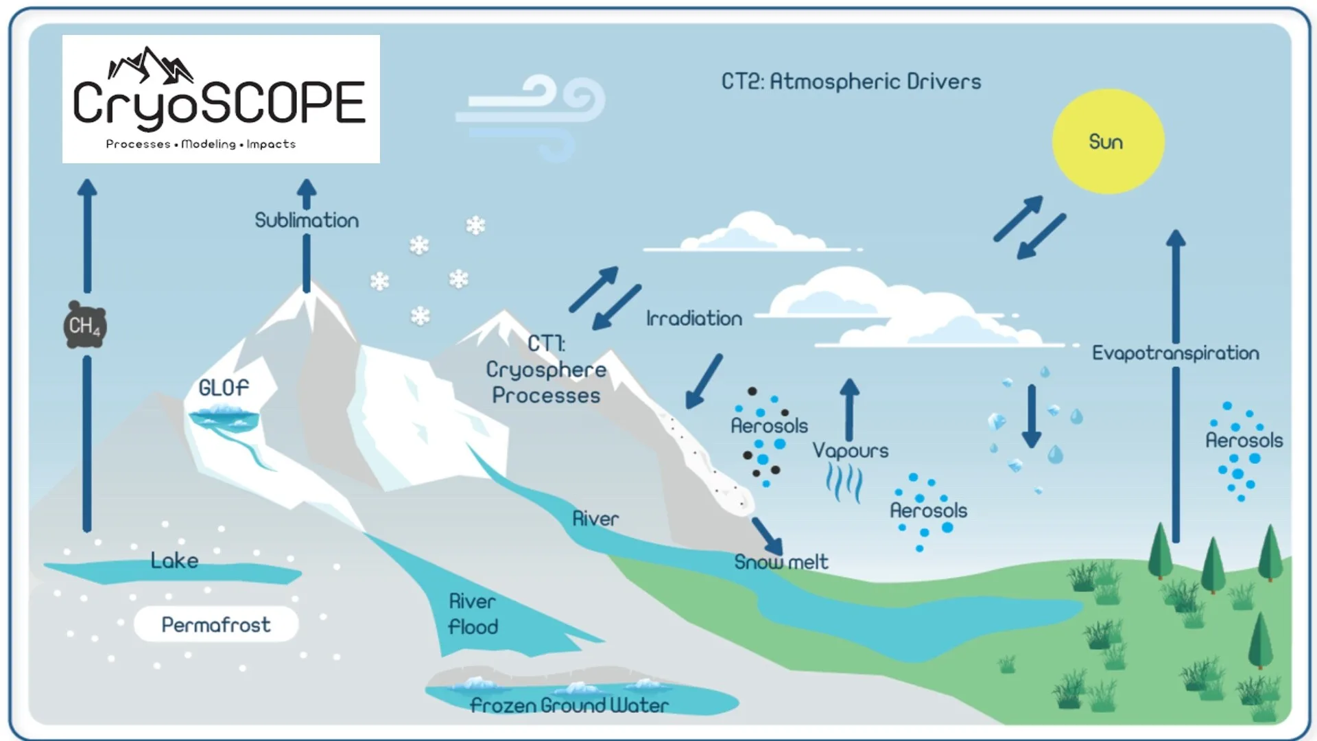
High-latitude and high-altitude cryosphere systems regulate sea levels and freshwater availability, supporting a substantial portion of the global population. These systems are undergoing rapid transformations such as diminished and earlier snowmelt, glacier retreat, intensified greening, and permafrost thaw, with cascading impacts on ecosystems and communities. This emphasizes the urgent need for improved modeling of cryosphere-atmosphere-hydrosphere interactions. However, current Earth System Models (ESMs) lack the spatial resolution to accurately represent processes at locally relevant scales. Integrating diverse datasets – including (but not limited to) stable water isotopes, novel remote sensing techniques, paleoclimate proxies like tree rings – into ESMs can refine process representation, enhancing their regional applicability. This session invites contributions ranging from field-scale measurements across diverse cryospheric regions (e.g., Alps, Nordics, Himalayas, Andes) to large-scale modeling approaches that bridge the scaling gap between local process models and global ESMs. This session is co-organized by CryoSCOPE, an EU Horizon project running from February 2025 to January 2029, aimed at enhancing cryospheric process representation in ESMs using innovative measurements across diverse region, including the Swiss Alps, Finnish Lapland, Svalbard, Iceland, Norway, and the Himalayas.

Submitted Abstracts

ID: 3.9238

Filling White, Blue and Blind Spots in High Mountain Regions – The Bhutanese-Swiss CRYO-SPIRIT Project

Nadine Salzmann
Pellet, Cécile; Lhamo, Sonam; Gugerli, Rebecca; Eden, Pema; Naegeli, Kathrin; Gurung, DB

Abstract/Description

Precipitation and permafrost measurements are pivotal to comprehending critical processes ranging from the global (climate dynamics) to the local (hazards such as mass movements, ecosystems). However, the spatio-temporal coverage of such measurements is limited and frequently accompanied by substantial uncertainties. One high-altitude region with particularly few (precipitation) or no (permafrost) measurements is Bhutan in the eastern Himalayas. In the recently initiated CRYO-SPIRIT project (funded by the Swiss National Science Foundation), collaboration between Switzerland and Bhutan is being initiated to conduct permafrost research and high-elevation precipitation measurements by means of a cosmic ray sensor in Bhutan. The overarching project strategy is focused on three principal aspects: firstly, the collection and computation of permafrost and precipitation (SWE) data using in-situ and remote sensing technologies; secondly, the assessment and enhancement of awareness regarding (future) risks associated with permafrost thaw, including the formulation of adaptation strategies; and thirdly, the capacity building of local researchers to sustain permafrost-related monitoring, research and teaching in Bhutan. The assessment of permafrost is achieved through the compilation of the first regional map of potential permafrost distribution in Bhutan, utilising in-situ Ground Surface Temperature (GST) measurements and remote sensing-based mapping of permafrost characteristic landforms, with a particular emphasis on rock glaciers.The first CRYO-SPIRIT field campaign was conducted in the autumn of 2024 in the vicinity of Thana glacier (Chamkhar Chhu Basin, Bumthang). The installation of a CRS (Cosmic Ray Sensor) was undertaken to measure SWE.The selection of the research site was based on its proximity to one of the three benchmark glaciers visited annually by researchers from Bhutan’s National Center for Hydrology and Meteorology (ensuring the long-term continuation of the measurements), as well as the presence of an automatic weather station and identified periglacial landforms. During the field campaign, ground surface temperature loggers were installed at elevations ranging from 4300 m asl (below the lower limit of permafrost) to 5200 m asl, spanning an elevation gradient and different exposure levels.This contribution presents and discusses the results of the first field campaign, including the data (SWE/precipitation) and the subsequent steps.
ID: 3.10845

Improved characterisation of rain on snow using integrated multidisciplinary datasets

Hannah Vickers

Abstract/Description

In Svalbard, continued climate warming is expected to produce a threefold increase in the frequency of winter warming events by 2100 leading to changes in wintertime rainfall, melting and refreezing with subsequent impacts on land and glaciers. Wintertime rain-on-snow (ROS) events have significant ecological impact in Svalbard. Layers of ice may form at the ground-snow interface after a ROS event, which can both damage vegetation and restrict access to forage by reindeer, which has in some years led to eventual starvation and large die-offs. Changes in the frequency, intensity, duration and spatial distribution of ROS events are therefore important to understand and quantify due to their wide-ranging impacts on the physical environment but also on society, wildlife and ecosystems. However, to understand which areas are most vulnerable to ROS impacts at present and in the future, reliable datasets describing the spatial and temporal variations of ROS characteristics are crucial. Until now, most studies of ROS have utilised single source datasets compared against a limited set of ground observations for validation. ROS events can be detected using gridded meteorological data, but these datasets are highly threshold-dependent and can give widely differing results depending on the thresholds applied. ROS impacts, on the other hand, such as snowmelt can be observed over large areas and at regular intervals using satellite remote sensing methods, but these types of observations lack the capability to distinguish the cause of snowmelt. In-situ measurements of ground ice provide direct measurements of the ROS impacts on the snowpack but are limited in spatial extent. A lack of integration of ROS data sources across disciplines hinders a more comprehensive understanding of their characteristics and associated impacts on terrestrial ecosystems. This pilot study has exploited the opportunity to carry out a multidisciplinary analysis of ROS characteristics and the spatial heterogeneity of its impacts on the cryosphere across Svalbard by analysing and integrating a diverse set of field, model, and remote sensing observations, thus providing a more holistic understanding of ROS and its signatures from atmosphere to cryosphere.

ID: 3.11603

Hydrological Impacts of a Warm, Low-Snow Winter in the Sainte-Marthe Experimental Watershed, QC

Lisa Michaud
Baraër, Michel; Poulin, Annie; Kinnard, Christophe

Abstract/Description

Snow-dominated watersheds are among the most sensitive environments to climate change. In Quebec, projections indicate that climate change will lead to reduced snow accumulation and more frequent winter rain events. This project aims to observe the hydrological dynamics of an extremely warm winter to better anticipate the impact of climate change on recharge and runoff.

To achieve this, historical data were analyzed for meteorological stations with long time series using both standard and original indexes to determine what made the winter of 2024 extreme in the study area. This analysis showed that two out of three stations recorded their lowest maximum snow depth since 1981. We also observed that that the number of precipitation events during winter were unusually frequent, and that maximum and minimum daily air temperature during winter were higher than average, with values between the 75th and the 100th percentiles of historical data at all the observed stations for both variables.

Local hydro-meteorological data was then examined at the basin scale to explore the interactions between these processes and their hydrological impacts. Findings suggest that the lack of snow led to a shorter frozen ground period and shallower frost depth, a higher annual recharge of the water table, and reduced runoff rates during winter (which was inferred from the watershed winter and spring outflow). As extreme winters are likely to become more frequent due to climate change, it is crucial to better understand the impact of unusual winters and develop methods to capture the nuances of their impact on hydrology.

ID: 3.12090

Analysis of the surface energy balance of Hintereisferer based on observations and modelling

Lindsey Nicholson
Tudes, Paul; Richter, Niklas; Prinz, Rainer

Abstract/Description

Hintereisferner is one of the World Glacier Monitoring Service benchmark glaciers, with annual mass balance data available since 1952. Despite its significance as one of the best monitored glaciers in the world, analyses of the glacier surface energy balance (SEB) are limited. To address this, we leverage data from on-glacier stations installed in the upper and lower glacier during 2003/4 and 2023/24 and use the open source COSIPY model to quantify the characteristic flux partitioning from measured and modelled data. We set the SEB findings in the context of published surface energy balance studies from other glaciers and discuss the atmospheric controls on the SEB, the contrasts in SEB conditions between the upper and lower glacier sites and changes between the two time periods observed. The observed and simulated SEB conditions enable an analysis of the dominant drivers of glacier melt at Hintereisferner.

ID: 3.12174

Global sublimation estimates at ecosystem monitoring sites across the Northern Hemisphere

Harsh Beria
Shekhar, Ankit; Floriancic, Marius; Lehning, Michael

Abstract/Description

Sublimation is a key but poorly quantified water flux linking the atmosphere, cryosphere and the hydrosphere. Snowpack water is sublimated into water vapor, thereby bypassing runoff, soil and groundwater recharge, with significant implications for water management in snow-dominated landscapes. Large-scale quantification of sublimation remains challenging due to logistical constraints in remote cold regions and limited data synthesis efforts.
Here, we present sublimation estimates from >100 sites in the Northern Hemisphere from the FLUXNET, AMERIFLUX and ICOS networks. These sites, selected from >500 ecosystem monitoring sites, have seasonal snow-cover and at least 3 winters of latent heat measurements and include diverse land-use types (e.g., forests, wetlands, grasslands, croplands, etc.). By intersecting winter latent heat estimates at these sites with snow albedo, temperature, and remote sensing proxies (e.g., Normalized Difference Snow Index, NDSI), we estimate that sublimation could be as high as 15% of annual precipitation for many of these sites. We further compare these estimates with Earth System Model (ESM) simulations and assess the sensitivity of sublimation estimates to atmospheric drivers, including temperature, wind speed, and vapor pressure deficit.

ID: 3.12387

Disentangling anthropogenic from natural drivers of the climate variability in High Mountain Asia

Martin Menegoz
Santolaría-Otín, María

Abstract/Description

Climate change in High Mountain Asia (HMA) is largely uncertain because the lack of local observations does not allow a proper estimation of long-term trends. The complex topography induces marked heterogeneities of the atmospheric variables in an area under the influence of both the Asian monsoons and the Western disturbances, two circulation patterns that show considerable variability from daily to decadal timescales. It is therefore challenging to simulate the climate variability in HMA. The ongoing retreat of glaciers observed in the Southern Himalayas suggests a significant warming signal, since there is no clear trend of precipitation in this area. The relative stability of the glaciers located on the western part of HMA observed over the last decades, with some glaciers showing even positive mass balance in the Karakoram region is more difficult to interpret. To explain this “Karakoram anomaly”, several physical processes have been suggested, including cloud changes, summer cooling and winter snowfall increase. However, there is no consensus on the exact causes of this phenomenon and their relative contributions, including the role of anthropogenic influence. A general increase in precipitation is expected in this area, in relation to the warming associated with greenhouse gases that favour higher moisture rates in the atmosphere. This effect contrasts with the increase in aerosol concentrations observed in the Indian subcontinent that induces a local cooling and a weakening of the monsoon systems. In this study, a large set of observational and model datasets is used to investigate dynamical versus thermodynamic atmospheric changes in this area. Trends are decomposed to disentangle atmospheric circulation changes from thermodynamic signals, with their respective imprints in temperature and precipitation. The method is first applied to observations to directly interpret the atmospheric trends over the last decades as well as their potential impacts on the cryosphere. Then, climate simulations including and excluding anthropogenic forcings, as well as single forcing experiments considering separately aerosols and greenhouse gases (DAMIP) are used to highlight their signature in the climate of HMA.

ID: 3.12443

Changing subglacial and groundwater flow under retreating glaciers in Svalbard

Thomas Zwinger
Hodson, Andrew

Abstract/Description

Land-terminating polythermal glaciers in Svalbard and elsewhere in the Arctic are retreating rapidly, causing their forefields to expand rapidly, triggering equally rapid changes in conditions within their substrate (sediment, bedrock). This often results in permafrost aggradation in response to winter cooling in the recently exposed forefield. Permafrost aggradation may even begin in advance of glacier retreat, because the thinner ice can still lose sufficient heat during winter. As a consequence, the recharge, migration and discharge patterns of glacially-fed groundwater changes markedly. In Svalbard, many new groundwater springs are forming in recently deglaciated terrain, instead of following deeper migration routes beneath the permafrost. Furthermore, the springs collectively represent the largest known emission source of methane in Svalbard, enabling the escape of geological methane via shortened groundwater flowpaths pressurised by increasing meltwater fluxes. Therefore, we seek to better understand the relationship between glacier retreat, permafrost aggradation by collecting related data (thermistors, runoff measurements) at a selected field site (Scott-Turnebreen). With inputs from field measurements, modelling will be used to better understand the fate of the groundwater system as the glacier continues to retreat and the future development of permafrost in the forefield. In this talk we will present the first steps taken in the EU funded project CryoSCOPE, both, in field observations as well as modelling.

ID: 3.12476

Hectometer Scale Dynamic Downscaling over the Himalaya for Improved Snowcover Estimates

Dylan Reynolds
Lehning, Michael

Abstract/Description

The Himalaya provides hydrological and cultural resources to a growing downstream population of billions of people. In acknowledgement of this fact, the region has become a hotbed for research into the changing land surface systems of the mountain range. Such studies often rely upon high-resolution forcing datasets which can capture the spatial heterogeneity of mass and energy inputs into the land surface. Yet downscaling efforts over the Himalaya face serious challenges, including the scarcity of in-situ measurements for statistical downscaling, and the complexity of the topography for dynamical downscaling, a technique which has been further constrained by computational demand. Here we present a novel approach to dynamic downscaling over the Himalaya using the High-resolution Intermediate Complexity Atmospheric Research (HICAR) model. HICAR’s approach to atmospheric modeling reduces the need for terrain smoothing to retain numeric stability, allowing for a better representation of the steep orography of the range. Importantly, the HICAR approach also results in computational efficiency orders of magnitude greater than traditional atmospheric models, allowing for dynamic downscaling at higher horizontal resolutions and longer time scales. Prior studies have shown that the HICAR model improves estimates of seasonal snow relative to snow model simulations driven by coarser resolution forcing data from a traditional atmospheric model. We show preliminary results from an effort to run HICAR over the Himalaya at sub-kilometer resolutions. This effort is undertaken with the goal of improving long-range snow forecasts over the mountain range, a focus of study where simulations at scales of tens of kilometers using simplistic snow models currently offer the best predictions. A comparison of predicted snowcover from HICAR relative to current methods is shown, detailing which processes resolved by the high-resolution model contribute to differences in accumulated snow. HICAR relies greatly on input data from coarser resolution NWP models, and limitations of this modeling approach will also be discussed. This work also seeks to provide improved forcing data for the land surface modeling community and is intended to spur discussion about how sub-kilometer forcing data could best support their modeling efforts.

ID: 3.12826

Impact of extreme weather events on mass and energy balance of a polar glacier: examples from Svalbard

Anton V. Terekhov
Prokhorova, Uliana V.; Romashova, Kseniia V.

Abstract/Description

Since the early 21st century, we have conducted annual mass-balance monitoring of the Aldegondabreen glacier (5.2 km², 125–500 m a.s.l.) near Barentsburg. Although our observational record is relatively short, Aldegondabreen is a well-studied glacier with a well-documented geodetic mass balance throughout the 20th century. Recent observations confirm that mass loss has accelerated over the past decade, and in the last five years—exceptionally warm for both Svalbard and the entire Arctic—the glacier’s mass balance has reached unprecedentedly negative values. On average, Aldegondabreen has lost about 2.0 m w.e. per year (2019–2024). Mass balance variations strongly correlate with air temperature on an interannual timescale. However, rising temperatures are not the only significant manifestation of modern climate change. Increasing attention has been given to extreme weather events, such as heatwaves, which have become more frequent and are projected to intensify. To assess their impact on glacier melt, we conduct meteorological and actinometric measurements and apply an energy-balance model in a diagnostic rather than predictive manner. A striking example is the annual mass balance for 2022 (−2.13 m w.e.), one of the most negative on record. We identified four heatwaves (9–19 days) that significantly prolonged the melt season. Additionally, several short-term extreme melt events (1–3 days) were recorded, with melt rates reaching up to 75 mm w.e. day⁻¹. These events correlated strongly (r = 0.87, p < 0.01) with discharge from a proglacial stream and coincided with increased mean daily wind speeds (up to 10.3 m s⁻¹). Given the limitations of the glaciological method at short timescales, hydrological water-level measurements provide valuable validation for high-resolution energy-balance modeling. The impact of extreme weather events on Arctic glacier mass balance remains understudied. Two key challenges for modeling are: (1) low spatial resolution of meteorological datasets, which limits capturing turbulent flux variability, and (2) a lack of high-frequency field data for validation, as ablation stakes cannot resolve short-lived melt events.

ID: 3.12853

Towards improved understanding of spectral processes on the surface radiation balance in snow covered mountains

Anja Mödl
Lehning, Michael; Dadic, Ruzica

Abstract/Description

Surface radiation drives the energy balance on earth and so plays a crucial role in climate change. Here, snow surfaces are of particular interest due to their high reflectivity. In complex alpine terrain, radiation reflected from surrounding slopes significantly impacts the local radiation balance through multiple scattering and the forward scattering properties of snow. The anisotropy largely varies within the solar spectrum, thus leading to a spectral shift within the reflected radiation. Multiple reflections within the terrain further enhance this effect. In this study, we investigate the impact of anisotropic reflection on the spectral albedo and its local differences in complex terrain. We conducted ground-based spectral albedo measurements using a handheld ASD spectrometer on 14th March 2024. Note that scattered clouds during the observations add uncertainty due to non-uniform sky radiation. The measurements were compared with albedo calculations for a flat surface without terrain reflections using the Snow TARTES model. Our findings show enhanced albedo in specific near-infrared wavelength bands, which correlate for large viewing zenith angles positively with the anisotropic reflectance factor. These results suggest that the anisotropic scattering of snow surfaces creates the detected spectral shifts in reflected radiation, varying with viewing angle and terrain complexity. The observed anisotropy appears to preferentially enhance higher energy wavelengths. This effect may increase energy absorption by dark outcropping rocks and potentially accelerate local snow melt. With this study, we want to show the importance of considering anisotropic reflection and multiple scattering in complex terrain when assessing surface radiation budgets and snowmelt processes. To validate and expand our results, we plan to conduct additional measurements under various snow and atmospheric conditions in this winter season.

ID: 3.12859

Light-absorbing particles effect on the seasonal snowpack melt-out date at a high-altitude site in Central Himalaya

Svensson Jonas
Ström, Johan; Hooda, Rakesh; Meinander, Outi; Ruppel, Meri; Asmi, Eija; Hyvärinen, Antti

Abstract/Description

Snow darkening by deposited light-absorbing particles (LAP) has the potential to accelerate snowmelt, affecting the timing and magnitude of snowmelt. The sensitivity of the seasonal snow cover duration to changes in LAP at a high-altitude valley site in the Central Himalayas, India, is here investigated. An approach included a first step of mimicking the variation of the albedo of the seasonal snow using two seasons of automatic weather station (AWS) data and adapting a field-based deposition of LAP to the snow. Secondly, the number of days with snowmelt were evaluated based on the net energy budget of the seasonal snow cover and the derived surface temperature. The influence on the energy budget by LAP combined with the melt-day analysis resulted in relations to determine the contribution of LAP to the number of days with snowmelt. Above a concentration of 1 ng g-1 in equivalent LAP (LAPeq) , in new snow, the number of days with snowmelt can be estimated by; days=0.0109(log⁡(〖LAP〗_eq )+1)PP±0.0033(log⁡(〖LAP〗_eq )+1)PP, where PP is the seasonal precipitation in mm snow water equivalent. A change in LAPeq by a factor of two corresponds to about 1/3 of a day per 100 mm precipitation. Although the change in the number of days with melt caused by the changes in LAPeq is small, the estimated total change in the snow melt-out date by LAP can be significant. For our realistic base case scenario for the Sunderdhunga Valley, Central Himalayas, India, of LAPeq=100 ng g-1 and PP=400 mm, this yields in an advancement of the melt-out date of about 13 days.

ID: 3.13118

Coupling stable isotopes and energy-balance modelling to study snowmelt-groundwater interaction in Svalbard

Ekaterina Rets
Nawrot, Adam; Luks, Bartłomiej; Baneschi, Ilaria; Wachniew, Przemysław; Osuch, Marzena; Menichini, Matia; Franceschi, Linda; Doveri, Marco; Falck, Eva

Abstract/Description

Despite its significant role in the water cycle, the interaction between snowmelt and groundwater remains incompletely understood. Furthermore, climate change is altering this connectivity, a process further complicated in the Arctic by permafrost degradation. In this study, we analyze samples of snowpack, river runoff, precipitation, and groundwater collected during the warm season of 2024 in the small, unglacierized Fuglebekken catchment in Spitsbergen. These samples are examined for 17O, 18O and 2H, along with hydrochemical elements. Combined with energy-balance modeling, this approach is used to trace snowmelt from snowpack evolution to river runoff and groundwater recharge. The results show abrupt shifts in river runoff sources arising from seasonal changes in hydrological connectivity with groundwater. Dynamics of slope in the δ2H-δ18O relationship indicates strong fractionation processes in snow cover most likely connected with sublimation.

ID: 3.13997

Estimating snow sublimation using stable water isotopes and eddy-covariance measurements in the Swiss Alps

Isabella Anglin
Beria, Harsh; Teuling, Ryan; Floriancic, Marius; Lehning, Michael

Abstract/Description

Snow sublimation remains poorly quantified in the high-elevation European Alps, creating significant uncertainties in snow ablation partitioning. Specifically, the balance between sublimation losses to the atmosphere and snowmelt infiltration into the subsurface remains unclear. Accurately constraining this partitioning is essential for effective water management in downstream basins.

Here, we present snow sublimation estimates at three alpine sites in Davos, Switzerland, using eddy covariance-derived latent heat fluxes and stable water isotope (δ¹⁸O and δ²H) measurements from snow surface samples during the 2025 winter. These sites offer unique accessibility, enabling high-temporal-resolution snowpack sampling, from sub-diurnal to weekly time scales. This study improves our understanding of sublimation in the Alps by assessing to what extent fractionation patterns in stable water isotopes of surface snowpack can serve as a reliable proxy for estimating snow sublimation.