Private

FS 3.109

Climate Change Impacts on Alpine Mass Movements

Details

  • Full Title

    FS 3.109: The Changing Face of Mountain Regions: Climate Change Impacts on Alpine Mass Movements
  • Scheduled

    TBA
  • Location

    TBA
  • Assigned to Synthesis Workshop

    ---
  • Thematic Focus

    Cryo- & Hydrosphere, ES-Forests, Hazards, Multi-scale Modeling
  • Keywords

    natural hazards, cascading processes, risk, geomorphology, cryosphere

Description

Global warming is causing rapid changes in high mountain landscapes. Changes due to rising air temperatures are well-observed, whereas changes due to precipitation are much more uncertain. The latter are important because they affect the frequency, magnitude and severity of alpine mass movements (AMM). In particular, more research is needed on the interaction between processes, such as how forest disturbances will undermine the effectiveness of protective forests. Due to the increased risk of AMM and the alteration of protective forests, communities will have to adjust to these changes and need robust adaptation measures. Our session focuses on responding to the emerging challenges posed by climate change impacts on AMM. It will address the following questions:

  1. how will the hazard potential of different processes change,
  2. how will the impacts of AMM change due to changes in their initial conditions, meteorological trigger events, or flow dynamics,
  3. what is the role of cascading events involving different processes,
  4. what are the interactions of AMM with ecosystems, and
  5. how will these changes alter the risk?

Submitted Abstracts

ID: 3.8935

From cold to warm: Insights into snow avalanche flow regimes in the Southern Alps of New Zealand

Aubrey Miller
Sirguey, Pascal; Bartelt, Perry; Cullen, Nicolas; Bühler, Yves

Abstract/Description

The impact of a warming climate on snow avalanche hazards varies by region and season, influenced by factors such as the timing and intensity of rainfall on alpine snowpacks. For instance, winter rain on unconsolidated snow creates more complex hazards than spring rain on a consolidated snowpack. Snow avalanche flow dynamics are primarily driven by temperature and water content of the released and eroded snowpack.

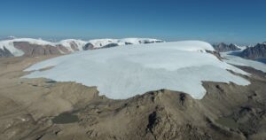
Aotearoa New Zealand (NZ), characterized by a maritime climate, frequently experiences large rain events (>100 mm) falling to high elevations. The Southern Alps experience steep precipitation and temperature gradients, resulting in large avalanches that often release as cold powder avalanches in the high alpine and rapidly transition into warm, wet flows as they descend to valley floors. Limited meteorological and avalanche observational data in NZ have so far constrained our understanding of how climate change influences avalanche flow regimes.

This study provides the first detailed insights into NZ’s avalanche flow regimes from naturally occurring events. Over four seasons, we inventoried 250 avalanches across nine paths in the Hooker Valley, Aoraki Mount Cook National Park, using a time-lapse camera network and meteorological data. We focused on 197 events (79% of total) from two adjacent paths with similar slope gradients and aspects. These paths reach to just over 2,300 m and descend directly into a paraglacial lake at 870 m.

Time-lapse observations reveal that while avalanches often initiate as storm or wind slabs, they quickly transition into warm, wet flows, frequently traveling below the snowline over bare ground or old debris before terminating in the lake. Sediment and rock entrainment further increases flow density and slows velocity. Although springtime rain reaching high elevations is common in NZ, frequent mid-winter intense rainfall events have been observed to occur in the release zones, creating complex release and flow dynamics.

NZ’s avalanche patterns provide valuable insights for other regions globally, where warm and wet avalanche cycles are increasingly observed in mid-winter. Understanding these shifting flow regimes is crucial for future hazard mitigation, including updates to hazard management plans and infrastructure design to accommodate denser, more dynamic avalanche conditions.

ID: 3.9222

Unprecedented speed-up and bare ice evidence at the rock glacier Hochebenkar (Ötztal Alps, Austria).

Martin Stocker-Waldhuber
Hartl, Lea; Seiser, Bernd; Bertolotti, Giulia; Gschwentner, Andreas; Fischer, Andrea

Abstract/Description

The rock glacier in the outer Hochebenkar (46°50’0″N, 11° 0’30″E, Ötztal Alps, Austria) has been subject to velocity measurements since as early as 1938 when first investigations using terrestrial photogrammetry aimed to quantify the movement of the rock glacier. From 1951 to 2007, geodetic methods came into operation and were eventually replaced by dGNSS observations. Aside from the discontinued early measurements and minor data gaps, velocity data is available at annual resolution since 1997 from 4 cross sections and a longitudinal profile. Each profile consists of 6 to 12 individual block positions.
Results from the early measurements showed annual rates of rock glacier motion in the order of a few metres. Highest rates up to 4 m/a were measured during the late 1950s and early 1960s and analysis of historic aerial imagery similarly indicates accelerated, destabilised movement of the lower section of the rock glacier during this time. However, for the majority of the time series since then, the flow velocity was hardly more than 1 m/a on average at all stone positions. A short acceleration phase was observed in 2004, maybe as a consequence of the summer 2003, followed by a deceleration and annual movement rates of 1-2 m/a. Since 2018 an exponential increase of rock glacier motion has been observed in the lowest section, showing the destabilisation of this part of the rock glacier. During the last 3 years, maximum displacement values at individual blocks increased from 20 m/a to almost 50 m/a (2024).
Aside from the in-situ measurements, the destabilisation is also evident from the appearance of the rock glacier surface with the increasing formation of crevasse like surface structures and unstable rocks. Bare ice became visible for the very first time in summer 2021 in a small crevasse, and in summer 2024 at the front face of a small step. In winter 2025, a deep crevasse opened within a few weeks across the entire rock glacier width. At depths of around 3 metres an almost continuous conglomerate of stones and ice was exposed at the steep crevasse walls, which enabled ice sampling in February 2025.

ID: 3.10907

Large-scale debris flow disposition and hazard index modelling under current and future environmental conditions

Feiko Van Zadelhoff
Bründl, Michael; Bühler, Yves; McArdell, Brian

Abstract/Description

Debris flows are a significant hazard to people and infrastructure in many mountainous areas. Quantification of intensity and spatial distribution of this hazard, however, remains challenging. This is due to the often-encountered lack of high-resolution spatial and temporal data and the complexity and wide-range of processes involved. This applies to current climatic conditions, but especially for future conditions where uncertainty in extreme precipitation and sediment availability is even larger. We present the outline of a national-scale, GIS-based approach to assess debris flow disposition with a statistical model under current extreme precipitation conditions and the best available estimates for 2065 and 2080 extreme precipitation and sediment loads. Debris flow disposition is assessed using properties derived from delineation of channels and their corresponding upstream contributing area, based on high spatial resolution (1m) elevation data. The disposition model is trained on a combination of available Swiss debris flow databases (such as StorMe). Runout is computed from disposition areas with calibrated RAMMS:Debrisflow software. Our method is applied to the network of the Swiss national railway (SBB) and results in a spatially distributed maximum debris-flow height. The results indicate sections of the railway network that are prone to debris flow hazard and serve as input to a risk assessment for the SBB. By adapting this approach, it could be applied also in other regions in the Alps and worldwide.

ID: 3.12396

Simulating Avalanches in a Warming Climate: lessons from Wet and Dry Slab Events in the Western Tatras

Carlo Bee
Juras, Roman; Eccel, Marco; Zugliani, Daniel; Rosatti, Giorgio

Abstract/Description

In view of climate change, multiple studies predict a rise in the frequency of wet snow avalanches relative to dry snow avalanches. This should be taken into account in future avalanche hazard mapping, as using numerical models without considering specific snow types may lead to less accurate results in many cases. Reliable and predictive dynamical numerical models require extensive validation with real-world observations. However, such data are often lacunose or, at best, approximative, significantly reducing the accuracy of models’ validation and hindering their development. Additionally, model parameters must consider the snow and avalanche type. In Slovakia, the Centre for Avalanche Prevention of the National Mountain Rescue Service (HZS) has, in recent years, collected detailed information on avalanche events and runout zones, including drone photogrammetry and, in some cases, even live video footage from webcams. This allowed us to apply the TRENT2D* model to perform reconstructions of two events recorded in the Žiarska Valley, Western Tatras, Slovakia, one from April 2023 and one from January 2024. Both events share the same avalanche path, called Prìslop, have similar volumes, but have a significant difference: the first event resulted from a wet slab that released when the flow from liquid water, caused by prolonged warming, weakened the bond with the ground, the second was a dry slab that fell in subzero temperatures and slid on top of a hard layer. This difference is deeply reflected in the nature of the deposit and more importantly in the dynamic behaviour in the avalanche track and runout zones. Indeed, the two events required significantly different model parameters due to the difference in snow type – wet in 2023 and dry in 2024. In light of the obtained results, we will suggest that, in the future, it would be beneficial to veer towards a methodology for avalanche mapping that separately considers wet and dry occurrences before overlapping the results to represent in the maps the overall hazard.

ID: 3.12844

Insights from a multi-approach analysis of Vieux Marinet rock glacier (French Alps) to better understand the context and characteristics of climate impacts on periglacial landforms.

Julia Agziou
Lehmann, Benjamin; Cusicanqui, Diego; Bodin, Xavier; Schoeneich, Philippe

Abstract/Description

The impact of climate change on mountain permafrost degradation is now well-established and manifests in different ways. In periglacial domain, the increase of temperatures leads an increase of rock glacier surface velocity. Consequently “Rock Glacier Velocity” has recently been recognized as a new “Essential Climate Variable”. Their movement is controlled by rheological properties (ice/rock proportion) and the topo-climatic conditions in which they evolve.
Most studies have focused on active rock glaciers (ice-rich landforms). Focusing on transitional rock glaciers, known as deactivating landforms, nonetheless appears relevant to evaluate the impact of climate on these, in which the response-time to climatic change occurs on decadal to millennial-timescales. In this way, a multi-method approach is required to understand the nature and chronology of external forcing controlling rock glacier’s activity. To handle these questions, we aim to present an evolutionary study of the Vieux Marinet rock glacier activity (Ubaye, French Alps) given its mismatched characteristics (morphically-relict and kinematically-active), bearing witness to a history of complex activity.
First, we estimated Vieux Marinet activity from DInSAR interferograms and compared with the interannual evolution of its activity using optical image correlation from 1950 to the 2022. Preliminary analysis revealed a differential activity between the lower and upper units with both methods (several millimeters to decimeters respectively).
Secondly, the paleo-activity of the Vieux Marinet was reconstructed using 10Be surface exposure dating of blocks sampled at the rock glacier’s surface. We measured one of the earliest activities in the Alps with ages of 15.19 – 13.68 ka at the terminal part of the rock glacier. Younger ages were found on the upper unit (2.63 – 11.22 ka). The exposure ages were correlated with horizontal distance to the headwall, but their dispersion testifies of numerous imbricated events.
Finally, electric resistivity measurements of the subsurface were performed and revealed a thick and heterogeneous body, with frozen and discontinuous areas. Particularly, the fast upper unit is neither as resistive as expected, with resistivity <50kΩ, and disrupted by conductive horizons. These findings suggest that permafrost creep can persist, even after significant degradation.

ID: 3.13139

Assessing the Protective Role of Mountain Forests Against Natural Hazards Under Climate Change

Adrian Ringenbach
Mauri, Achille; Ortner, Gregor; Helzel, Kevin; Christen, Marc; Zaugg-Ettlin, Linda; Bottero, Alessandra; Temperli, Christian; Bebi, Peter

Abstract/Description

The protective role of mountain forests against natural hazards is well established. However, climate change presents a significant challenge for their stability and management. Norway spruce (Picea abies) is becoming increasingly susceptible to bark beetle infestations, even at higher elevations, highlighting the need for climate-adapted tree species and increased species diversity. We assessed the long-term development of rockfall and avalanche risks in the Davos region (172 km2) through to the end of the century. We used the stochastic process-based model LandClim, incorporating CH2018 climate scenarios, to simulate future forest structures and species composition under different forest management and ungulate browsing pressure scenarios. Subsequently, dynamic simulations of rockfall and avalanche hazards were conducted for the initial forest conditions (2011) and two future projections (2060 and 2090). The resulting hazard intensity maps, categorized by return periods, were overlaid with buildings, roads, and railway lines. For these damage potential assets, we ascertained detailed information for each object category, including current population data and economic values. Risk assessments were then carried out using the EconoMe framework to quantify expected damages and evaluate the protective role of forests. Our findings indicate that the lowest risk levels and strongest climate adaptation for both avalanches and rockfall are achieved under the combined low-browsing pressure and high-management scenario. These results underscore the importance of proactive forest management in maintaining the protective functions of mountain forests and mitigating future natural hazard risks in Alpine regions.

ID: 3.13759

Impact of Climate Change on Rockfalls in the Pyrenees: A Dendrogeomorphological Approach

Jaime Boyano-Galiano
Muñoz-Torrero, Alberto; Robredo Sánchez, José Carlos; Fábregas Reigosa, Santiago; Ballesteros-Cánovas, Juan Antonio

Abstract/Description

In high mountain environments, rockfalls are a frequent natural hazard, involving the free fall, bouncing, or rolling of rock blocks of various sizes on steep slopes. Climate change is expected to influence their magnitude and frequency, particularly through increased extreme precipitation events and permafrost degradation. Understanding the occurrence, trajectories, and intensity of these processes is essential for developing effective mitigation strategies. However, direct observational data remains scarce. In this context, dendrogeomorphology provides a valuable tool for reconstructing rockfall activity, as tree-ring growth disturbances serve as reliable indicators of past events, allowing for long-term analysis of their temporal and spatial patterns. In this study, 261 increment cores from disturbed trees were systematically collected from two plots located in two rockfall prone areas in the Pyrenees, respectively (Artouste in the north -France- and Pineta in the south -Spain). Climate correlations were performed using E-OBS data (0.1° x 0.1° resolution), and linear-effect mixed model (LMMs) assessed the relationship between rockfall occurrence and climatic variables. Additionally, a GeoSLAM terrestrial laser scanner (TLS) characterized topography and boulder size. The results show a higher number of events on the northern Pyrenees but of lower intensity than on the south slope. Ice-thaw cycles and precipitation exceeding 110 mm/day are the climatic variables with the highest correlation with respect to rockfalls. These findings underline the multiple and complex relationship between rockfall dynamics and climate and help in the design of risk management strategies in high mountain areas.

ID: 3.13761

Insights from the longest debris flow reconstruction in the Pyrenees using tree rings

Jaime Boyano-Galiano
Muñoz-Torrero, Alberto; Benito, Gerardo; Ballesteros-Cánovas, Juan Antonio

Abstract/Description

Mountain landscapes are influenced by geomorphological processes such as debris flows. These affect both their infrastructures and ecosystems, and the assessment of their magnitude and frequency is key to land management and risk assessment. On the other hand, the reconstruction of their past activity remains a challenge due to the scarcity of continuous historical records. To fill this gap, a dendrogeomorphological study was conducted on an alluvial cone in the Pineta Valley (Central Pyrenees, Spain). A total of 924 tree samples (851 cores and 73 cross-sections) from 758 disturbed trees were collected, allowing the identification of growth disturbances linked to past events. These data were complemented by detecting geomorphological changes from multitemporal LiDAR analysis over the last three and aerial picture recognitions, which provided additional insights into surface modifications and supported the tree-ring-based reconstructions. Analyses of the unprecedented number of trees analyzed suggest a complex history of debris flow activity, with variations in both magnitude and frequency over time. These results reveal trend changes potentially related to climatic conditions and dissimilar sediment connectivity. Using dendrochronology with LiDAR-based analysis of the terrain, a detailed spatio-temporal reconstruction was carried out, providing insight into the dynamics and triggers of debris flows. This integrated approach contributes to better hazard assessment and to identifying factors and periods of different levels of activity. The use of tree ring records combined with high-resolution topographic data highlights the importance of integrating different methodologies for the reconstruction of past geomorphological processes. These findings provide insight into the dynamics of debris flows in mountain landscapes and highlight the importance of using tree rings in conjunction with remote sensing for risk assessment.