Private

FS 3.103

Creating knowledge about alpine-treeline ecotones

Please log in to add items to your favorites.

Details

  • Full Title

    FS 3.103: Creating knowledge about alpine-treeline ecotones in changing mountains
  • Scheduled

    TBA
  • Location

    TBA
  • Convener

  • Co-Conveners

    ---

  • Assigned to Synthesis Workshop

    ---
  • Thematic Focus

    Conservation, Ecosystems, ES-Forests, Monitoring, Paleoperspective
  • Keywords

    treeline, mountain forest, alpine vegetation, climate change, vegetation patterns

Description

Alpine-treeline ecotones mark the transition from mountain forest to alpine vegetation in mountains worldwide. As the physical realisation of the thermal limit to tree growth, these ecotones should respond strongly to climate warming, but additional limitations at various spatial scales lead to large variation in the observed responses. These include land management, natural disturbances, climatic and edaphic stress factors, tree population processes, and biotic interactions. To understand treeline dynamics, all of these limitations and the interactions among them need to be understood, which requires combining scientific disciplines and information gathered by many different methodological approaches. Important disciplines include plant ecology, ecophysiology, dendroecology, palaeoecology, human and physical geography, soil science, and (micro)climatology, while relevant approaches include field and lab experiments, field observations, remote sensing, and modelling. This session aims to bring together scientists studying alpine treeline ecotones from different scientific perspectives, with different methods and in different geographical contexts, in order to show the breadth of current treeline research. The session will combine regular talks and flash talks introducing posters. A related workshop then aims to synthesize and connect these different angles, methods and contexts. Also closely related is a pre-conference field trip for the 50th anniversary of the Stillberg treeline experiment near Davos, on September 12, before the #IMC25, offering an additional opportunity to discuss treeline research and visit this unique long-term treeline research experiment.

Submitted Abstracts

ID: 3.5066

Treeline dynamics of pine and birch in response to climate change in the Karakoram mountain, Pakistan

Munawar Ali

Abstract/Description

The Alpine treeline is considered a sensitive indicator to climate change. Since low temperature is a primary constraint of treeline dynamics, upslope shifts in response to climate warming are expected. The Karakoram, under a westerly-dominated climate, has experienced significant warming since the mid-nineteenth century. However, in comparison to adjacent mountains, little is known how alpine treelines have responded to rising temperatures in westerly-dominated dry areas, such as the Karakoram. To test if climate warming triggered upslope shift of alpine treelines in the Karakoram, we compared the recent dynamics of blue pine (Pinus wallichiana) and Himalayan birch (Betula utilis) treeline populations. We expected a higher responsiveness of pine recruitment to temperature as compared with birch due to the higher drought tolerance of pine species. Tree mapping and dendrochronological methods were used to determine stand age structure, and to reconstruct spatiotemporal treeline dynamics during the past 150 years. The decadal recruitment rate of pine was positively correlated with summer and winter temperatures, whereas the birch recruitment was negatively correlated. Accordingly, pine treelines showed significant upslope shifts in two out of three plots, whilst two birch treelines remained stable in the two studied plots. Such different treeline shift rates agree with their divergent recruitment responses to climate warming. Thus, projected warming in the Karakoram will differently impact treelines depending on species-specific responses with pine showing a more dynamic and rapid upward treeline advancement.

ID: 3.5108

“Treeline Species at Risk! Exploring Climate Vulnerability in the Indian Himalayas Using GIS

Laraib Ahmad
Saran, Sameer

Abstract/Description

Betula utilis, a critical treeline species in the Indian Himalayas, plays a vital role in maintaining ecological balance and supports local communities by providing non-timber forest products (NTFPs). This study models the potential distribution and assesses the climate vulnerability of Betula utilis using the Random Forest (RF) model, a robust machine learning method suited for analyzing complex ecological datasets. Occurrence data were collected along trekking paths in Uttarakhand and Himachal Pradesh, while climatic variables from the CHELSA dataset—such as temperature and precipitation—were integrated with topographic factors, including elevation and aspect. Climate projections were based on the IPCC AR6 scenarios: SSP1-2.6 (low emissions), SSP3-7.0 (intermediate emissions), and SSP5-8.5 (high emissions). The RF model demonstrated high predictive accuracy, with an Area Under the Curve (AUC) of 0.98 and an overall accuracy of 94.6%, underscoring its suitability for habitat modeling. Results revealed that elevation and precipitation were the most influential factors shaping the distribution of Betula utilis. Under the high-emission scenario (SSP5-8.5), significant habitat loss and fragmentation were projected, posing a severe threat to Betula utilis and the livelihoods dependent on its ecosystem services. In contrast, the low-emission scenario (SSP1-2.6) suggested minimal habitat loss, emphasizing the potential of sustainable practices to preserve this species and enhance community resilience. These findings underscore the need for targeted climate mitigation and conservation strategies to protect both Betula utilis and the local communities that rely on it.

ID: 3.7946

Global warming accelerates growth but reduces lifespan of trees in cold regions

Mai-He Li

Abstract/Description

Global warming has profoundly impacted forest ecosystems, particularly in boreal and alpine regions. Rising temperatures and extended growing seasons have accelerated tree growth by enhancing photosynthesis and increasing nutrient uptake. However, this rapid growth often comes at a cost: compromised structural integrity, heightened vulnerability to environmental stressors, and ultimately, reduced lifespan. By synthesizing recent tree-ring analyses and physiological studies, this talk will explore the ecophysiological mechanisms behind global warming’s dual effects on tree growth and longevity in cold regions. Moreover, the broader implications for carbon sequestration, forest stability, biodiversity, and the future dynamics of cold-region forests will be discussed. By highlighting the intricate relationship between accelerated growth and increased mortality, this talk aims to deepen our understanding of the challenges these forests face in a warming world.

ID: 3.8821

Delayed onset and short duration characterize radial stem growth of the deciduous shrub Alnus alnobetula within the treeline ecotone

Walter Oberhuber
Wieser, Gerhard; Gruber, Andreas

Abstract/Description

Green alder (Alnus alnobetula (Ehrh.) K. Koch) is a tall, multi-stemmed deciduous shrub widespread in the Central European Alps across the treeline ecotone. The focus of this study was to determine key dates of intra-annual radial stem growth (RG) along an elevational transect within the treeline ecotone (1940–2150 m asl). For this purpose, RG was continuously recorded by dendrometers mounted on shoots (n=16–20 dendrometer records per year) at three study plots on Mt. Patscherkofel (2246 m asl) during 2022–2024. The Gompertz function was applied to determine phenological dates of intra-annual RG, i.e., onset, end, duration and time of maximum RG. Results revealed that within the treeline ecotone RG started and ceased around end of June (doy 177±7) and end of August (doy 233±9), respectively. Bud-break was found to occur 28±3 days before the onset of radial stem growth, and leaf shedding was observed to commence in early October. The mean growth duration amounted to 56±9 days, considering all sites and study years. The time of maximum RG was observed in July (doy 192±8), with about 60 % of the annual increment developing during this month. Results of this study revealed that RG of A. alnobetula within the treeline ecotone was limited to a period of only two months, and that the timing of the highest growth rates is not related to photoperiodic constraints. The substantial discrepancy between bud-break and the onset of RG is most likely attributable to the deciduous habit of this tall shrub, indicating that carbon reserves are initially allocated toward leaf development, with cambium activity commencing subsequent to ongoing photosynthesis. The short duration of RG is explained by the clonal propagation strategy, which may trigger an early shift of carbon allocation below ground.
This research was funded by the Austrian Science Fund (FWF), P34706-B.

ID: 3.9026

Treeline Dynamics and Its Impact on Carbon Storage

Badri Bhattarai
Thapa, Mahendra Singh; Adhikari, Rabindra

Abstract/Description

The study of alpine tree-line dynamics is a crucial effort in identifying biological processes that are influenced by the climate under projected global warming scenarios. Treeline dynamics have significant effects on the alpine ecotone’s biodiversity and the global carbon cycle by altering the terrestrial carbon sink and perhaps driving out rare species and upsetting alpine plant ecosystems. This research work deals with delineating the treeline elevations of the years 1993, 2006, 2013, and 2023 carbon stock along the tree-line zone, and identifying the effective measures for the carbon benefit in the North-west aspect of the Rolwaling valley, Dolakha, Nepal by using Landsat imagery, inventory, key-informant survey, and secondary data analysis. The treeline elevation was done using the LISA (Local Indicator of Spatial Association) autocorrelation method, above-ground carbon estimation was done by inventory using stratified random sampling where the strata were based on the elevation of 100m, and 12 sample plots of size 500 m2 were laid randomly and an effective measure for carbon benefit was identified by key informant survey using the pairwise comparison. The treeline elevation remained almost constant in the study area with an average elevation of 3956.93±18.62m in 1993, 3957.83±17.28.68m in 2006, 3961.49±18.30m in 2013, and 3961.49±18.30 in 2023 with a shift of 4.56m in the given time frame. There was a slightly upward trend in the NDVI of 0.0011 units per year, indicating improved vegetation health or density over the 30 years in the study area. Additionally, there was a decrease in above-ground carbon with the increase in elevation, so elevation 3700-3800m has the highest above-ground carbon of 48.33 Mg/ha and 3900-4000m has the least carbon of 40.52 Mg/ha showing the above-ground carbon decreases by approximately 67.84 kg per meter rise in elevation. Forest restoration and Silviculture interventions were found to be the most effective measures for carbon benefits, while scientific research and monitoring, as well as introducing keystone species, were seen as the least effective. A thorough assessment of carbon stock should be conducted at regular intervals for the economic valuation of carbon to enable carbon trading and bolster the national economy.

ID: 3.9698

Does shrub encouragement change the water balance within the treeline ecotone?

Gerhard Wieser
Gruber, Andreas; Oberhuber, Walter

Abstract/Description

During the last decades shrub encroachment occurred across arctic and alpine environments. Especially in the European Alps decreasing grazing pressure, land abandonment, and climate warming favour the expansion of green alder [Alnus alnobetula (Ehrh.) K. Koch; former Alnus viridis (Chaix) DC.] and Pine tree [Pinus mugo (Turra)]. Expansion of A. alnobetula primarily occurs in avalanche gullies and steep north-facing slopes with high water availability. On the other hand, A. alnobetula is also expanding into sun exposed sites with shallow soils and impaired water availability. Which typically are colonized by P. mugo. Nevertheless, shrub encroachment may strongly affect ecosystem biogeochemical cyclers such as transpiration, and runoff. Therefore, the specific goal of this study was to investigate seasonal patterns of sap flow density of A. alnobetula and P, mugo at four study plots within the treeline ecotone on Mt. Patscherkofel (1950 – 2200 m a.s.l.). These data were then scaled up to the stand level per growing season and compared with published transpiration rates of adjacent low stature vegetation and tree canopies. Our estimates suggest shrub encroachment may considerably affect the water balance of the treeline ecotone. This study was funded b the AUSTRIA Science Fund (FWF), P 34706-B).

ID: 3.10267

Tracking ecotones on aerial images with computer vision in a mountain forest landscape

Michael Maroschek
Seidl, Rupert; Rammer, Werner

Abstract/Description

Mountain forest ecosystems are sensitive to global change. Especially at the ecotones we often expect high sensitivity to changes in climate, disturbance regimes or land use. The advent of machine learning, specifically computer vision, provides powerful tools to investigate ecotones across extended spatiotemporal extents using remote sensing data. Here, we focused on the spatiotemporal development of the treeline and montane-subalpine forest ecotones in a protected area in the European Alps. First, we aimed to identify trees and shrubs on aerial images, with special attention to integrating multiple sensor types into one computer vision framework. Second, we mapped a) the montane forest zone, b) the subalpine forest zone, and c) the krummholz zone, as well as d) the ecotones in between. Third, we investigated the spatiotemporal changes occurring in the vegetation zones and the ecotones. We based our analysis on aerial images of Berchtesgaden National Park covering nine time steps from 1953 to 2020. The images were captured through analog (panchromatic, color infrared) and digital (color infrared, RGB) cameras. To generate training data, we manually interpreted randomly distributed 0.5 ha scenes across all time steps, resulting in >110,000 annotations of trees, shrubs, and standing dead trees. We tested a set of instance segmentation frameworks and compared individual models for each image type with models integrating all image types. We used the inference of the best performing model to generate wall-to-wall tree maps. Using structure and composition of the tree maps, we delineated zones and ecotones and tracked changes over time. We found that a combined computer vision model for all image types performed better than individual models for each image type. While the extent of montane and subalpine forest zones changed over time, krummholz was notably stable. Conversely, crown cover increased more strongly for krummholz and the subalpine zone than for the montane zone. Although we did not find a general pattern of ecotones shifting upward, we observed remarkable local upward shifts. On average, the upward shift of the montane-subalpine ecotone was roughly two times faster than the subalpine-alpine ecotone, decreasing the subalpine forest area by approximately 25% over 67 years.

ID: 3.10432

Geographic patterns in the global predictability of treeline elevation

Maaike Bader
Kessler, Michael; Urquiaga-Flores, Erickson

Abstract/Description

The elevation of the climatic upper treeline can be predicted with astonishing accuracy based on climate information alone, hinting at a common cause for treelines across climate zones. However, although the overall accuracy of climate-based treeline predictions is very high, our validation of such a prediction (the TREELIM model by Paulsen & Körner (2014), implemetned based on CHELSA clmate data by Karger et al. (2019)) showed clear geographical patterns in the model bias. Thereby a lack of observed trees at the predicted treeline might be due to factors lowering tree cover (e.g. disturbances, lagged responses to climate change) and does not necessarily indicate an inaccurate model prediction. However, in some regions trees and forest were observed far above the predicted treeline, which is, by definition, not possible. Regions showing this pattern included very wet regions and those with very low annual thermal seasonality (Patagonia, the Canadian Coast Mountains) and regionswith very high solar radiation inputs (parts of the Tropical Andes, including the Bolivian Altiplano). This phenomenon still awaits an explanation, but we will present a number of suggestive correlations and speculations, hoping to encourage discussion on the limitations of models and climate data and on the causes of global treeline.

ID: 3.11150

Biotic and abiotic constraints of Scots pine and mountain birch seedlings on the treeline ecotone of subarctic Finnish Lapland

Johanna Toivonen
Wallen, Henri; Stark, Sari; Kumpula, Jouko; Aakala, Tuomas

Abstract/Description

The range expansion and growth of tree seedlings on treeline ecotones are influenced by a combination of biotic and abiotic factors, including impacts of different land uses. Subarctic treeline ecotones are excellent manifestations of a stress gradient, where facilitation can be expected to increase and competition to decrease from favorable climatic conditions of closed forests to harsh climatic conditions of open tundra. We studied the growth and abundance of Scots pine (Pinus sylvestris) and mountain birch (Betula pubescens subsp. czerepanovii) seedlings on the treeline ecotone of the Finnish subarctic. We sampled 135 plots from an extensive reindeer pasture monitoring plot network, distributed in the main biomes of the ecotone: boreal coniferous forests, mountain birch forests and open tundra. In each plot, we measured seedling height, growth during the last three years (for Scots pine), described their microtopographic position, took soil samples and extracted climate data from the Finnish Meteorological Institute’s data. In this work, we will show the associations of seedling growth and density with climate and soil properties and intensity of reindeer pasture, aiming to shed light on the potential and requirements of these two species to maintain their dominance and to expand their ranges to open tundra, as the climate warms and environmental stress decreases in subarctic treelines.

ID: 3.11308

Multi-Scale Analysis of Alpine Treeline Elevation and Taxonomic Patterns: A Global Synthesis

Yuyang Xie

Abstract/Description

Alpine treelines define the upper boundary of tree growth and serve as critical indicators of climate constraints on forest distribution. While treeline elevation is theoretically governed by temperature—following a mean growing-season temperature isotherm—empirical data reveal substantial deviations from this model. The mechanisms driving these deviations remain debated, partly due to research scale limitations and insufficient attention to taxon-specific patterns. To address these gaps, this study integrates two comprehensive global treeline datasets. The first dataset includes over 53,000 recorded treeline points from 70+ major mountain regions, forming a sub-meter resolution global database that captures tree species composition and canopy structure using biodiversity databases and machine learning algorithms. The second dataset, compiled from research spanning the past half-century, consists of over 2,000 treeline species records from 39 mountain regions in 43 countries, allowing for an in-depth taxon-specific analysis of treeline patterns. Our findings confirm that potential treelines align with a growing-season mean temperature isotherm of 6.6 ± 0.3°C, yet approximately two-thirds of actual treelines deviate from this threshold. The primary driver of these deviations is drought stress (51%), followed by the mountain elevation effect (MEE), which modulates surface heat conditions (27%). Additionally, treeline species richness peaks in northern mid-latitude mountains, corresponding with the highest observed treeline elevations. Taxon-specific analyses reveal that moisture availability and climatic variability further differentiate treeline distributions across genera. Despite these variations, a universal pattern emerges: treeline positions occur 30–40% below the thermal optimum of each genus’ niche range, reflecting a physiological constraint on tree survival at high elevations. By integrating elevational and taxonomic perspectives, this study provides a global synthesis of treeline distribution mechanisms. Our findings refine the understanding of species-specific responses to climate, contribute to biodiversity conservation in alpine environments, and improve predictions of forest dynamics under climate change.

ID: 3.11392

Forest-line dynamics in the French Northern Alps since 1860: a substantial upward shift, recently limited by human activities?

Noémie Delpouve
Rathgeber, Cyrille B. K.; Bergès, Laurent

Abstract/Description

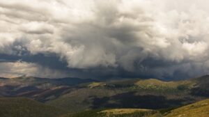
The forest line is a key feature of mountain landscapes around the world. Currently, most forest lines in the Northern Hemisphere are rising due to the combined effects of land-use and climate changes, leading to major changes in the adjacent alpine grasslands and subalpine forests functions. However, it has not been elucidated how the recent forest-line upward shift fits into the longer context of land abandonment, and how it is currently responding to the accelerating global warming. To answer this question, we assessed the forest-line elevation change over the French Northern Alps since the forest minimum using historical and current land cover maps, displaying forest cover at four dates: 1860, 1951, 1995 and 2007. These maps were standardized and combined with a digital elevation model to estimate the average forest-line elevation for 150 municipalities across three French departments of the Northern Alps: Haute-Savoie, Savoie and Isère. We compared forest-line elevations between dates and municipalities to explore temporal and spatial patterns. The forest line in the French Northern Alps was stable between 1860 and 1951, and then rose by 166 m, from 1865 m a.s.l. in 1951 to 2031 m a.s.l. in 1995. From 1995 to 2007, no general upward shift was observed and in the Haute-Savoie department, a downward shift of 5.3 m.yr-1 was even noticed, while forest lines in Isère and Savoie were stable. Forest-line upward shift in the French Northern Alps has been driven by pastoral abandonment and global warming. However, forest-line dynamics did not follow the recent acceleration of temperature increase. Its current limitation may be attributed to pastoral and tourism contemporary pressures. This regional study on long temporal scale shows how global and regional drivers interact in the long-term to shape mountain landscapes. Today, the forest-line dynamics is still linked to the contradictory tensions dividing our societies (conservation vs. exploitation). Thus, we advocate the cautious management of the adjacent alpine grasslands and subalpine forests, which could contribute to carbon sequestration and biodiversity conservation, provided they are not subjected to excessive human pressure.

ID: 3.11578

A standardized, globally applicable method for detecting spatial patterns at alpine treeline ecotones

Nishtha Prakash
Bader, Maaike

Abstract/Description

Treeline dynamics have been studied using a range of remote sensing and GIS methods depending on the scale of analysis (regional, landscape, hillslope and stand scale). At the landscape scale, alpine forest can be delineated from grassland using medium resolution imagery (10-30 m spatial resolution). At the hillslope scale, high resolution imagery (5 m spatial resolution) can help detect the general pattern of treeline ecotone and any vertical or lateral shifts, while very high-resolution imagery (<1 m spatial resolution) could help detect the pattern within the ecotone by telling individual trees or clusters of trees apart from the surrounding low-stature vegetation. However, there is a dearth of such very high-resolution data for treeline ecotone sites around the world, especially those in the global south. Therefore, there is the need for a treeline pattern detection method that works efficiently using limited data and that can be applied with high level of accuracy to diverse geographical regions. We are developing a deep learning method trained on the best available data; but that also works well for lower-quality data from new alpine treeline sites. Through this process, we are studying what level of detail and spatial accuracy is needed to characterise different aspect of treeline spatial pattern to answer different ecological questions. An effective method should be able to detect treeline-ecotone patterns in a consistent and comparable manner to allow a global comparison of patterns and their relation to driving factors and processes.

ID: 3.12226

Could LiDAR data enhance the identification of alpine-treeline ecotones? A case study in the Mont Blanc massif

Chiara D'angeli
Chassagneux, Agathe; Delestrade, Anne; Stanisci, Angela; Froidevaux, Jérémy S.P.

Abstract/Description

Ecotones, defined as transition areas between two biomes, are often considered as biodiversity hotspots due to the overlap of species from adjacent ecosystems. This is particularly evident in alpine-treeline ecotones, which form the transition between closed forests at lower elevations and open alpine areas at higher altitudes. Their high species richness is further amplified by the complex topography of mountain regions, creating a mosaic of microhabitats with varying climatic and environmental conditions. Treeline ecotones are also highly sensitive to climate change, as rising temperatures drive an upward shift of the forest boundary. Given their ecological significance and vulnerability, accurately mapping and monitoring these areas is crucial for understanding their spatiotemporal dynamics. However, identifying treeline ecotones remains a challenge: since ecotones are dynamic habitats in both space and time, it is not easy to delimit them. To address this, we propose a novel methodology that combines LiDAR data and field surveys to map and characterize treeline ecotones in mountain areas. Three study areas were selected within the French side of the Mont Blanc massif: Loriaz, Peclerey and Plan de l’Aiguille. A hierarchical sampling protocol was designed to capture key vegetation characteristics above and below the treeline. Sampling points were selected using a random stratified approach, based on the habitat map of the Chamonix valley and on the Canopy Height Model (CHM) derived from LiDAR data. Vegetation surveys were carried out within 10 x 10 m plots, where structural and compositional attributes of the vegetation were measured. During the 2024 summer season, 54 field vegetation surveys were conducted along 6 transects within the three study areas. Five EUNIS habitat types were identified: S22 Alpine and subalpine ericoid heath; S25 Subalpine and subarctic deciduous scrub; T311 Alpine and Carpathian subalpine Picea forests and T343 Western Larix, mountain pine and Pinus cembra forests. Preliminary analyses combining field and LiDAR data suggest that LiDAR-derived canopy height appears to be a good predictor of forests and shrubs. These findings highlight the potential of LiDAR data for refining the mapping of treeline ecotones and providing a more reliable framework for long-term monitoring of these sensitive ecosystems.

ID: 3.12482

Integrating field surveys and drone-based remote sensing to monitor mediterranean mountain treeline patterns

Alessandro Vitali
Tonelli, Enrico; Baglioni, Lorena; Balestra, Mattia; Fiorani, Federico; Carrieri, Erik; Anselmetto, Nicolò; Ngujen, Ha Trang; Atzeni, Francesco; Lingua, Emanuele; Marzano, Raffaella; Meloni, Fabio; Morresi, Donato; Urbinati, Carlo; Gennaretti, Fabio; Garbarino, Matteo

Abstract/Description

Monitoring treeline dynamics is crucial for assessing the impacts of global change and ecosystem shifts in mountainous environments. This study integrates field and remote sensed data collected along altitudinal gradients to analyze vegetation patterns and structural characteristics of the upper treeline ecotones. We sampled at two distinct sites: i) in the Western Alps, above a larch (Larix decidua) and Swiss stone pine (Pinus cembra) forests, ii) in the Central Apennines, above an European black pine (Pinus nigra) high-elevation plantation. During the summer of 2024, we conducted ground-based measurements along altitudinal transects from the mountain peak down to the closed forest margin, providing detailed information on species composition, tree structure features and environmental parameters. In the field, we recorded tree positions using a GNSS receiver and measured tree basal diameter and height. We collected tree cores at the stem base with a Pressler borer to determine the tree cambial age, the encroachment date and the radial growth pattern. These field data served as ground truth to validate and extend the analysis to the entire slope surveys with UAVs. On the same slopes hosting the altitudinal transects, we used drones to cover areas of approximately 20 ha each. With a LiDAR sensor we recorded the tree positions along the entire slope, detected the spatial patterns of the tree recolonization process, measured tree parameters with high accuracy, and extracted microtopography features, a potential driver for seedling establishment. Additionally, we used multispectral camera to detect tree species distribution. Point-pattern analyses aimed to determine the spatio-temporal patterns of the tree recolonization process, highlighting facilitation or limitation processes between species, between cohorts or individuals of different ages, and with respect to the presence of shrubs or microtopographic features. This integrated approach, within the PRIN-OLYMPUS Italian project, will contribute to improve the accuracy of treeline mapping and the detection of key drivers of spatial variability. It will also enhance the efficiency to monitor high altitude ecosystem changes over time and to develop predictive models for future treeline shifts.

ID: 3.12488

OLYMPUS – Spatio-temporal analysis of mediterranean treeline patterns: a multiscale approach

Matteo Garbarino
Anselmetto, Nicolò; Atzeni, Francesco; Baglioni, Lorena; Balestra, Mattia; Carrieri, Erik; Lingua, Emanuele; Marzano, Raffaella; Meloni, Fabio; Morresi, Donato; Nguyen, Ha Trang; Tonelli, Enrico; Fiorani, Federico; Urbinati, Carlo; Vitali, Alessandro

Abstract/Description

Mountain treeline ecotones are transition zones between the closed forest and the upper treeless vegetation and are considered sentinels of global change effects on terrestrial ecosystems. Treeline ecotones are constrained by multiple factors acting at different spatial and temporal scales. For this reason, we present OLYMPUS, a project based on a multiscale approach to monitor treelines in the Italian Alps and Apennines, the two main peninsular mountain ranges. The specific goals of the research are: 1) to detect the current forestline and to assess its drivers and dynamics through LANDSAT time series; 2) to assess human pressure and land abandonment effects on the treeline ecotone by adopting a diachronic approach with historical (70 years) aerial images; 3) to evaluate the role of biotic and abiotic factors on tree establishment and survival by integrating centimeter UAV images with field data collection and manipulation experiments. Landsat images of the last 4 decades were used to infer long-term trends in vegetation dynamics (greening and wetness) at the regional scale. At the landscape scale (10-20 km2) we measured land-use change dynamics with landscape metrics and treeline ecotonal shift through a deep learning land-cover classification of historical (1950s) and current (2020s) aerial photographs. A fine-scale assessment of treeline ecotones included a selection of 10 treeline ecotones where a UAV-based structure-from-motion (SfM) photogrammetric approach was used to derive local land cover and seedling position maps. We analyzed biotic and abiotic drivers of seedling establishment at the treeline through spatially-explicit statistical analysis and tree growth performance and patterns were assessed by tree-ring analysis. The overall contribution of the project is its spatially explicit approach crossing different disciplines (remote sensing, landscape ecology, forest ecology, dendroecology, etc.) and different spatial scales (region-landscape-tree).

ID: 3.12506

Beneath the surface: How the declining health of Pinus mugo impairs soil carbon storage

Barbara Mateos Perez Bianco De Araujo
Maroschek, Michael; Göttlein, Axel; Rammer, Werner; Dollinger, Christina; Seidl, Rupert

Abstract/Description

Mountain pine (Pinus mugo) is a keystone species at the treeline ecotone of the European Alps. This pioneer shrub contributes to soil development, prevents erosion by gravitational processes, and contributes to carbon sequestration at high elevations. These ecosystem services are at risk as climate-related stressors and invasive species threaten mountain pine health. A widespread die-off could have serious consequences for alpine ecosystems and their role in the carbon cycle. We investigated 1. how declining mountain pine health influences topsoil carbon stocks; 2. whether changes in carbon concentration or soil volume drive these patterns; 3. when the carbon balance shifts from gains to losses upon mountain pine die-off; and 4. the potential impacts of a die-off on ecosystem-level soil carbon storage.
We collected soil samples from plots representing three conditions (healthy mountain pine, ailing mountain pine, no mountain pine) along an elevational gradient (1065 – 1810 m a.s.l.) in Berchtesgaden National Park, Germany. Organic carbon concentration was determined by elemental analysis. We analysed how mountain pine health and elevation influence topsoil carbon stocks using Linear Mixed Models (LMMs). Working with a simple model of soil carbon dynamics, we simulated how carbon stocks change over time upon mountain pine die-off and estimated the ecosystem-level impacts of a die-off within the national park.
Our LMM analyses showed that soil carbon stocks increased with elevation. In comparison to the healthy state, carbon stocks increased moderately under ailing mountain pines. However, carbon stocks in plots without mountain pines were considerably lower than those under healthy and ailing mountain pines. In our soil carbon simulations, the carbon gain from needle loss under ailing mountain pines lasted less than a decade before net losses from decomposition set in. This process slowed down as elevation increased. In Berchtesgaden National Park, our model estimated that loss of mountain pine would reduce soil carbon stocks above 1500 m a.s.l. by more than 15%.
Carbon stock decline upon mountain pine die-off is slower at higher elevations, yet the long-term trend shows a substantial net loss. Our results highlight the consequences of declining mountain pine health on the dynamics of alpine ecosystems through impaired soil carbon storage.

ID: 3.12512

Treeline dynamics and seedling survival in the Italian Alps: Insights from the OLYMPUS Project

Francesco Atzeni
Vitali, Alessandro; Tonelli, Enrico; Baglioni, Lorena; Balestra, Mattia; Fiorani, Federico; Urbinati, Carlo; Morresi, Donato; Garbarino, Matteo; Anselmetto, Nicolò; Meloni, Fabio; Nguyen, Ha Trang; Carrieri, Erik; Marzano, Raffaella; Lingua, Emanuele

Abstract/Description

It is widely acknowledged that treeline, the ecotone delineating the transition between closed forests and tree-less vegetation, serves as a key indicator of the impacts of global warming on terrestrial ecosystems. Despite its recognized ecological significance, only a limited number of studies on treeline ecology addresses the spatial components of its patterns and processes. These ecotones are shaped by a complex interplay of environmental factors operating across different spatial and temporal scales. The present study focuses on the role of microsites in tree regeneration at the treeline, in two sites of the Alps, Genevris Mt. (Piedmont, TO) and Croda da Lago (Veneto, BL), using both field and UAV derived data (e.g. LiDAR). The experimental design involves the transplantation of Pinus cembra wildlings, with the objective of assessing the efficacy of three microsites (open field, within shrub cover and downslope of debris) in promoting seedling survivorship. This setup aims to evaluate the impact of different microsite conditions on seedling establishment and survival in two different alpine environments. At each site we transplanted 105 individuals, manipulated in groups of five to reduce the transplant mortality. Additionally, high-resolution LiDAR and multispectral drone surveys were conducted to generate detailed digital elevation models, supporting microsite characterization. By integrating environmental manipulation trials with LiDAR-derived Digital Surface Models (DSM), this study aims to identify key drivers of tree regeneration at the treeline. The findings will contribute to broader ecological and conservation discussions, helping to guide adaptive management strategies for mountain forests in a changing climate.

ID: 3.12598

Upper forestline dynamics in the Italian Alps and Apennines revealed by Landsat time-series

Lorena Baglioni
Morresi, Donato; Garbarino, Matteo; Urbinati, Carlo; Lingua, Emanuele; Marzano, Raffaella; Vitali, Alessandro

Abstract/Description

The interest on the ecological effects of global warming and land use changes on vegetation, combined with the increasing development of remote sensing techniques, have fostered the research about the successional dynamics at the upper forest ecotones . In this context, the aims of this study are: i) to define an automatic approach for mapping the current position of the most representative upper forestlines in the Alps and Apennines (Italy); ii) to detect and assess the long-term spectral changes at their ecotones using Landsat-based trend analysis; iii) to appraise the performance of greenness and wetness indices along a forestline buffer which includes the closed forest below and the ecotone above it. We used a regional scale approach to make the method replicable in different geographic areas. We calculated spectral greenness and wetness vegetation indices from Landsat timeseries for the period 1984 – 2023 and tested the significance of their long-term spectral trends with the Contextual Mann-Kendall test for monotonicity. Our results show an overall increasing trend, mainly close to the forestline ecotone and at lower elevations inside the buffer. Comparing the relative trends with the current canopy cover, we found in the Alps the highest values of greenness and wetness trends in the sparse and dense cover class respectively, as a result of encroachment and gap filling dynamics. We plan to analyse the detected trends integrating the Landsat data with others at higher-resolution to better assess the effect of structure and site-specific drivers.

ID: 3.12835

Stem wood density variability and compression wood proportions in European treeline seedlings of Picea abies.

I. Eunice Romero P.
González, Edgar J.; Rydval, Miloš; Treml, Václav

Abstract/Description

Wood density (WD) plays an important role in tree function and ecological performance in species inhabiting extreme environments like treelines, where climatic and mechanical constraints shape wood structure. Treeline seedlings not only endure low temperatures but also face continuous mechanical stresses, including strong winds, snow loads that may cover their stems for extended periods, and the forces associated with steep slopes in mountainous terrain. These stresses induce modifications in stem shape and wood anatomy, potentially impacting stem function. It is common for treeline gymnosperm trees to develop compression wood (CW) in mechanically stressed tissue of their stems, leading to changes in WD, strength, elasticity, and hydraulic conductivity, all of which influence ecological performance. In this study, we analyzed the WD variations in stems of Norway spruce (Picea abies) seedlings from Central European treelines with conspicuous climatic differences, focusing on high wood density areas (HWD) including unaffected latewood and compression wood (CW, which may affect earlywood, latewood, or both). We developed a novel method to quantify WD heterogeneity, allowing the estimation of low wood density (LWD, which includes stem areas with wide tracheid lumina, radial parenchyma, and resin channels) and HWD proportions. For each treeline site, to estimate and compare the means and variance of HWD, CW, and LWD proportions while quantifying uncertainty, we employed Bayesian generalized linear models. As initially hypothesized, HWD, composed predominantly of unaffected latewood and CW, remained consistent across treeline sites, accounting for approximately half of the stem cross-section. Stem eccentricity was generally high, likely due to mechanical forces such as wind and snowpack loads. Unexpectedly, high CW proportions did not consistently coincide with greater eccentricity at the whole cross-section level. CW accounted for a substantial portion of the cross-section, highlighting its possible ecological role in treeline seedling growth. Our method detects and quantifies WD variations in treeline seedlings, with potential applications extending to mature trees using radial cores or whole cross-sections. Assessing WD enhances our understanding of treeline seedlings’ structure, function, and ecological performance. Further research on severe CW proportions could improve insights into tree mechanical stability, growth, and carbon storage.

ID: 3.13039

The role of biotic and abiotic drivers in shaping treeline spatial patterns in the Italian Alps

Erik Carrieri
Meloni, Fabio; Anselmetto, Nicoló; Morresi, Donato; Garbarino, Matteo

Abstract/Description

Treeline ecotones are extremely sensitive to multiple drivers and are generally considered as indicators of vegetation response to climate change. It is widely recognized that multiple factors in addition to climate drive the upward and poleward tree migration and that many other drivers act at finer spatial scales. Multi-scale approaches to better understand how the interaction of multiple drivers influences treeline position, its spatial patterns, and dynamics are needed. In a research conducted over 90 hectares of treelines divided in 10 sites and distributed across the Italian Alps, we have comprehensively stem-mapped the trees by integrating UAV and filed data collection. We here aim to provide valuable insights on the joint effect that several biotic and abiotic drivers have on the ecotone spatial patterns across the entire mountain range. The high-resolution ground cover classification obtained through a deep learning model was combined with fine-scale terrain features and topographic attributes, and with intra- and inter-specific relationships existing between coniferous and broadleaved species. The combination of the biotic and abiotic component was finally related to the spatial patterns of the treeline ecotones by using spatial and multivariate statistical tools (PPA, RDA, RF). Preliminary results highlight that tree establishment is majorly driven by ground cover, with grass and deadwood displaying a predominant role in driving the process. Apart for the heatload and the eastness, which displayed a direct, positive correlation with the seedlings presence, the other topographic variables did not show any particular influence. The presence of previously established trees in the close surrounding of a microsite seemed to have a negative effect on tree establishment, suggesting that competition prevails over facilitation in the studied ecotones. The applied setup aims at disentangling and giving a broader understanding of the role that different microsites and biotic interactions have on tree recruitment and survival at the upper tree limit. We expect our findings to explain the variability in treeline patterns and processes that macro- and mesoclimate factors alone cannot explain.

ID: 3.13300

Climatology of European treelines

Vaclav Treml
Kaczka, Ryszard; Kalita, Jakub; Romero, Eunice; Masek, Jiri; Tumajer, Jan; Lange, Jelena

Abstract/Description

Current uppermost tree positions represent cold boundaries of realized niche of trees which may or may not overlap with the boundaries of fundamental niche. Climatic characterization of uppermost tree locations allows an evaluation whether current treelines are in equilibrium with climate or they lag behind the pace of warming. Furthermore, climatic characteristics of treelines may indicate potential treelines where trees are absent due to various disturbances or long-term land-use pressures. Surprisingly, we lack comprehensive climatological characterization of European treelines. In this study, we systematically screened European treeline regions, identified uppermost tree positions and calculated treeline bioclimatic metrics derived from CHELSA dataset including growing season length, growing season temperature, degree days and growing season daily precipitation. We identified 5100 locations of uppermost trees in more than thousand 20 km gridcells that overlaid treeline areas. For each point we recorded treeline form, ground cover and topographic features. We hypothesized that treelines face varying climatic conditions with trade-offs between growing season heat sums and growing season moisture stress. Our results show that according to climatic metrics, European treelines can be divided into five distinct groups: (1) very warm and dry located predominantly in southern Europe, (2) moderately cold and dry located mainly in eastern Europe and in inland parts of Scandes and in very northern part of Europe, (3) cold found mainly in the Alps and Pyrenees, (4) moderately cold and wet with very short growing season located mainly in maritime parts of Scandes, and (5) moderately cold with very long growing season found in Scotland and Ireland. Treeline climatic groups differ mainly in their location, and to lesser extent also in terrain morphology and treeline form. Accordingly, the most influential predictors of treeline temperature metrics were geographical position, slope steepness, distance to summits and presence of broadleaves/conifers. Warmer treelines were drier suggesting trade-off between temperature and moisture-limited tree growth. Identified differences in temperature metrics between treeline groups indicate that there is a complex gradient of meteorologic conditions that influence occurrence and intensity of tree growth allowing woody plants to achieve tree stature. Our study brings a climatic context of European treelines.

ID: 3.13775

Challenging Alpine Borders: The Case of Larix Decidua

Luna Maes

Abstract/Description

As elevation nature, the alps act as a prism, allowing for space/time extrapolations of (a)biotic responses to global climate change. This abstract contains a selection from research on alpine inhabitation in Aosta and Susa Valley, northwest Italy, through the concepts of a border. Four key protagonists and site-specific interventions address a different form of spatial border and ongoing habitat tensions. This abstract discusses one border(1), one protagonist(2) and one intervention(3).
1/ TWO-DIMENSIONAL BORDER
Cartographic delineations do not exclusively define spatial divisions within a mountainous territory. Moving beyond two-dimensional borders on a map, we step into the territory, into the ecotone. Subject to a climate-driven ascending of species, the ecotone shifts upwards. As its borders fluctuate, so does the inherent biotic constellation. The link between species compositions and specific geographic locations is tearing apart. How can we classify these new iso-spaces of living when ‘iso’ becomes void of the actual heterogeneity of the site? A redefining of ecotones where companion species engage in actively shaping new ecological assemblages.
2/ EUROPEAN LARCH (LARIX DECIDUA)
As a pioneer species and the only deciduous conifer in the Alps, European Larches easily and eagerly colonize freshly disturbed soils such as abandoned Alpine pastures. Thriving on the remains of recent extraction, they show the possibility of life in ruins of anthropological activity. Considered a nurse species, it can create microclimatic islands as stepping stones for other species to migrate towards. Additionally, it is a habitat in itself, hosting insects in its bark and feeding the avian community with its seeds.
3/ CATCHMENT
‘Reverse shelter-method’: instead of trees being remnants from earlier treelines, they become pioneers. The intervention aims to aid the upward migration of the Larch and thereby other species facing climatic warming rates that extend their speed of migration. Just like humans, non-humans need shelter to explore new heights, depths and extremes. On the slopes of Pila, Aosta, three structures utilise the monoecious character of the seeds and wind dispersal to foresee and accommodate upward movement. The distinction between the catchment and the terrain will fade until it is part of the slope entirely.

ID: 3.14634

Fungi in pine forest regeneration at the upper tree line under the climate change

Jelena Lazarević
Topalović, Ana; Menkis, Audrius

Abstract/Description

Pinus heldreichii H. Christ and Pinus peuce Griseb are endemic and relict species to the Balkans, mostly remain as small, isolated stands on slopes and exposed terrains at altitudes between 1,200 and 2,100 m a.s.l. Fungi play key roles in alpine forest ecosystems and represent an essential part of biodiversity. They directly influence several physiological processes in trees and contribute to carbon, nutrient and water cycling. They can also significantly contribute to the successful regeneration, establishment and growth of pine trees, particularly in marginal habitats under harsh environmental conditions. To better understand the diversity, composition and possible roles, communities of fungi associated with forest trees and seedlings of P. heldreichii and P. peuce, as well as forest soils were studied in high-altitude forest sites in Montenegro. These sites are often subjected to forest fires, which represent a main ecological disturbance in forest ecosystems. In attempt to understand the mechanisms of ecosystem recovery and resilience following fire disturbances, we also studied the impact of forest fires on the composition and diversity of fungal communities in P. heldreichii forest soils at the upper forest line. Needles, rootlets and forest soil of P. heldreichii and P. peuce were sampled from their typical habitats, and associated fungi were studied using high-throughput sequencing. Soil physical and chemical properties were also determined through mechanical and chemical analyses. The results revealed a high fungal diversity associated with two pine species, as well as site-specific effects on the abundance and composition of fungal communities. In regard to forest fire, results showed that the fungal community composition differed markedly between the post-fire and unburned sites, and that there was a slow recovery of fungal communities in high-altitude environments. The new knowledge generated through these studies can contribute to the development of relevant strategies for management and conservation of P. heldreichii and P. peuce forests and their associated biodiversity. The need for active restoration strategies in fire-affected and other high-altitude regions is suggested.

ID: 3.18626

Climate, not land-use, drives a recent acceleration of larch expansion at the forest-grassland ecotone in the southern French alps

Baptiste Nicoud
Bayle, Arthur; Corona, Christophe; Francon, Loïc; Choler, Philippe

Abstract/Description

In recent decades significant forest expansion into treeless alpine zones has been observed across global mountain ranges, including the Alps, driven by a complex interplay of global warming and land-use changes. The upward shift of treelines has far-reaching implications for ecosystem functioning, biodiversity, and biogeochemical cycles. However, climate variables alone account for only a fraction of treeline dynamics, highlighting substantial research gaps concerning the influence of non-climatic factors. This study addresses these gaps by combining dendrochronological methods, high-resolution bioclimatic data, and historical land-use records to investigate treeline dynamics in the southern French Alps. Our results reveal a marked acceleration in tree establishment, starting in the early 2000s, attributable primarily to climate change rather than the pastoral abandonment of the 19th century. We demonstrate that historical land-use changes created predisposing conditions for tree establishment, while recent climate change has increasingly acted as an accelerator for this dynamic. While key climatic factors, such as thermal indicators and growing season length, are identified as significant contributors to treeline shifts, our study highlights the need for further research to disentangle the specific drivers of tree recruitment and survival in the context of ongoing climate change.