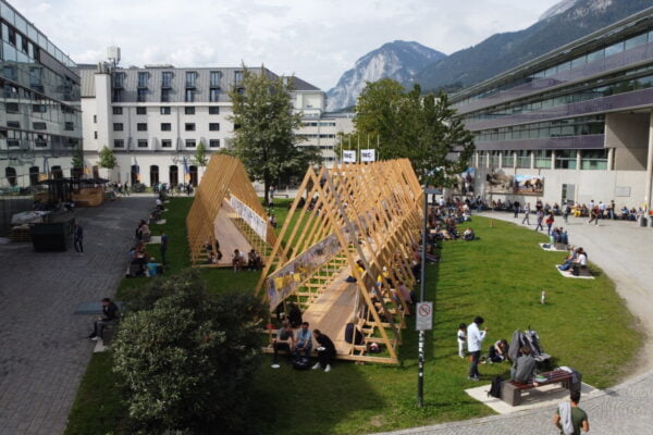
NAME:
SOWI - Garden
BUILDING:
SOWI
FLOOR:
0
TYPE:
Garden
CAPACITY:
2000
ACCESS:
Public Access
EQUIPMENT:
---
Climatic changes are expected to alter the relative importance of the water balance components in high mountain catchments. Thereby, snowfall amount, the timing of snowmelt and the amount of evapotranspiration are expected to be affected. One way to quantify the water balance components in high mountain catchments is through snow-hydrological modeling. In this study, we build a workflow to create a new high resolution (i.e. 10 m) land cover map based on satellite data from the Copernicus Land Cover Monitoring Service (CLMS). This map is specifically tailored for the use with snow-hydrological models that include snow-canopy processes, where usually the leaf area index is the most important parameter. To quantify the benefit of this new high resolution land cover map, we conduct snow-hydrological simulations using the physically-based, open source model openAMUNDSEN in different configurations. We increase the model complexity step-wise starting with simulations using a simple temperature index approach and ending with energy balance based snow cover simulations including lateral snow redistribution and snow-canopy processes using the new high resolution land cover map. The study area is the National Park Berchtesgaden (Germany), which is characterized by a complex mountain topography including coniferous and deciduous forests in the lower elevations. A dense climate station network as well as a long history in snow, climate and forest research makes it the ideal research site for our analysis. Preliminary results suggest that the selection of model configuration has considerable impact on the quantification of water balance components and that high resolution land cover maps improve the modeled small scale variability characterizing forested high mountain catchments.

We and use cookies and other tracking technologies to improve your experience on our website. We may store and/or access information on a device and process personal data, such as your IP address and browsing data, for personalised advertising and content, advertising and content measurement, audience research and services development. Additionally, we may utilize precise geolocation data and identification through device scanning.
Please note that your consent will be valid across all our subdomains. You can change or withdraw your consent at any time by clicking the “Consent Preferences” button at the bottom of your screen. We respect your choices and are committed to providing you with a transparent and secure browsing experience.