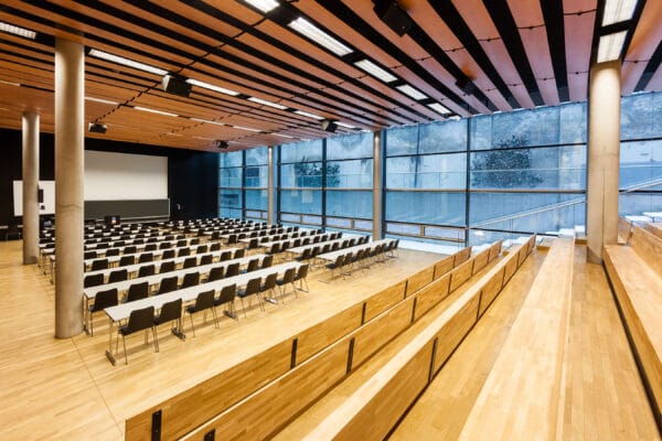
NAME:
SOWI - Aula
BUILDING:
SOWI
FLOOR:
0
TYPE:
Assembly Hall
CAPACITY:
450
ACCESS:
Only Participants
EQUIPMENT:
Beamer, PC, WLAN (Eduroam), Overhead, Flipchart, Blackboard, Sound System, Handicapped Accessible, Microphones, Light Installation
During the 2025 Blatten glacier collapse, approximately 10 million cubic meters of rock and ice flowed into the Lötschental, covering large parts of the village Blatten and damming the Lonza river. Using oblique imagery collected through the BAFU/swisstopo Rapid Mapping program, a digital elevation model (DEM) was derived in Agisoft Metashape. This enabled the creation of a 3D visualization that was published to Sketchfab to show the extent of the event to the general public. Additionally, by comparing the DEM to existing LiDAR elevation data from swisstopo, the thickness of the deposit and volume gains/losses could be estimated independently from numbers provided by local authorities.
We and use cookies and other tracking technologies to improve your experience on our website. We may store and/or access information on a device and process personal data, such as your IP address and browsing data, for personalised advertising and content, advertising and content measurement, audience research and services development. Additionally, we may utilize precise geolocation data and identification through device scanning.
Please note that your consent will be valid across all our subdomains. You can change or withdraw your consent at any time by clicking the “Consent Preferences” button at the bottom of your screen. We respect your choices and are committed to providing you with a transparent and secure browsing experience.