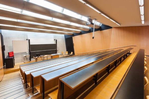
NAME:
SOWI - HS 3
BUILDING:
SOWI
FLOOR:
0
TYPE:
Lecture Hall
CAPACITY:
140
ACCESS:
Only Participants
EQUIPMENT:
Beamer, PC, WLAN (Eduroam), Overhead, Blackboard, Sound System, Microphones, Handicapped Accessible
Mountain permafrost is widespread across the European Alps and can occur above 2300-2500 m a.s.l., depending on slope orientation, gradient, subsurface properties, latitude and regional climate. Even in the absence of visible indicators, permafrost exists in slopes, rock-faces, and sediments, playing a crucial role in the stability and longevity of high-alpine infrastructures. In recent years and decades, climate change has driven extensive permafrost degradation, leading to intensified rockfall activity and slope instability, which directly and indirectly impact high-alpine infrastructures across the Alps. In response to these challenges, we present the newly launched Frost.INI project (ITAT-24-005, Interreg V-A Italia-Österreich), which integrates in-situ geophysical methods and remote sensing techniques to generate comprehensive 3D characterizations of selected key test sites along the Italian-Austrian border. Among these, the Bus Tofana Cableways, the Grawand ridge at the summit station of the Schnalstal cable car, the Madritschjoch ski lift and Kitzsteinhorn are currently monitored through an integrated approach, employing a multi-method design that combines satellite-based multispectral and radar data, UAV imagery, and in-situ geophysical measurements such as continuous temperature measurements in boreholes, electrical Resistivity Tomography (ERT), Ground Penetrating Radar (GPR), and the Electromagnetic (EM) method. This practice-oriented, two-year project (2025-2027), which involves research partners as well as public authorities and tourism stakeholders, will provide valuable insights into surface displacement patterns and ground surface properties around high-alpine infrastructures. The findings will improve our quantitative understanding of permafrost degradation trends and contribute to engineering and geological analyses. Ultimately, the project aims to support the development of digital twins of the studied slopes, offering both a representation of current conditions and a predictive tool for assessing permafrost evolution under changing environmental conditions and external triggers.
