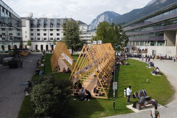
NAME:
SOWI - Garden
BUILDING:
SOWI
FLOOR:
0
TYPE:
Garden
CAPACITY:
2000
ACCESS:
Public Access
EQUIPMENT:
---
Climate change is accelerating glacier retreat in high-mountain areas, together with related geomorphological and periglacial processes, leading to major changes in glacier forelands. This includes changes in glacial lakes and river courses, landslides, deformation of debris deposits, and revegetation. Earth observation (EO) data offer excellent opportunities to map and monitor features and their evolution in glacier forelands. We use both optical and synthetic aperture radar (SAR) data to map glacial forefield features and associated landform changes in selected study areas in the Austrian Alps. Using object-based image analysis (OBIA) and optical satellite imagery, complemented by digital elevation model (DEM) data, we semi-automatically map specific features and landforms such as landslides, screes, and moraines. Time series of synthetic aperture radar (SAR) data are used to track surface deformation changes using advanced interferometric SAR (InSAR) techniques. The delineated features from the optical data will be enriched with InSAR-derived surface deformation rates to gain deeper insights into how landforms in glacier forelands evolve over time. Our findings can contribute to a better understanding of landscape evolution in recently deglaciated areas and provide valuable information for alpine associations to support the maintenance of hiking infrastructure in these changing landscapes. Additionally, the results may aid alpine infrastructure managers, cartographic divisions, and mountaineers in making better informed decisions to improve the safety and sustainability of high-altitude hiking.

We and use cookies and other tracking technologies to improve your experience on our website. We may store and/or access information on a device and process personal data, such as your IP address and browsing data, for personalised advertising and content, advertising and content measurement, audience research and services development. Additionally, we may utilize precise geolocation data and identification through device scanning.
Please note that your consent will be valid across all our subdomains. You can change or withdraw your consent at any time by clicking the “Consent Preferences” button at the bottom of your screen. We respect your choices and are committed to providing you with a transparent and secure browsing experience.