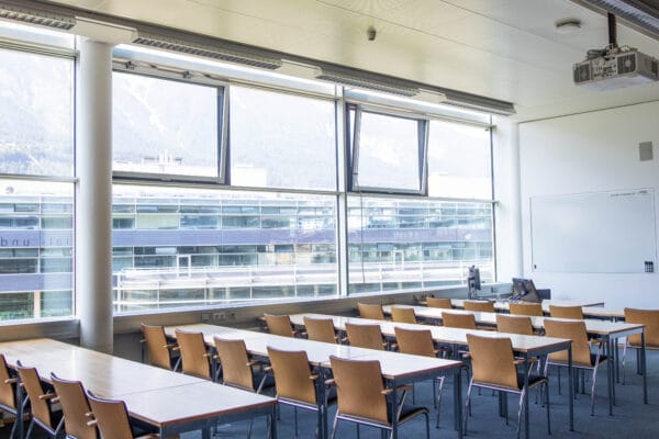
NAME:
MCI - SR 303
BUILDING:
Management Center Innsbruck
FLOOR:
3
TYPE:
Seminar Room
CAPACITY:
54
ACCESS:
Only Participants
EQUIPMENT:
Beamer, Handicapped Accessible, PC, Sound System, Whiteboard, WLAN (Eduroam), Microphones
Debris-covered glaciers present acute challenges for fieldwork due to the presence of rocky debris and steep slopes. Consequently, the spatial distribution of surficial debris layers and the processes governing debris-covered glacier evolution remain understudied. Recent advances in drone-based remote sensing have improved our observation abilities for debris-covered glaciers, including ground-penetrating radar (GPR) and thermal infrared imagery. We present research that integrates thermal infrared imagery with airborne GPR to improve investigations of supraglacial debris. Data for this study was collected in the summer of 2024 on a debris-covered glacier in the Shár Shaw Tagà (also known as Grizzly Creek) watershed in Kluane National Park and Reserve, Yukon, Canada.
While airborne GPR provides unprecedented spatial coverage, it is limited in the minimum debris thickness that can be measured (approximately 1/4 the wavelength, or 0.37 m for the 200 MHz GPR radar). As a result of this limitation, we present a novel technique to measure a range of debris thicknesses by combining airborne GPR and thermal infrared photogrammetry surveys. In locations where debris is thin (< 0.5 m), thermal imaging enables debris thickness estimation where the radar would be unable to distinguish the surface and the ice/debris interface. Conversely, where debris thicknesses is greater, the GPR can more effectively evaluate debris thickness when empirical relationships of thickness and temperature become less precise. Combining these two techniques allows the debris thickness to be accurately assessed across varied debris thicknesses over the 0.5 ha study site. This new technique for debris mapping has applications for larger areas, where varied supraglacial debris thicknesses prevent estimations using a single technique.

We and use cookies and other tracking technologies to improve your experience on our website. We may store and/or access information on a device and process personal data, such as your IP address and browsing data, for personalised advertising and content, advertising and content measurement, audience research and services development. Additionally, we may utilize precise geolocation data and identification through device scanning.
Please note that your consent will be valid across all our subdomains. You can change or withdraw your consent at any time by clicking the “Consent Preferences” button at the bottom of your screen. We respect your choices and are committed to providing you with a transparent and secure browsing experience.