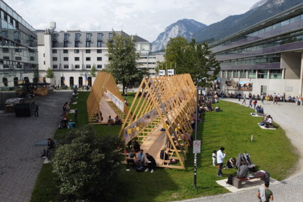
NAME:
SOWI - Garden
BUILDING:
SOWI
FLOOR:
0
TYPE:
Garden
CAPACITY:
2000
ACCESS:
Public Access
EQUIPMENT:
---
Alpine regions are particularly vulnerable to climate change, with snowmelt dynamics playing a key role in their hydrological processes. Snow water equivalent (SWE) is a crucial indicator of snowmelt; however, its measurements are scarce and limited to specific locations, making it challenging to obtain accurate spatial estimates. Remote sensing products offer a valuable solution by providing spatialized observations. Recently, it has been developed a multi-source data approach to generate high-resolution (20 m) daily snow cover area (SCA) maps using optical remote sensing data from MODIS, Landsat, and Sentinel-2, SAR data from Sentinel-1, and in situ observations. This study explores the integration of this method with the semi-distributed hydrological model GEOframe to reconstruct high-resolution (20 m) SWE in the Dischma alpine catchment (Kanton Graubünden, Switzerland, ~40 km²) and in the Venosta catchment (Südtirol, Italy, ~1500 km²). The simulated discharges are assessed by comparing them with observed discharges at the outlet of the two basins, while the modelled SWE is evaluated against high-resolution SWE maps.
The GEOframe model accurately replicates the observed discharges for both catchments, achieving a KGE of 0.904 and 0.810, for the Dischma and Venosta catchment, respectively. However, being a semi-distributed model, modelled SWE spatial patterns are too coarse and less accurate. We find that the most effective SWE downscaling approach is based on the combination of topographic parameters and the snow persistency estimated using the multi-source remote sensing approach previously mentioned. The SWE estimates derived from the proposed approach show good correlations with observations, particularly in the Dischma catchment. The proposed method indicates that combining high-resolution remote sensing data with hydrological models effectively captures SWE spatial patterns, and at the same time the catchment-averaged SWE is bound to the water mass balance estimated by the hydrological model.

We and use cookies and other tracking technologies to improve your experience on our website. We may store and/or access information on a device and process personal data, such as your IP address and browsing data, for personalised advertising and content, advertising and content measurement, audience research and services development. Additionally, we may utilize precise geolocation data and identification through device scanning.
Please note that your consent will be valid across all our subdomains. You can change or withdraw your consent at any time by clicking the “Consent Preferences” button at the bottom of your screen. We respect your choices and are committed to providing you with a transparent and secure browsing experience.