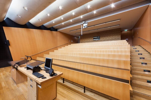
NAME:
SOWI - HS 2
BUILDING:
SOWI
FLOOR:
0
TYPE:
Lecture Hall
CAPACITY:
80
ACCESS:
Only Participants
EQUIPMENT:
Beamer, PC, WLAN (Eduroam), Overhead, Flipchart, Blackboard, Sound System, Handicapped Accessible, Light Installation
Glaciers in the Central Andes of Argentina are vital in the mountain hydrological system, contributing up to 60% of river flow during drought periods. This region contains 82% of the country’s debris-covered glaciers. Using remote sensing data, we observed a 21% increase in debris-covered areas over the past 40 years, with 62% of this growth occurring in the last decade. Despite their significance, the processes controlling mass loss and climate change responses by debris-covered glaciers are still poorly understood. To explore how debris cover affects surface ablation and ice dynamics, we recently installed monitoring equipment on the Horcones Superior Glacier (32° 4′ S, 70° 3′ W), located at the base of Aconcagua (6,962 m a.s.l.), the highest peak in the Southern and Western Hemispheres. Our setup includes an ablation stake network along the transition from debris-covered (0.5 m thick debris layer) to debris-free ice, temperature sensors to study heat transfer through the debris, and an Automatic Weather Station close to the glacier. Ground-penetrating radar (GPR) surveys were conducted to map debris layer thickness and ice thickness, and we used GNSS measurements to track surface velocity through boulders and stakes displacement. Additionally, we plan to conduct annual UAV surveys to monitor surface elevation and morphological changes in detail. We expect this monitoring approach to help us better understand the complex interactions between debris and ice and calibrate energy balance models. Our findings will improve our understanding of Andean debris-covered glaciers and their response to climate change.

We and use cookies and other tracking technologies to improve your experience on our website. We may store and/or access information on a device and process personal data, such as your IP address and browsing data, for personalised advertising and content, advertising and content measurement, audience research and services development. Additionally, we may utilize precise geolocation data and identification through device scanning.
Please note that your consent will be valid across all our subdomains. You can change or withdraw your consent at any time by clicking the “Consent Preferences” button at the bottom of your screen. We respect your choices and are committed to providing you with a transparent and secure browsing experience.