

NAME:
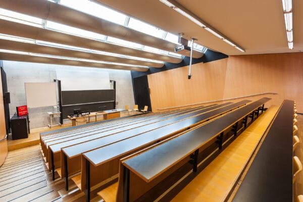
SOWI - HS 1
BUILDING:
SOWI
FLOOR:
0
TYPE:
Lecture Hall
CAPACITY:
160
ACCESS:
Only Participants
EQUIPMENT:
Beamer, PC, WLAN (Eduroam), Overhead, Flipchart, Blackboard, Sound System, Handicapped Accessible, Microphones
The Canadian Rockies are the headwaters of rivers that flow to three oceans and supply freshwater to a vast portion of North America. These mountains are partly glaciated and most runoff is generated from the spring melt of the seasonal snowpack. By late century, under RCP 8.5 scenarios, atmospheric models predict that temperatures will have risen on average 5 oC and precipitation will increase about 15%. However, Regional Climate Models (RCM) have not had sufficient resolution to accurately simulate the sharp gradients of high mountain precipitation and climate and this has introduced uncertainty into hydrological predictions using these forcings. Here, mountain climate is dynamically downscaled using the Weather Research and Forecasting (WRF) model to 4 km. WRF was run over North America for two 20-year periods as part of Global Water Futures, 1995-2015 and 2080-2100, downscaling boundary conditions from coarser-scale RCMs. The WRF forcing was evaluated against observations from four well-instrumented headwater research basins that comprise the Canadian Rockies Hydrological Observatory. Marmot Creek is mostly montane and subalpine forest; Fortress Mountain is subalpine and alpine; Helen Creek is alpine, lake and rock and Peyto Glacier is glaciated. Whilst current climate WRF dynamics are synthetic and so differed from observations – the basic nature of mountain meteorological patterns and extremes was captured sufficiently well for evaluating climate change. Future forcing with WRF was used to run the basin-specific models created using the Cold Regions Hydrological Modelling platform (CRHM) that described snow redistribution, sublimation, energy balance melt, snow and glacier albedo, evapotranspiration, runoff and subsurface hydrology with a high degree of realism. The CRHM models were set up for current and future levels of glaciation, and depressional storage. The results show reduced snow season, similar peak accumulation, earlier peak flows, higher spring flows and reduced summer flows in the non-glaciated basins, with drastically reduced flows and much earlier but reduced peaks in the currently glaciated basin. The importance of forest and glacier cover in modulating the translation of climate change to hydrological change, including compensating hydrological processes that dampen change, is emphasized.
We and use cookies and other tracking technologies to improve your experience on our website. We may store and/or access information on a device and process personal data, such as your IP address and browsing data, for personalised advertising and content, advertising and content measurement, audience research and services development. Additionally, we may utilize precise geolocation data and identification through device scanning.
Please note that your consent will be valid across all our subdomains. You can change or withdraw your consent at any time by clicking the “Consent Preferences” button at the bottom of your screen. We respect your choices and are committed to providing you with a transparent and secure browsing experience.