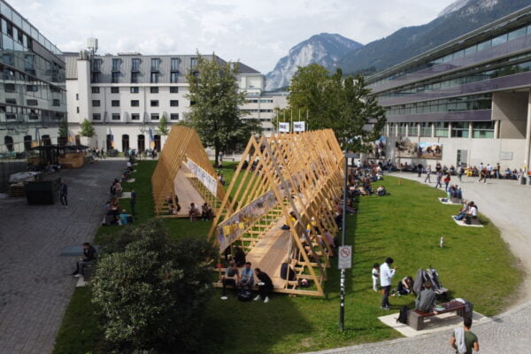
NAME:
SOWI - Garden
BUILDING:
SOWI
FLOOR:
0
TYPE:
Garden
CAPACITY:
2000
ACCESS:
Public Access
EQUIPMENT:
---
The Cordillera Blanca, located in the Peruvian Andes, host to the largest concentration of tropical glaciers in the world. These glaciers play a fundamental role in supplying water to high Andean communities, ecosystems, and various economic activities in the region. However, the rapid retreat of glacier cover, driven by global warming, represents a growing threat to water security. In this context, accurate mapping is necessary to understand and monitor the glacier cover evolution, enabling the assessment of climate change impacts on these high mountain ecosystems. This study aimed to evaluate the effectiveness of the Random Forest classification algorithm applied to Sentinel-1 satellite radar images for mapping glacier cover in three hydrographic units of the Cordillera Blanca. For this purpose, the accuracy of the producer and the Kappa index were analyzed as model performance metrics. Sentinel-1 images from October and November of 2016 and 2020 were used. The images were preprocessed using speckle noise reduction, geometric and radiometric correction techniques, ensuring better data quality before classification. Three classification scenarios were proposed by combining different SAR bands as inputs for the Random Forest algorithm. The results were compared with national glacier inventories (INAIGEM, 2018, 2023) to validate the model´s accuracy. The best results were obtained for Scenario 3, with producer accuracy values of 79.61% and a Kappa index of 0.78 in 2016 and 75.66% and 0.74 in 2020, respectively. These values indicate a good model reliability of the model in the identification of glacier cover using radar images, demonstrating its potential for generating glaciological inventories more efficiently. The results demonstrate good reliability in the mapping of glacier coverage, giving improvements in time and accuracy for future inventory work of the glaciers of the Cordillera Blanca, which is key to later evaluate glacier reduction and its impact on water availability.

We and use cookies and other tracking technologies to improve your experience on our website. We may store and/or access information on a device and process personal data, such as your IP address and browsing data, for personalised advertising and content, advertising and content measurement, audience research and services development. Additionally, we may utilize precise geolocation data and identification through device scanning.
Please note that your consent will be valid across all our subdomains. You can change or withdraw your consent at any time by clicking the “Consent Preferences” button at the bottom of your screen. We respect your choices and are committed to providing you with a transparent and secure browsing experience.