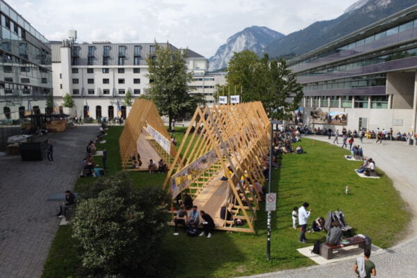
NAME:
SOWI - Garden
BUILDING:
SOWI
FLOOR:
0
TYPE:
Garden
CAPACITY:
2000
ACCESS:
Public Access
EQUIPMENT:
---
Continuous monitoring of glacier cover is essential for assessing the effects of climate change, water resource availability, and glacier dynamics over time. Traditionally, glacier mapping has relied on remote sensing techniques such as the Normalized Snow Differentiation Index (NDSI), which while proven to be effective, has limitations in cloudy and shaded conditions. With recent advances in artificial intelligence and access to large volumes of data, deep neural networks (Deep CNNs) have emerged as a robust alternative for automated segmentation of glacier coverage, allowing for faster and more accurate detection. In this study, free resolution optical satellite images (sentinel-2 and landsat-8) and radar images (sentinel-1) were used, which have been processed to generate the data sets (images and masks) for model training using the PyTorch machine learning framework. PyTorch allows fast and accurate computation of partial derivatives (gradients) automatically through its automatic inverse differentiation system, known as autograd. This system allows the behavior of the neural network to be dynamically modified during execution, without incurring significant computational delays or overhead. As a result, the model parameters (weights and biases) are optimally adjusted according to the gradient of the loss function with respect to each parameter. This dynamic and efficient tuning capability is essential for improving the performance of convolutional neural networks. The results indicate that models trained on Sentinel-2 (0.97) and Landsat-8 (0.95) optical satellite imagery significantly outperformed traditional methods such as NDSI spectral index (0.85) and Random Forest-based supervised classification (0.81). However, model performance on Sentinel-1 radar imagery (0.54) was considerably lower, suggesting that glacier segmentation using SAR remains a challenge, particularly in high slope regions such as the Cordillera Blanca. This study highlights the relevance of artificial intelligence in geospatial analysis and proposes future lines of research aimed at model optimization. These include the integration of new datasets (e.g., masks) and the implementation of advanced architectures, such as Bayesian U-Net, to improve the segmentation of glacier coverage in radar images. These improvements will optimize glacier detection in complex conditions and extend the applicability of artificial intelligence models in remote sensing of high mountain areas.
