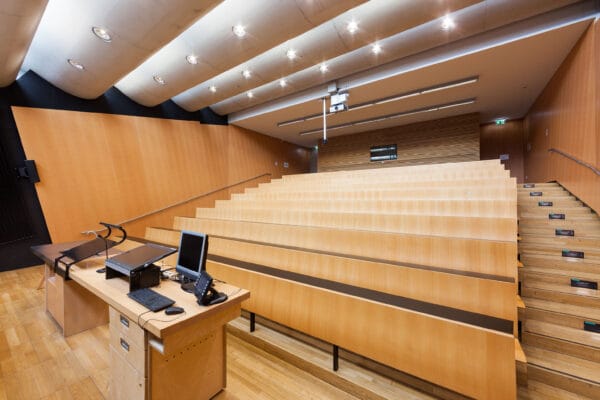
NAME:
SOWI - HS 2
BUILDING:
SOWI
FLOOR:
0
TYPE:
Lecture Hall
CAPACITY:
80
ACCESS:
Only Participants
EQUIPMENT:
Beamer, PC, WLAN (Eduroam), Overhead, Flipchart, Blackboard, Sound System, Handicapped Accessible, Light Installation
Originally, ALPTHERM was a tool for assessing convection for air sports. Between 1993 and March 2024, daily results were disseminated by the German, the Austrian, and the Swiss Weather Services as forecasts for soaring conditions. A new version could do more than that, because it allows to simulate mixing processes during convective days, the formation of cold pools, or studies on the influence of surface properties and their interaction with an atmosphere in a changing climate. Operational LAM, still limited by the steepness of the orography, have other priorities, and need big computing power. The Lagrangian architecture and other short-cuts are allowing to make such studies on a PC. AlpTherm3d is not a stand-alone simulation model, but rather a heuristic downscaling algorithm with flexible options for the initial and boundary conditions (e.g. from ICON-D2, or GFS). The horizontal coarse grid is adjusted to ICON-D2 (0.02°; interpolated for other sources), but the formation of katabatic or anabatic flow is running on the much higher resolution of the underlying DTM (e.g. SRTM topography on a horizontal grid spacing of less than 100 m, and 1 m vertical resolution), with several options for the surface properties (e.g. albedo from MODIS). “Lagrangian” means, that pockets of air cooled or heated on the surface pixels are proceeding as katabatic or anabatic flows, or leaving the surface as a thermal plume, after they had the possibility to follow a slope, accumulating and interacting with the wind field. The resulting mass imbalances are then compensated by subsidence, and lifting, before the resulting pressure gradients are relaxed, modifying the larger scale wind field taken from the external model. “Heuristic” means, that the turbulent fluxes are not resolved explicitly. However, results from LES, observations and experience are used to parameterise the shortcuts. Despite these shortcuts, the algorithm is conserving mass (including water and optional trace gases) and energy. Results from case studies as well in other regions than the Alps provided good results. The main limitation is the availability of highly resolved, dynamic soil properties.
We and use cookies and other tracking technologies to improve your experience on our website. We may store and/or access information on a device and process personal data, such as your IP address and browsing data, for personalised advertising and content, advertising and content measurement, audience research and services development. Additionally, we may utilize precise geolocation data and identification through device scanning.
Please note that your consent will be valid across all our subdomains. You can change or withdraw your consent at any time by clicking the “Consent Preferences” button at the bottom of your screen. We respect your choices and are committed to providing you with a transparent and secure browsing experience.