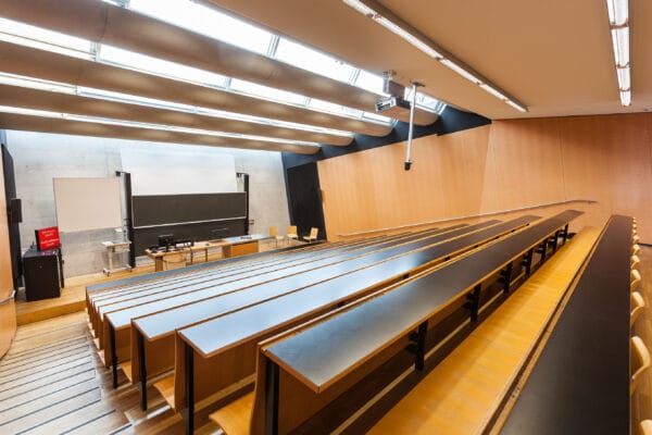
NAME:
SOWI - HS 3
BUILDING:
SOWI
FLOOR:
0
TYPE:
Lecture Hall
CAPACITY:
140
ACCESS:
Only Participants
EQUIPMENT:
Beamer, PC, WLAN (Eduroam), Overhead, Blackboard, Sound System, Microphones, Handicapped Accessible
For landslides over Georgia Upper Svaneti, this study incorporates multi-scale numerical modeling, hazard assessment, and monitoring. After using FSLAM to identify high-risk regions, we used pore water pressure and surface deformation sensors in the field. RAMMS simulations are used to study semi-empirical models in various scenarios. The results provide a robust basis for hazard planning in areas susceptible to landslides by emphasizing the importance of slope geometry and pore pressure. The findings underline the importance scenario-based modeling and continuous monitoring to risk assessment and mitigation methods. In mountainous regions susceptible to landslides and debris flows, this method can help early warning systems for long-term hazard management.

We and use cookies and other tracking technologies to improve your experience on our website. We may store and/or access information on a device and process personal data, such as your IP address and browsing data, for personalised advertising and content, advertising and content measurement, audience research and services development. Additionally, we may utilize precise geolocation data and identification through device scanning.
Please note that your consent will be valid across all our subdomains. You can change or withdraw your consent at any time by clicking the “Consent Preferences” button at the bottom of your screen. We respect your choices and are committed to providing you with a transparent and secure browsing experience.