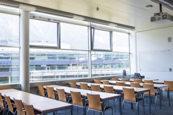
NAME:
MCI - SR 303
BUILDING:
Management Center Innsbruck
FLOOR:
3
TYPE:
Seminar Room
CAPACITY:
54
ACCESS:
Only Participants
EQUIPMENT:
Beamer, Handicapped Accessible, PC, Sound System, Whiteboard, WLAN (Eduroam), Microphones
Accurate data on population size and density is essential for effective urban planning, disaster risk reduction, and climate change adaptation. This is particularly pertinent in mountain regions which are exposed to specific natural hazards as well as in regions of high socioeconomic vulnerability. However, in many such regions a lack of reliable population data poses significant challenges to risk management and planning in a broader sense. This study therefore develops and applies a low-cost, replicable methodology that integrates remote sensing and household surveys to estimate both the residential population and its spatial distribution. The study takes as a case region the semi-urban mountainous area of Qwaqwa, South Africa. The study area, encompassing approximately 200 km², includes the former homeland of Qwaqwa, which is characterised by dispersed, small, single-story buildings across hilly and mountainous terrain. Our approach involved the manual identification of all residential buildings (n=80,907) using high-resolution satellite imagery, followed by stratification of the area into six strata based on building- and spatial characteristics. A household questionnaire (n=439) provided data on occupancy rates and the residential use of additional buildings, which was used to refine population estimates. This methodology offers a significant improvement over previous approaches, particularly in areas with complex topography and informal urban spatial pattern. The resulting population estimates not only fill a critical data gap for Qwaqwa but also provide a methodology that can be adapted for similar regions worldwide, supporting more effective resource allocation, service delivery and risk management in challenging mountainous environments.

We and use cookies and other tracking technologies to improve your experience on our website. We may store and/or access information on a device and process personal data, such as your IP address and browsing data, for personalised advertising and content, advertising and content measurement, audience research and services development. Additionally, we may utilize precise geolocation data and identification through device scanning.
Please note that your consent will be valid across all our subdomains. You can change or withdraw your consent at any time by clicking the “Consent Preferences” button at the bottom of your screen. We respect your choices and are committed to providing you with a transparent and secure browsing experience.