Private

FS 3.502

Natural hazards in mountainous regions

Details

  • Full Title

    FS 3.502: Natural hazards in mountainous regions – Introduction to the different types of natural hazards common in mountain regions
  • Scheduled

    TBA
  • Co-Conveners

  • Assigned to Synthesis Workshop

    ---
  • Thematic Focus

    No focus defined
  • Keywords

    soil mechanics, natural hazards, geotechnical analysis, geological analysis, landslides

Description

Mountainous regions are prone to a variety of natural hazards, including landslides, avalanches, earthquakes, and floods, which can have devastating impacts on communities and infrastructure. Understanding these hazards and implementing effective mitigation strategies are crucial for reducing risk and enhancing resilience. This session aims to provide participants with a comprehensive introduction to the types of natural hazards prevalent in mountainous regions and the existing strategies employed to mitigate their effects. Discussions will focus on: Identifying and characterizing different natural hazards in mountain environments, evaluating the effectiveness of various mitigation measures, such as engineering solutions, land-use planning, and early warning systems, exploring interdisciplinary approaches that integrate geosciences, engineering, and social sciences for comprehensive hazard assessment, understanding the role of community engagement and educational researches in disaster preparedness and response.

Participants are encouraged to share their experiences, challenges, and successes related to natural hazard management in mountainous regions.

This session will provide a foundation for understanding the geotechnical factors that contribute to these events as well as a discussion and sharing of ideas about mitigation techniques and their effectiveness.

Registered Abstracts

ID: 3.7637

Geo-Hydrological Disasters in the Himalayas: Vulnerability, Risk Assessment and Mapping

Saurav Kumar

Abstract/Description

The Himalayas are prone to several geo-hydrological disasters such as flash floods, debris flows, landslides, mass movements, and rock falls. The Cloudbursts and glacier bursts usually trigger these disasters that are very active and frequent in the Himalayan regions and happens mainly during the peak monsoon season usually from July to September. The study assesses the geo-hydrological disasters of the Uttarakhand Himalaya that occurred from July to September, 2022. Additionally, the study examines the magnitude of the disaster and maps the disaster hotspot areas in the Uttarakhand regions. The study employs both qualitative and quantitative approaches. The Data on geo-hydrological disasters which occurred during the monsoon season were collected from the Uttarakhand State Disaster Management Authority. Besides, an empirical study of the Song and Bandal and River valleys was carried out. These two river valleys were severely hit by cloudburst-triggered debris flows and flash floods in 2022. A household-level survey of the damage caused by huge flash floods and debris flows in three villages of Bandal valley was carried out. The data was analyzed and mapped and the Uttarakhand Himalayas was divided into various disaster hotspot zones. The study suggests that the construction of settlements must be banned in the vulnerable areas, along the river valleys, and on the fragile slopes. Nature-based disaster risk reduction approach should be implemented to reduce the impact of geo-hydrological disasters in the Himalayan regions.

ID: 3.7847

The Mental Health Toll of Glacial Lake Outburst Floods in the Hunza Valley, Pakistan

Aaliya Aaliya
Waqas, Ahmed; Rahman, Atif; McAdoo, Brian

Abstract/Description

With human-induced climate change, glacial lake outburst flood (GLOF) events have increased in the Gilgit-Baltistan region of the Pakistani Himalayas. In Hassanabad village of Hunza Valley, four massive GLOF events occurred in the past five years. However, to date, no studies have been conducted to examine how GLOF events impact the mental health of downstream communities. To address this scholarly gap, we conducted a descriptive cross-sectional study in Hassanabad to estimate the prevalence of depression, anxiety, and post-traumatic stress disorder (PTSD) among the residents impacted by past GLOF events. In August 2024, we administered a household survey using the stratified random sampling technique in Hassanabad. We used self-report measures of the Generalized Anxiety Disorder-7 (GAD-7), the Patient Health Questionnaire-9 (PHQ-9), and the Impact of Event Scale-Revised (IES-R). We performed multiple regression analyses to assess the significant associations. We surveyed 177 (58%) females and 128 (42%) males between 18 and 60 years (Mean 37.7, SD 12.65). Of the total surveyed (n=305), 213 (69.84%) witnessed four GLOFs. The overall prevalence of anxiety, depression, and PTSD in our sample was 15.08% (cut-off score ≥ 10, 95% CI), 15.40% (cut-off score ≥ 10, 95% CI), and 56.60% (cut-off score ≥ 33, 95% CI) indicating mild to severe symptoms among participants. When comparing gender-wise prevalence, women had a higher prevalence for anxiety (PrR=22.03%, 95% CI), depression (PrR=23.72%, 95% CI), and PTSD (PrR=66.24%, 95% CI) than men. Notably, males were predicted to have statistically significantly lower anxiety, depression, and PTSD scores (p<0.001) compared to females, holding all other predictors constant. Concerning age-wise prevalence, adults in the age group (46-60) had a higher prevalence of anxiety (PrR=20.87%, 95% CI), depression (PrR=18.68%, 95% CI), and PTSD (PrR=59.30%, 95% CI). Age was a statistically significant (p<0.001) predictor for PTSD. This study reveals higher levels of PTSD among the residents of Hassanabad. The prevalence of common mental disorders reflects the long-term impacts of these events. The study emphasizes the importance of early identification of mental health issues, the implementation of culturally tailored interventions targeting vulnerable groups, and the allocation of funding for mental health services before and after such hazards.

ID: 3.8554

Rockfall Hazards and Mitigation Strategies: A Focused Study on Rockfall Simulation in Gebel El-Mokattam, Egypt

Mohamed Abdelkader
Csámer, Árpád

Abstract/Description

Rockfalls are one of the main natural hazards that cause significant damage and loss of life globally, especially in mountainous regions. These hazards are particularly dangerous due to their unpredictability and varying magnitudes. Rapid urbanization and inadequate infrastructure in developing countries increase vulnerability to these risks. This study aimed to investigate the stability of rock slopes in the northern part of Gebel El-Mokattam in East Cairo, Egypt. This work includes intensive field and laboratory tests to collect geological, structural, geomorphological, and geotechnical data from this region. This area has been affected frequently by rockfalls and landslides that impacted both the inhabitants and infrastructure. Field investigations revealed that the rock slopes are primarily composed of highly fractured limestone with medium to weak strength interbedded with highly swelling clays. During this research, rockfall modeling was conducted through trajectographic analysis on representative slope profiles to simulate the path of falling blocks. This analysis provided valuable data on the kinetic energy, bounce height, and runout distance of falling blocks, helping to evaluate the risk to nearby buildings and infrastructure. Furthermore, a rockfall rating system has been applied to evaluate the magnitude of the risk. The results show a high risk of rockfalls. Therefore, several preliminary and major mitigation strategies were recommended and tested to reduce rockfall hazards, which are directly linked to the results of rockfall modeling. This study highlights the importance of rockfall modeling in understanding hazards in mountainous areas. Also, the findings of this research will assist land-use planners and decision-makers in selecting appropriate mitigation strategies in areas of complex geomorphological and geological factors.

ID: 3.11066

Mechanisms of Slope instabilities along the Hill Roads of Nepal: A Case Study from Beni-Jomson Road, Gandaki Province

Prakash Chandra Ghimire
Dhital, Meghraj; Paudayal, Khum Narayan

Abstract/Description

Nepal is situated in the seismically active Himalayan region, where the construction of roads has notably increased the frequency of slope instabilities. These instabilities, including landslides, rockfalls, topple events, debris flows, and gully erosion, are commonly observed along roads in the Nepal Himalayas. This research investigates the causes and mechanisms behind landslides along a section of the Beni-Jomsom Road in Gandaki Province, Nepal. The study applies time series analysis to examine the mechanisms and frequencies of different instability types, taking into account various environmental factors along the road. The research employs specific tools GIS, WAVELET, SPSS, ORIGIN to analyze the landform, surrounding geology, geological structures, and geotechnical characteristics of the soil and rocks. The study reveals that the primary causes of instability along the road are translational slides, debris flows, and rockfalls/rockslides, with these events occurring repeatedly after road construction. The results highlight a clear connection between road-building activities and the occurrence of slope instability in the region. This research will serve as an important reference for authorities, providing valuable insights for managing and mitigating slope instability in future road construction projects.

Key Words: Hill Roads, Slope instabilities, Mechanism, Time series analysis, Himalaya.

ID: 3.11922

Atlas of Morphosedimentary Connectivity in Alpine Torrent Watersheds.

Anaïs Fichot
Astrade, Laurent; Peiry, Jean-Luc

Abstract/Description

As part of the National Action Plan for the Prevention of Glacial and Periglacial Hazards, French scientific, technical experts, and mountain area managers collaborate to anticipate risks. Our objectives are fourfold: 1. identifying areas at risk from glacial and periglacial hazards, 2. developing tools and methods for characterization, 3. fostering a community of interest and exchange, 4. and supporting local authorities in their prevention efforts.

One of the effects of climate change is the cryosphere degradation. While many processes focus on upstream areas, we propose shifting attention to the transmission of these processes downstream by the way of the sedimentaruy cascade. Glacial retreat, permafrost degradation of rock faces, and destabilization of rock glaciers result in a sediment overproduct in the headwaters. When these sediments are mobilized and transported, they can pose a significant hazard to downstream streams and valley floors during floods or debris flows. The torrent thus becomes central to this sediment transfer, approached through the concept of sediment cascade. This concept allows us to conceptualize the efficiency of sediment transfers between geomorphological units of the watershed, emphasizing the interactions between these units rather than focusing solely on each of them.

I hold a background in geography, and since November 2024, I am working to prepare a PhD in geomorphology. My research addresses the issue of sedimentary connectivity in torrents within the context of climate change. As part of this, i am conducting an inventory of cryosphere-affected watersheds and identifying the parameters that explain the functioning of the sediment cascade. Our approach combines both local and regional scales. Several local case studies help to identify the diversity of sediment cascade efficiencies and examine explanatory parameters. The regional inventory allows us to map and characterize torrent-prone watersheds in the northern French Alps.

My ultimate goal is to synthesize this work into a susceptibility index of sediment cascade efficiency to better characterize watersheds. Our aim is to produce an atlas of torrent-prone watersheds as a reliable and accessible tool for both managers and researchers.

ID: 3.12047

Towards Decolonizing Disaster Risk Communication and Resilience Building; Indigenous Knowledge Insights from High Mountain Asia

Sultan Ahmed

Abstract/Description

This research examines disaster risk communication (DRC) and resilience-building in High Mountain Asia (HMA) through the lens of Indigenous Knowledge (IK) among the Wakhi people, who span the borders of Afghanistan, Pakistan, Tajikistan, and China. Preliminary findings from the four countries reveal nuanced and complex dynamics: while elders emphasize the value of IK—rooted in centuries of evolution—youth increasingly favor scientific methods as more relevant to contemporary challenges. This contrast highlights a gap in DRC, as government-led initiatives prioritize scientific knowledge and adopt an autocratic, top-down approach, whereas NGOs employ participatory approaches, though their reach and effectiveness remain limited. Indigenous practices such as resilient construction, communal storage, land planning, and ritual offerings reflect a profound relationship with the environment, grounded in both practical adaptations and spiritual traditions. These practices embody a spiritual bond with nature, where rituals and offerings seek harmony with natural and supernatural forces, reinforcing both community resilience and individual confidence in facing disasters. Yet, formal systems often marginalize these practices. This study advocates for a decolonized approach that respects both scientific and Indigenous epistemologies, recognizing the unique resilience strategies of cross-border communities. By bridging these knowledge systems, this research aims to foster inclusive, context-sensitive frameworks for DRC in HMA.

ID: 3.12406

Construction and Demolition Wastes (C&DW) for a more sustainable Gabion application

Berhanu Arega Tadesse

Abstract/Description

Mountain regions necessitate efficient yet sustainable protection measures to face natural hazards. Gabions offer a convenient, environmental friendly solution to face problems ranging from soil erosion control, river bank stabilization, stream energy dissipation, landslides prevention, creation of rockfall safety barriers, and protection of structures like bridge abutments or viaduct foundation. Filling gabion baskets with natural resources like ad hoc quarried rock fragments often turns to be expensive and poses environmental concerns. C&DW offer an alternative solution for creating more sustainable structures, provided their engineering performance is proved together with their environmental compatibility. A comprehensive research has been undertaken in the geotechnical laboratory of the University of Cassino and Southern Lazio to investigate the mechanical and environmental performance of gabions filled with different C&DW. The mechanical performance is detected by performing unconfined and confined uniaxial compression tests using an ad-hoc designed equipment on smaller scale models (0.4×0.4×0.4 m) of gabions filled with different blocks. They include concrete fragments artificially created with variable types and proportions of components (cement, water and aggregates) to infer controlled properties to the constituent material. Their performance is compared with that of gabions filled with natural rock fragments, the latter used for reference. In all cases, the mechanical properties of the constituent materials are evaluated with specific tests (point load, uniaxial compression, Los Angeles abrasion and freeze-thaw) to characterize material strength and fix standard acceptance levels. In a second phase, focus is given to the combination of high-quality materials (recycled concrete) with lower-quality components (bricks) to optimize performance and resource utilization. Stiffness and strength of gabions are examined to determine their influence on the overall performance of structures distinguishing the effects of particle sizes, shapes, and material combinations on deformation behaviour and load-bearing capacity. This study contributes to the sustainability of mountain hazard mitigation measures, addressing the increasing need for high performance materials with circular economy solutions based on the transformation of wastes into valuable resources. Its outcomes aim to establish guidelines for the practical implementation of C&DW in gabion structures.

ID: 3.13933

Scrutinizing Environmental Hazards in Mountaineer’s Narratives Trough Archival and Visual Analysis

Hossein Rasaei

Abstract/Description

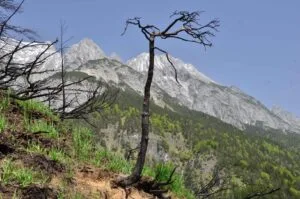
Ski season is becoming shorter due to the lack of enough snow pack; because of the poor quality of ice, climbers rarely can rely on any ice to fix their ice screws; rock fall is disappearing traditional climbing routes, and permafrost is retreating mountain glaciers. All these environmental changes are reshaping the physical landscape of mountains, and the spirit of mountain climbing as a sport, adventure, and recreation is changing. While scientific studies have documented these hazards, mountaineer’s narratives interwoven with such environmental change remain unexplored. By employing visual and archival methods, we scrutinized the 20 volumes of the Canadian Alpine Journal (1922-1931 and 2013-2022), categorizing the data into early and modern narratives. We hypothesized that early climbers would concentrate solely on heroism, first-ascent, and adventure themes, while more recent mountaineers, would heavily bring environmental change awareness. In contrast to our predictions, however, many old twentieth-century records reported many environmental hazards in their narratives, even without explicit modern environmental terms like permafrost and/or climate change. Our findings not only are a rich archival investigation, but also could be an important awareness for global mountain forums, stakeholders, guides, and scientists, sharing stories from the past, analyzing them with the current state, and planning adaptation strategies for the future of mountaineering.

ID: 3.12544

The Silent Threat of Sinking Mountains under Anthropogenic Induced Seismicity in Western and Central Himalayas

Diksha Verma
Kumar, Vishavjit

Abstract/Description

The susceptibility of mountain physiography towards natural hazard is due to numerous factors, primarily being the complex topography, climatic variability, and geological instability. The Indian Himalayan Region (IHR) is enriched with ecological and diverse resources, supporting the sustenance of nearly 50 million local communities. Existing research highlights that the Western and Central Himalayan Mountain faces heightened risks due to accelerated anthropogenic pressures including rapid urbanization, deforestation, and unplanned development. Historical records on seismicity shows that frequent earthquakes have occurred in the Himalayan states of Jammu & Kashmir, Himachal Pradesh and Uttarakhand as the region falls under seismic zones 4 or 5, which means the risk of earthquakes always remains high. Systematic review observed that many Himalayan states are facing the threat of land subsidence, because of induced seismicity resulting into frequent earthquakes in the Himalayas. The study is primarily focused on the issue of land subsidence due to weak geology of Himalayas, as the hazard affect human well-being and ecosystem resilience at heightened degree. Land subsidence can lead to socio-economic destruction including infrastructural damage, social displacement and frequent flooding. The study is also focussed on enlisting various method of assessing land deformation other than ground observation primarily based on remote sensing such as GPS surveys, MT-InSAR (Multi-Temporal Synthetic Aperture Radar Interferometry) and LIDAR (Light Detection and Ranging), to suggest region specific methodologies in response to natural hazards. These advancements facilitate the accurate measurement of ground points in research and detect asynchrony in them. The significant case studies of land subsidence in Western and Central Himalayas of India include sinking of different parts of Chenab valley in Jammu & Kashmir, Lindur village in Himachal Pradesh and Joshimath in Uttarakhand. The study highlights the need of preventive mitigation measures, including as controlled resource extraction, sustainable land-use planning, and comprehensive GIS monitoring, considering the sensitive tectonic activity in the region. The research offers vital insights to formulate resilience-focused actions and securing the long-term environmental and socio-economic sustainability for policymakers and disaster management authorities.